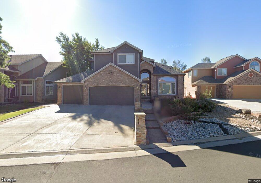
260 Berthoud Trail Broomfield, CO 80020
The Outlook NeighborhoodEstimated Value: $759,000 - $995,000
4
Beds
3
Baths
3,896
Sq Ft
$234/Sq Ft
Est. Value
About This Home
This home is located at 260 Berthoud Trail, Broomfield, CO 80020 and is currently estimated at $913,284, approximately $234 per square foot. 260 Berthoud Trail is a home located in Broomfield County with nearby schools including Aspen Creek K-8 School, Broomfield High School, and Nativity: Faith and Reason.
Ownership History
Date
Name
Owned For
Owner Type
Purchase Details
Closed on
Jul 27, 2012
Sold by
Fannie Mae
Bought by
Keco Samir
Current Estimated Value
Home Financials for this Owner
Home Financials are based on the most recent Mortgage that was taken out on this home.
Original Mortgage
$310,836
Outstanding Balance
$215,838
Interest Rate
3.72%
Mortgage Type
New Conventional
Estimated Equity
$697,446
Purchase Details
Closed on
Apr 16, 2012
Sold by
Bank Of America Na
Bought by
Federal National Mortgage Association
Purchase Details
Closed on
Apr 11, 2012
Sold by
Gill Marc and Gill Paula
Bought by
Bank Of America Na
Purchase Details
Closed on
Feb 23, 1995
Purchase Details
Closed on
Feb 25, 1994
Purchase Details
Closed on
Feb 8, 1994
Purchase Details
Closed on
May 17, 1993
Create a Home Valuation Report for This Property
The Home Valuation Report is an in-depth analysis detailing your home's value as well as a comparison with similar homes in the area
Home Values in the Area
Average Home Value in this Area
Purchase History
| Date | Buyer | Sale Price | Title Company |
|---|---|---|---|
| Keco Samir | $300,000 | Assured Title | |
| Federal National Mortgage Association | -- | None Available | |
| Bank Of America Na | -- | None Available | |
| -- | $249,900 | -- | |
| -- | $4,700 | -- | |
| -- | $28,300 | -- | |
| -- | $33,000 | -- |
Source: Public Records
Mortgage History
| Date | Status | Borrower | Loan Amount |
|---|---|---|---|
| Open | Keco Samir | $310,836 |
Source: Public Records
Tax History Compared to Growth
Tax History
| Year | Tax Paid | Tax Assessment Tax Assessment Total Assessment is a certain percentage of the fair market value that is determined by local assessors to be the total taxable value of land and additions on the property. | Land | Improvement |
|---|---|---|---|---|
| 2025 | $5,363 | $56,700 | $11,060 | $45,640 |
| 2024 | $5,363 | $57,230 | $10,700 | $46,530 |
| 2023 | $5,352 | $63,190 | $11,820 | $51,370 |
| 2022 | $4,368 | $45,180 | $8,340 | $36,840 |
| 2021 | $4,346 | $46,480 | $8,580 | $37,900 |
| 2020 | $3,977 | $42,280 | $7,870 | $34,410 |
| 2019 | $3,970 | $42,570 | $7,920 | $34,650 |
| 2018 | $3,510 | $37,190 | $6,840 | $30,350 |
| 2017 | $3,457 | $41,120 | $7,560 | $33,560 |
| 2016 | $3,341 | $35,430 | $7,440 | $27,990 |
| 2015 | $3,226 | $30,310 | $7,440 | $22,870 |
| 2014 | $2,821 | $30,310 | $7,440 | $22,870 |
Source: Public Records
Map
Nearby Homes
- 147 Keystone Trail
- 146 Keystone Trail
- 13971 Telluride Dr
- 267 Powderhorn Trail
- 36 Carla Way
- 49 Carla Way
- 523 Columbine Ave
- 1719 Daisy Ct
- 583 Redstone Dr
- 1660 Emerald St
- 53 Douglas Dr S
- 1732 Peregrine Ln
- 1747 Whistlepig Ln
- 1677 Hemlock Way
- 23 Scott Dr N
- 1757 Whistlepig Ln
- 20 Scott Dr N
- 1880 Mallard Dr
- 1490 Saint Andrews Dr
- 1607 Garnet St
- 264 Berthoud Trail
- 256 Berthoud Trail
- 268 Berthoud Trail
- 252 Berthoud Trail
- 245 Summit Trail
- 243 Summit Trail
- 247 Summit Trail
- 241 Summit Trail
- 259 Berthoud Trail
- 255 Berthoud Trail
- 263 Berthoud Trail
- 272 Berthoud Trail
- 248 Berthoud Trail
- 249 Summit Trail
- 239 Summit Trail
- 251 Berthoud Trail
- 267 Berthoud Trail
- 271 Berthoud Trail
- 247 Berthoud Trail
- 276 Berthoud Trail