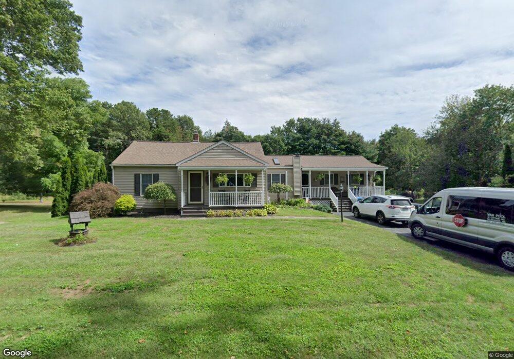
260 Bumstead Rd Monson, MA 01057
Estimated Value: $419,000 - $462,000
3
Beds
2
Baths
2,061
Sq Ft
$214/Sq Ft
Est. Value
About This Home
This home is located at 260 Bumstead Rd, Monson, MA 01057 and is currently estimated at $440,979, approximately $213 per square foot. 260 Bumstead Rd is a home located in Hampden County with nearby schools including Quarry Hill Community School, Granite Valley School, and Monson High School.
Ownership History
Date
Name
Owned For
Owner Type
Purchase Details
Closed on
Aug 31, 2009
Sold by
Stacy James L
Bought by
Stacy James L and Stacy Rosemarie A
Current Estimated Value
Home Financials for this Owner
Home Financials are based on the most recent Mortgage that was taken out on this home.
Original Mortgage
$80,000
Outstanding Balance
$52,267
Interest Rate
5.17%
Mortgage Type
Purchase Money Mortgage
Estimated Equity
$388,712
Create a Home Valuation Report for This Property
The Home Valuation Report is an in-depth analysis detailing your home's value as well as a comparison with similar homes in the area
Home Values in the Area
Average Home Value in this Area
Purchase History
| Date | Buyer | Sale Price | Title Company |
|---|---|---|---|
| Stacy James L | -- | -- |
Source: Public Records
Mortgage History
| Date | Status | Borrower | Loan Amount |
|---|---|---|---|
| Open | Stacy James L | $80,000 |
Source: Public Records
Tax History Compared to Growth
Tax History
| Year | Tax Paid | Tax Assessment Tax Assessment Total Assessment is a certain percentage of the fair market value that is determined by local assessors to be the total taxable value of land and additions on the property. | Land | Improvement |
|---|---|---|---|---|
| 2025 | $5,431 | $365,200 | $68,000 | $297,200 |
| 2024 | $5,306 | $342,300 | $68,000 | $274,300 |
| 2023 | $4,944 | $311,700 | $68,000 | $243,700 |
| 2022 | $4,684 | $262,700 | $68,000 | $194,700 |
| 2021 | $4,126 | $239,900 | $68,000 | $171,900 |
| 2020 | $4,383 | $239,900 | $68,000 | $171,900 |
| 2019 | $3,417 | $228,500 | $68,000 | $160,500 |
| 2018 | $4,094 | $232,600 | $75,400 | $157,200 |
| 2017 | $2,674 | $223,600 | $72,300 | $151,300 |
| 2016 | $3,739 | $218,400 | $67,100 | $151,300 |
| 2015 | $3,587 | $215,200 | $67,100 | $148,100 |
| 2014 | $3,486 | $215,200 | $67,100 | $148,100 |
Source: Public Records
Map
Nearby Homes
- 179 Bumstead Rd
- 96 Stafford Hollow Rd
- 150 Stafford Hollow Rd
- 285 Lower Hampden Rd
- 221 Moulton Hill Rd
- 24 Ash St
- 10 Ash St
- 0 Moulton Hill Rd
- 89 Crow Hill Rd
- 80 Blodgett Rd
- 59 St Germain Rd
- 0 Stony Ln
- 283 Leonard Rd
- Lot 16 Wood Hill Rd
- 0 Paradise Lake Rd
- 6 Bridge St
- 155 S Monson Rd
- 101 Cote Rd
- 192 Leonard Rd
- 199 Munn Rd
- 256 Bumstead Rd
- 264 Bumstead Rd
- 257 Bumstead Rd
- 9 Old Stafford Rd
- 268 Bumstead Rd
- 22 May Hill Rd
- 267 Bumstead Rd
- 18 May Hill Rd
- 5 Old Stafford Rd
- 19 May Hill Rd
- 25 May Hill Rd
- 17 May Hill Rd
- 246 Bumstead Rd
- 13 Old Stafford Rd
- 274 Bumstead Rd
- 36 May Hill Rd
- 271 Bumstead Rd
- 7 May Hill Rd
- 247 Bumstead Rd
- 8 Old Stafford Rd