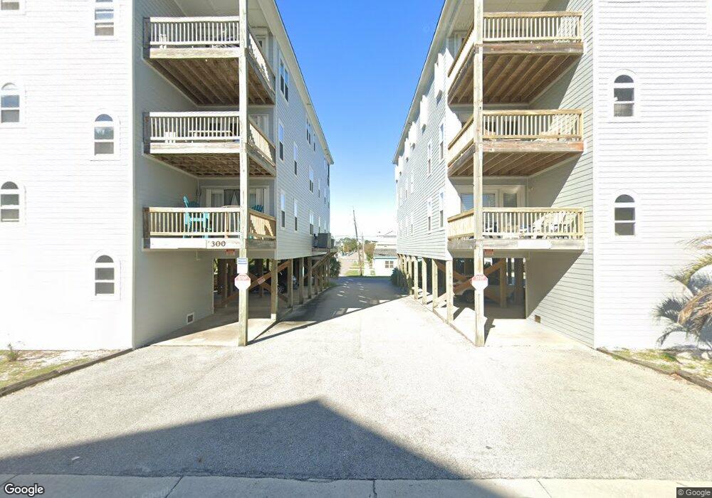
260 Carolina Beach Ave S Carolina Beach, NC 28428
Estimated Value: $713,640 - $752,000
3
Beds
2
Baths
2,270
Sq Ft
$324/Sq Ft
Est. Value
About This Home
This home is located at 260 Carolina Beach Ave S, Carolina Beach, NC 28428 and is currently estimated at $735,410, approximately $323 per square foot. 260 Carolina Beach Ave S is a home located in New Hanover County with nearby schools including Carolina Beach Elementary School, Charles P. Murray Middle School, and Eugene Ashley High School.
Ownership History
Date
Name
Owned For
Owner Type
Purchase Details
Closed on
Mar 22, 2017
Sold by
Anglia Richard E and Anglia Ann M
Bought by
Hughes Arthur S and Hughes Rhonda G
Current Estimated Value
Home Financials for this Owner
Home Financials are based on the most recent Mortgage that was taken out on this home.
Original Mortgage
$232,000
Outstanding Balance
$115,083
Interest Rate
3.39%
Mortgage Type
New Conventional
Estimated Equity
$620,327
Purchase Details
Closed on
Sep 20, 2004
Sold by
Woody Hewett Properties Llc
Bought by
Anglin Richard E Jr Ann M
Purchase Details
Closed on
Nov 21, 2003
Sold by
Kay Allan Eileen
Bought by
Woody Hewett Properties Llc
Create a Home Valuation Report for This Property
The Home Valuation Report is an in-depth analysis detailing your home's value as well as a comparison with similar homes in the area
Home Values in the Area
Average Home Value in this Area
Purchase History
| Date | Buyer | Sale Price | Title Company |
|---|---|---|---|
| Hughes Arthur S | $352,000 | None Available | |
| Anglin Richard E Jr Ann M | $425,000 | -- | |
| Woody Hewett Properties Llc | -- | -- |
Source: Public Records
Mortgage History
| Date | Status | Borrower | Loan Amount |
|---|---|---|---|
| Open | Hughes Arthur S | $232,000 |
Source: Public Records
Tax History Compared to Growth
Tax History
| Year | Tax Paid | Tax Assessment Tax Assessment Total Assessment is a certain percentage of the fair market value that is determined by local assessors to be the total taxable value of land and additions on the property. | Land | Improvement |
|---|---|---|---|---|
| 2025 | $5,317 | $1,187,700 | $0 | $1,187,700 |
| 2024 | $4,364 | $637,100 | $0 | $637,100 |
| 2023 | $4,364 | $637,100 | $0 | $637,100 |
| 2022 | $4,269 | $637,100 | $0 | $637,100 |
| 2021 | $4,396 | $637,100 | $0 | $637,100 |
| 2020 | $5,056 | $632,000 | $0 | $632,000 |
| 2019 | $5,056 | $632,000 | $0 | $632,000 |
| 2018 | $4,930 | $632,000 | $0 | $632,000 |
| 2017 | $5,024 | $632,000 | $0 | $632,000 |
| 2016 | $4,204 | $490,000 | $0 | $490,000 |
| 2015 | $3,964 | $490,000 | $0 | $490,000 |
| 2014 | $3,866 | $490,000 | $0 | $490,000 |
Source: Public Records
Map
Nearby Homes
- 208 Carolina Beach Ave S Unit 300
- 201 Carolina Beach Ave S Unit 304
- 200 Carolina Beach Ave S
- 115 Carolina Beach Ave S Unit 3a
- 307 S Lake Park Blvd Unit 105
- 108 S Lake Park Blvd Unit 101
- 205 Fayetteville Ave Unit 1
- 208 Hamlet Ave
- 204 Charlotte Ave
- 200 S Lake Park Blvd Unit 3a
- 200 S Lake Park Blvd Unit 3B
- 308 Carolina Beach Ave S Unit 1
- 805 Carolina Beach Ave S
- 806 Carolina Beach Ave S
- 306 Charlotte Ave
- 108 N Lake Park Blvd Unit 307
- 812 Carolina Beach Ave S
- 209 Carolina Beach Ave N Unit B1
- 222 N Carolina Beach Ave Unit 312
- 222 Carolina Beach Ave N Unit 120
- 260 Carolina Beach Ave S Unit 102
- 260 Carolina Beach Ave S Unit 300
- 260 Carolina Beach Ave S Unit 100
- 260 Carolina Beach Ave S Unit 3
- 260 Carolina Beach Ave S Unit 202
- 260 Carolina Beach Ave S Unit 200
- 307 Carolina Beach Ave S
- 305 Carolina Beach Ave S Unit 3052
- 305 Carolina Beach Ave S Unit 3051
- 305 Carolina Beach Ave S Unit 1
- 305 Carolina Beach Ave S Unit 1
- 305 Carolina Beach Ave S Unit 2
- 309 Carolina Beach Ave S Unit 11
- 309 Carolina Beach Ave S Unit 22
- 309 Carolina Beach Ave S Unit 2
- 309 Carolina Beach Ave S Unit 1
- 303 Carolina Beach Ave S Unit 2
- 303 Carolina Beach Ave S Unit 1
- 301 Carolina Beach Ave N
- 301 Carolina Beach Ave N Unit 1