Estimated Value: $154,000 - $204,000
3
Beds
2
Baths
1,368
Sq Ft
$123/Sq Ft
Est. Value
About This Home
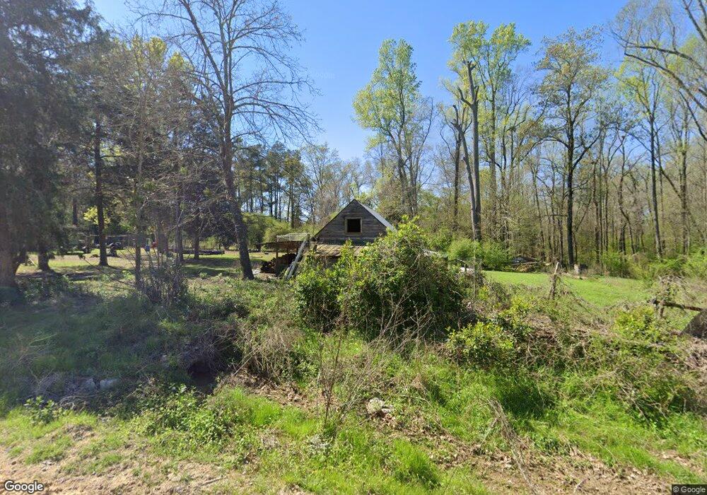
This home is located at 260 Dempsey Rd, Cope, SC 29038 and is currently estimated at $167,816, approximately $122 per square foot. 260 Dempsey Rd is a home located in Orangeburg County with nearby schools including Edisto Primary, Edisto Elementary, and Carver Edisto Middle School.
Ownership History
Date
Name
Owned For
Owner Type
Purchase Details
Closed on
Apr 27, 2021
Sold by
Richardson Wendy
Bought by
Hartland Richard and Mackenzie-Hartland Amber
Current Estimated Value
Home Financials for this Owner
Home Financials are based on the most recent Mortgage that was taken out on this home.
Original Mortgage
$112,917
Outstanding Balance
$102,331
Interest Rate
3.1%
Mortgage Type
FHA
Estimated Equity
$65,485
Purchase Details
Closed on
Jun 3, 2020
Sold by
Wilmington Savings Fund Society Fsb
Bought by
Richardson Wendy
Home Financials for this Owner
Home Financials are based on the most recent Mortgage that was taken out on this home.
Original Mortgage
$20,000
Interest Rate
3%
Mortgage Type
Unknown
Purchase Details
Closed on
Nov 18, 2019
Sold by
Agic Craig M
Bought by
Wilmington Savings Fund Society and Pretium Mortgage Acquisition Trust
Create a Home Valuation Report for This Property
The Home Valuation Report is an in-depth analysis detailing your home's value as well as a comparison with similar homes in the area
Purchase History
| Date | Buyer | Sale Price | Title Company |
|---|---|---|---|
| Hartland Richard | -- | None Listed On Document | |
| Richardson Wendy | $27,500 | None Available | |
| Wilmington Savings Fund Society | $55,000 | None Available |
Source: Public Records
Mortgage History
| Date | Status | Borrower | Loan Amount |
|---|---|---|---|
| Open | Hartland Richard | $112,917 | |
| Previous Owner | Richardson Wendy | $20,000 |
Source: Public Records
Tax History
| Year | Tax Paid | Tax Assessment Tax Assessment Total Assessment is a certain percentage of the fair market value that is determined by local assessors to be the total taxable value of land and additions on the property. | Land | Improvement |
|---|---|---|---|---|
| 2024 | $860 | $4,470 | $860 | $3,610 |
| 2023 | $875 | $4,476 | $1,748 | $2,728 |
| 2022 | $509 | $4,476 | $1,748 | $2,728 |
| 2021 | $509 | $4,068 | $822 | $3,246 |
| 2020 | $1,522 | $4,068 | $0 | $0 |
| 2019 | $442 | $2,712 | $548 | $2,164 |
| 2018 | $403 | $2,828 | $548 | $2,280 |
| 2017 | $399 | $2,828 | $0 | $0 |
| 2016 | $398 | $2,828 | $0 | $0 |
| 2015 | $367 | $2,828 | $0 | $0 |
| 2014 | $367 | $2,828 | $548 | $2,280 |
| 2013 | -- | $3,080 | $548 | $2,532 |
Source: Public Records
Map
Nearby Homes
- 1071 Binnicker Bridge Rd
- 598 Binnicker Bridge Rd
- 142 Brown Meadows Ct
- 122 Retha Rd
- 156 Retha Rd
- 234 Binnicker Bridge Rd
- 3735 Bamberg Rd
- 2036 Colony Dr
- 2024 Colony Dr
- 2099 Legrand Smoak St
- 259 Bill Salley Rd
- 3230 Cordova Rd
- Tbd Binnicker Bridge Rd
- 1035 Norway Rd Unit Of
- 2672 Frazier Ln
- 0 Frolic Meadows Ln Unit Lane 24022605
- 968 Fawn Ln
- 808 Lakeside Dr NE
- 0 Carver School Rd Unit 24022381
- 00 Ryn St
- 110 Poplar Grove Rd
- 118 Poplar Grove Rd
- 0 Dempsey Rd
- 141 Poplar Grove Rd
- 4296 Bamberg Rd
- 4296 Bamberg Rd
- 333 Dempsey Rd
- 4354 Bamberg Rd
- 170 Poplar Grove Rd
- 4286 Bamberg Rd
- 157 Jerendon Pro Ln
- 4313 Bamberg Rd
- 4287 Bamberg Rd
- 4309 Bamberg Rd
- 4309 Bamberg Rd
- 4380 Bamberg Rd
- 4381 Bamberg Rd
- 104 Elder Branch Rd
- 100 Dempsey Rd
- 100 Dempsey Rd
Your Personal Tour Guide
Ask me questions while you tour the home.