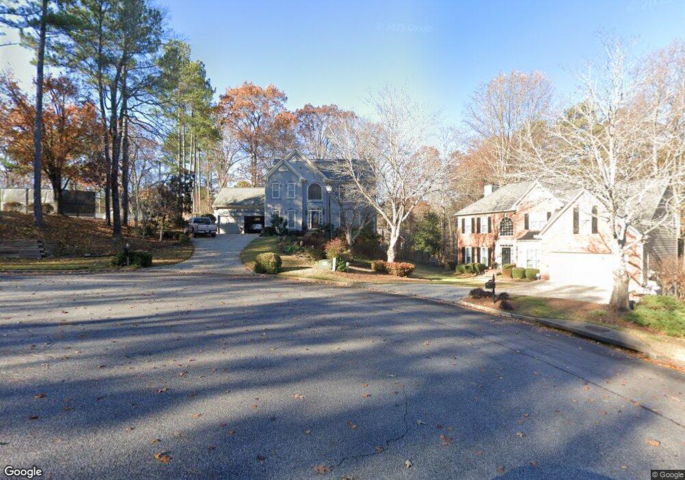
260 Dunhill Way Dr Alpharetta, GA 30005
Estimated Value: $624,000 - $711,000
4
Beds
3
Baths
2,448
Sq Ft
$275/Sq Ft
Est. Value
About This Home
This home is located at 260 Dunhill Way Dr, Alpharetta, GA 30005 and is currently estimated at $672,793, approximately $274 per square foot. 260 Dunhill Way Dr is a home located in Fulton County with nearby schools including Abbotts Hill Elementary School, Taylor Road Middle School, and Chattahoochee High School.
Ownership History
Date
Name
Owned For
Owner Type
Purchase Details
Closed on
May 8, 2019
Sold by
Kirkpatrick Randal
Bought by
Kirkpatrick James Randal and Kirkpatrick Sandra Jean
Current Estimated Value
Create a Home Valuation Report for This Property
The Home Valuation Report is an in-depth analysis detailing your home's value as well as a comparison with similar homes in the area
Home Values in the Area
Average Home Value in this Area
Purchase History
| Date | Buyer | Sale Price | Title Company |
|---|---|---|---|
| Kirkpatrick James Randal | -- | -- |
Source: Public Records
Tax History Compared to Growth
Tax History
| Year | Tax Paid | Tax Assessment Tax Assessment Total Assessment is a certain percentage of the fair market value that is determined by local assessors to be the total taxable value of land and additions on the property. | Land | Improvement |
|---|---|---|---|---|
| 2025 | $2,915 | $254,240 | $56,160 | $198,080 |
| 2023 | $6,554 | $232,200 | $58,120 | $174,080 |
| 2022 | $2,742 | $173,960 | $50,520 | $123,440 |
| 2021 | $2,688 | $140,720 | $30,360 | $110,360 |
| 2020 | $2,699 | $139,760 | $28,880 | $110,880 |
| 2019 | $369 | $137,280 | $28,360 | $108,920 |
| 2018 | $3,737 | $134,040 | $27,680 | $106,360 |
| 2017 | $2,972 | $99,480 | $16,440 | $83,040 |
| 2016 | $2,921 | $99,480 | $16,440 | $83,040 |
| 2015 | $2,953 | $99,480 | $16,440 | $83,040 |
| 2014 | $3,049 | $99,480 | $16,440 | $83,040 |
Source: Public Records
Map
Nearby Homes
- 335 Dunhill Way Ct
- 1660 Gladewood Dr
- 5610 N Hillbrooke Trace
- 11619 Davenport Ln
- 11686 Davenport Ln
- 6365 Murets Rd
- 11615 Windbrooke Way
- 130 Wyndlam Ct
- 5575 Ashwind Trace
- 11260 Donnington Dr
- 11150 Highfield Chase Dr
- 775 Ellsborough Ct
- 485 Portrait Cir
- 5680 Abbotts Bridge Rd
- 4905 Weathervane Dr
- 11235 Surrey Park Trail
- 5200 Cresslyn Ridge
- 270 Dunhill Way Dr
- 325 Dunhill Way Ct
- 335 Dunhill Way Dr
- 345 Dunhill Way Ct
- 315 Dunhill Way Ct
- 325 Dunhill Way Dr
- 315 Dunhill Way Dr
- 0 Dunhill Way Ct Unit 7423431
- 0 Dunhill Way Ct Unit 8729103
- 0 Dunhill Way Ct Unit 8599133
- 0 Dunhill Way Ct Unit 8405969
- 0 Dunhill Way Ct Unit 8121550
- 305 Dunhill Way Dr Unit 305
- 305 Dunhill Way Dr
- 250 Dunhill Way Dr
- 340 Dunhill Way Ct
- 295 Dunhill Way Dr
- 350 Dunhill Way Ct Unit 50
- 350 Dunhill Way Ct
- 285 Dunhill Way Dr