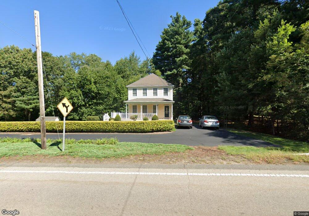
260 Franklin St Wrentham, MA 02093
Estimated Value: $709,000 - $814,000
3
Beds
3
Baths
1,938
Sq Ft
$385/Sq Ft
Est. Value
About This Home
This home is located at 260 Franklin St, Wrentham, MA 02093 and is currently estimated at $746,515, approximately $385 per square foot. 260 Franklin St is a home located in Norfolk County with nearby schools including Delaney Elementary School and Charles E Roderick.
Ownership History
Date
Name
Owned For
Owner Type
Purchase Details
Closed on
Apr 28, 2017
Sold by
Tocci Cynthia J
Bought by
Tocci 2017 Funding T and Tocci
Current Estimated Value
Purchase Details
Closed on
Mar 1, 2017
Sold by
Leland Rt and Tocci
Bought by
Tocci Cynthia J
Purchase Details
Closed on
Jul 31, 2001
Sold by
Vito Anthony P
Bought by
Leland Rt
Home Financials for this Owner
Home Financials are based on the most recent Mortgage that was taken out on this home.
Original Mortgage
$100,000
Interest Rate
7.18%
Mortgage Type
Purchase Money Mortgage
Purchase Details
Closed on
Jan 11, 2001
Sold by
Whipple Jonathan N
Bought by
Vito Anthony P
Home Financials for this Owner
Home Financials are based on the most recent Mortgage that was taken out on this home.
Original Mortgage
$275,000
Interest Rate
7.64%
Mortgage Type
Purchase Money Mortgage
Purchase Details
Closed on
Apr 12, 2000
Sold by
Eds Constr Inc
Bought by
Whipple Jonathan N
Create a Home Valuation Report for This Property
The Home Valuation Report is an in-depth analysis detailing your home's value as well as a comparison with similar homes in the area
Home Values in the Area
Average Home Value in this Area
Purchase History
| Date | Buyer | Sale Price | Title Company |
|---|---|---|---|
| Tocci 2017 Funding T | -- | -- | |
| Tocci Cynthia J | -- | -- | |
| Leland Rt | $315,000 | -- | |
| Vito Anthony P | $307,000 | -- | |
| Whipple Jonathan N | $72,000 | -- |
Source: Public Records
Mortgage History
| Date | Status | Borrower | Loan Amount |
|---|---|---|---|
| Previous Owner | Whipple Jonathan N | $100,000 | |
| Previous Owner | Whipple Jonathan N | $275,000 | |
| Previous Owner | Whipple Jonathan N | $175,000 |
Source: Public Records
Tax History Compared to Growth
Tax History
| Year | Tax Paid | Tax Assessment Tax Assessment Total Assessment is a certain percentage of the fair market value that is determined by local assessors to be the total taxable value of land and additions on the property. | Land | Improvement |
|---|---|---|---|---|
| 2025 | $7,954 | $686,300 | $303,600 | $382,700 |
| 2024 | $7,645 | $637,100 | $303,600 | $333,500 |
| 2023 | $7,210 | $571,300 | $276,000 | $295,300 |
| 2022 | $7,092 | $518,800 | $257,500 | $261,300 |
| 2021 | $6,547 | $465,300 | $224,900 | $240,400 |
| 2020 | $6,457 | $453,100 | $200,100 | $253,000 |
| 2019 | $6,233 | $441,400 | $200,100 | $241,300 |
| 2018 | $5,663 | $397,700 | $180,500 | $217,200 |
| 2017 | $5,515 | $387,000 | $177,000 | $210,000 |
| 2016 | $5,429 | $380,200 | $171,800 | $208,400 |
| 2015 | $5,420 | $361,800 | $165,200 | $196,600 |
| 2014 | $5,365 | $350,400 | $158,900 | $191,500 |
Source: Public Records
Map
Nearby Homes
- 10 Nature View Dr
- 15 Nature View Dr
- 270 Dedham St
- 570 Franklin St
- 1 Lorraine Metcalf Dr
- 246 Forest Grove Ave
- 131 Creek St Unit 7
- 50 Reed Fulton Ave Unit Lot 61
- 45 Joshua Rd
- 11 Earle Stewart Ln
- 3 Oak Rd
- 362 East St
- Lot 3 - 14 Earle Stewart Ln
- Lot 1 - Blueberry 2 Car Plan at King Philip Estates
- Lot 8 - Blueberry 2 Car Plan at King Philip Estates
- Lot 6 - Blueberry 3 Car Plan at King Philip Estates
- Lot 2 - Camden 2 Car Plan at King Philip Estates
- Lot 7 - Cedar Plan at King Philip Estates
- Lot 4 - Hemingway 2 Car Plan at King Philip Estates
- Lot 3 - Blueberry 2 Car Plan at King Philip Estates