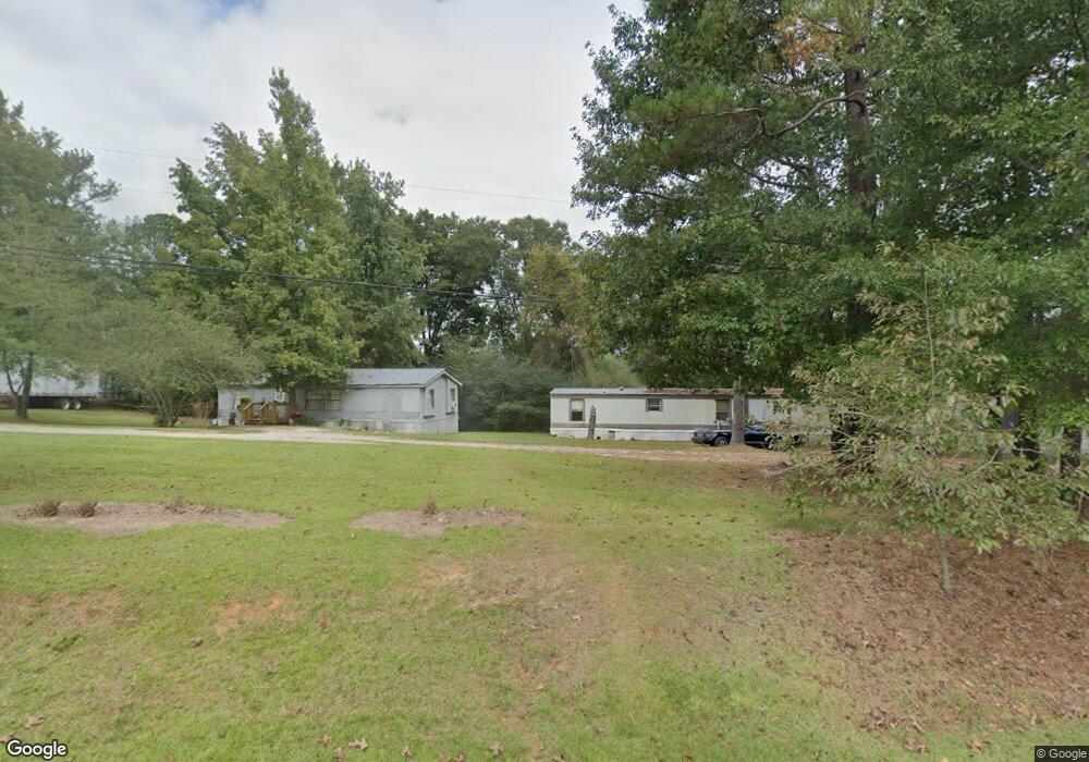
260 Hurst Mill Rd N Bremen, GA 30110
Estimated Value: $244,000 - $261,000
3
Beds
2
Baths
1,276
Sq Ft
$198/Sq Ft
Est. Value
About This Home
This home is located at 260 Hurst Mill Rd N, Bremen, GA 30110 and is currently estimated at $253,039, approximately $198 per square foot. 260 Hurst Mill Rd N is a home located in Haralson County with nearby schools including Haralson County High School.
Ownership History
Date
Name
Owned For
Owner Type
Purchase Details
Closed on
Sep 27, 2018
Sold by
Herod Joseph Anthony
Bought by
Herod Joseph Anthony and Fonner Samantha
Current Estimated Value
Home Financials for this Owner
Home Financials are based on the most recent Mortgage that was taken out on this home.
Original Mortgage
$67,750
Outstanding Balance
$59,993
Interest Rate
5.25%
Mortgage Type
FHA
Estimated Equity
$193,046
Purchase Details
Closed on
Apr 18, 1977
Bought by
Mcadams Pat
Create a Home Valuation Report for This Property
The Home Valuation Report is an in-depth analysis detailing your home's value as well as a comparison with similar homes in the area
Home Values in the Area
Average Home Value in this Area
Purchase History
| Date | Buyer | Sale Price | Title Company |
|---|---|---|---|
| Herod Joseph Anthony | -- | -- | |
| Herod Joseph Anthony | $69,000 | -- | |
| Mcadams Pat | $26,400 | -- |
Source: Public Records
Mortgage History
| Date | Status | Borrower | Loan Amount |
|---|---|---|---|
| Open | Herod Joseph Anthony | $67,750 | |
| Closed | Herod Joseph Anthony | $67,750 |
Source: Public Records
Tax History Compared to Growth
Tax History
| Year | Tax Paid | Tax Assessment Tax Assessment Total Assessment is a certain percentage of the fair market value that is determined by local assessors to be the total taxable value of land and additions on the property. | Land | Improvement |
|---|---|---|---|---|
| 2024 | $1,572 | $62,617 | $3,400 | $59,217 |
| 2023 | $1,540 | $59,435 | $3,400 | $56,035 |
| 2022 | $1,197 | $46,639 | $3,400 | $43,239 |
| 2021 | $1,180 | $44,252 | $3,400 | $40,852 |
| 2020 | $686 | $26,448 | $3,400 | $23,048 |
| 2019 | $762 | $26,156 | $3,400 | $22,756 |
| 2018 | $669 | $24,644 | $3,400 | $21,244 |
| 2017 | $676 | $22,786 | $3,400 | $19,386 |
| 2016 | $785 | $27,635 | $3,400 | $24,235 |
| 2015 | $769 | $27,084 | $3,400 | $23,684 |
| 2014 | $769 | $27,479 | $3,400 | $24,079 |
Source: Public Records
Map
Nearby Homes
- 386 Springwater Way
- 000 Crosstown Pkwy
- 1549 Georgia Ave S
- 1141 Whispering Hills Dr
- 86 Pine Brook Dr
- 126 Covered Bridge Rd
- 1122 Whispering Hills Dr
- 92 Liberty Station Dr
- 64 Liberty Station Dr
- 16 Liberty Station Dr
- 650 N Raburn Rd
- 539 Saddle Chase Dr
- 48 Covered Bridge Rd
- 256 Mangham Rd
- 8 Brock Ln
- 1556 Cashtown Rd
- 124 Greystone Dr
- 282 Hurst Mill Rd N
- 240 Hurst Mill Rd N
- 46 Twin Creeks Dr
- 302 Hurst Mill Rd N
- 222 Hurst Mill Rd N
- 0 Twin Creek Rd
- 295 Hurst Mill Rd N
- 86 Twin Creeks Dr
- 316 Hurst Mill Rd N
- 316 N Hurst Mill Rd
- 311 Hurst Mill Rd N
- 45 Twin Creeks Dr
- 289 Hurst Mill Rd N
- 63 Twin Creeks Dr
- 170 Hurst Mill Rd N
- 129 Hurst Mill Rd N
- 249 Hurst Mill Rd N
- 83 Twin Creeks Dr
- 319 Hurst Mill Rd N
- 0 Twin Creeks Dr