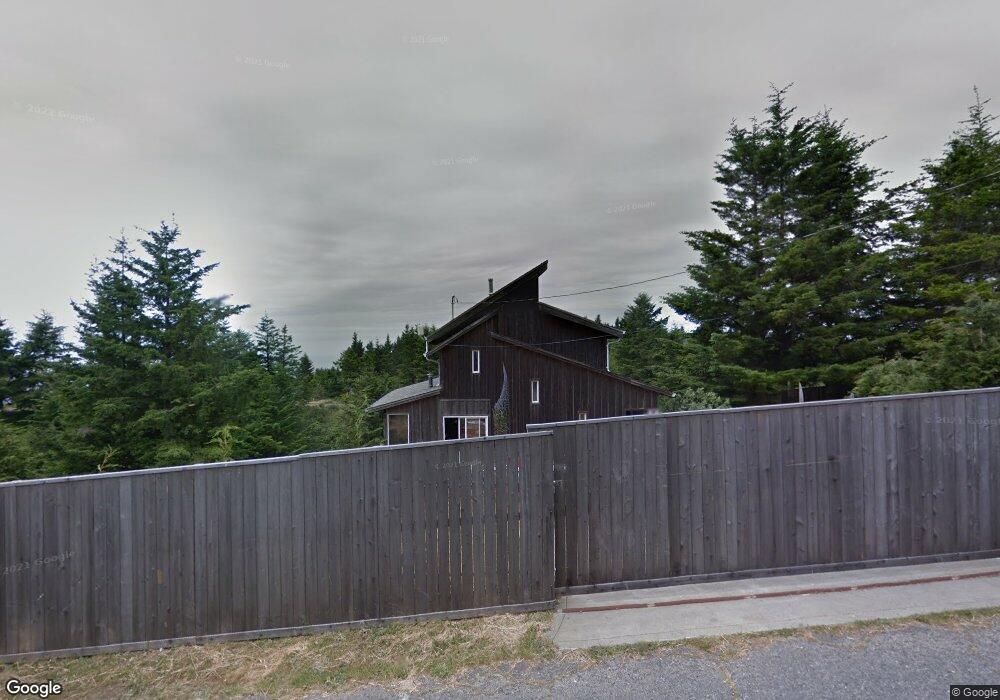
260 Landis Rd Whitethorn, CA 95589
Estimated Value: $352,877 - $624,000
Studio
--
Bath
1,458
Sq Ft
$304/Sq Ft
Est. Value
About This Home
This home is located at 260 Landis Rd, Whitethorn, CA 95589 and is currently estimated at $443,469, approximately $304 per square foot. 260 Landis Rd is a home located in Humboldt County.
Ownership History
Date
Name
Owned For
Owner Type
Purchase Details
Closed on
Dec 26, 2007
Sold by
Wilson Sommer D
Bought by
Holland Kenneth L
Current Estimated Value
Home Financials for this Owner
Home Financials are based on the most recent Mortgage that was taken out on this home.
Original Mortgage
$368,000
Interest Rate
6.04%
Mortgage Type
Purchase Money Mortgage
Purchase Details
Closed on
May 31, 2006
Sold by
Wilson John L and Wilson Melva
Bought by
Wilson Sommer D and Holland Kenneth L
Home Financials for this Owner
Home Financials are based on the most recent Mortgage that was taken out on this home.
Original Mortgage
$356,000
Interest Rate
6.55%
Mortgage Type
Fannie Mae Freddie Mac
Purchase Details
Closed on
Dec 20, 2004
Sold by
Thompson Robert A and Thompson Sara G
Bought by
Holland Kenneth L and Wilson Sommer D
Home Financials for this Owner
Home Financials are based on the most recent Mortgage that was taken out on this home.
Original Mortgage
$340,000
Interest Rate
5.73%
Mortgage Type
New Conventional
Purchase Details
Closed on
Jan 14, 2003
Sold by
Holman J Anne and Holman Trust
Bought by
Thompson Robert A and Thompson Sara G
Home Financials for this Owner
Home Financials are based on the most recent Mortgage that was taken out on this home.
Original Mortgage
$135,000
Interest Rate
5.83%
Purchase Details
Closed on
Dec 22, 1998
Sold by
Holman J Anne
Bought by
Holman J Anne and Holman Trust
Purchase Details
Closed on
Jul 27, 1998
Sold by
Anderson Beatrice P
Bought by
Holman J Anne
Home Financials for this Owner
Home Financials are based on the most recent Mortgage that was taken out on this home.
Original Mortgage
$100,000
Interest Rate
6.91%
Purchase Details
Closed on
Nov 14, 1996
Sold by
Anderson Beatrice P
Bought by
Anderson Beatrice P
Home Financials for this Owner
Home Financials are based on the most recent Mortgage that was taken out on this home.
Original Mortgage
$90,000
Interest Rate
7.94%
Mortgage Type
Balloon
Create a Home Valuation Report for This Property
The Home Valuation Report is an in-depth analysis detailing your home's value as well as a comparison with similar homes in the area
Home Values in the Area
Average Home Value in this Area
Purchase History
| Date | Buyer | Sale Price | Title Company |
|---|---|---|---|
| Holland Kenneth L | -- | Humboldt Land Title Company | |
| Wilson Sommer D | -- | Fidelity National Title Comp | |
| Holland Kenneth L | $425,000 | Humboldt Land & Title Co | |
| Thompson Robert A | $215,000 | Humboldt Land Title Company | |
| Holman J Anne | -- | -- | |
| Holman J Anne | $166,000 | Fidelity National Title Co | |
| Anderson Beatrice P | -- | Fidelity National Title Co |
Source: Public Records
Mortgage History
| Date | Status | Borrower | Loan Amount |
|---|---|---|---|
| Previous Owner | Holland Kenneth L | $368,000 | |
| Previous Owner | Wilson Sommer D | $356,000 | |
| Previous Owner | Holland Kenneth L | $340,000 | |
| Previous Owner | Thompson Robert A | $135,000 | |
| Previous Owner | Holman J Anne | $100,000 | |
| Previous Owner | Anderson Beatrice P | $90,000 | |
| Closed | Holland Kenneth L | $42,500 |
Source: Public Records
Tax History
| Year | Tax Paid | Tax Assessment Tax Assessment Total Assessment is a certain percentage of the fair market value that is determined by local assessors to be the total taxable value of land and additions on the property. | Land | Improvement |
|---|---|---|---|---|
| 2025 | $3,540 | $300,000 | $70,000 | $230,000 |
| 2024 | $3,540 | $300,000 | $70,000 | $230,000 |
| 2023 | $3,618 | $300,000 | $70,000 | $230,000 |
| 2022 | $3,630 | $300,000 | $70,000 | $230,000 |
| 2021 | $3,295 | $275,000 | $50,000 | $225,000 |
| 2020 | $3,344 | $275,000 | $50,000 | $225,000 |
| 2019 | $3,325 | $275,000 | $50,000 | $225,000 |
| 2018 | $3,330 | $275,000 | $50,000 | $225,000 |
| 2017 | $3,230 | $275,000 | $50,000 | $225,000 |
| 2016 | $5,861 | $509,103 | $147,796 | $361,307 |
| 2015 | $5,831 | $501,456 | $145,576 | $355,880 |
| 2014 | $5,486 | $491,634 | $142,725 | $348,909 |
Source: Public Records
Map
Nearby Homes
- 141 Cove Point W
- 19 Haven Ct
- 145 Cove View Dr
- 8936 Shelter Cove Rd
- 9020 Shelter Cove Rd
- 356 Nob Hill Rd
- 62 Highview Cir
- 39 High Ct
- 336 Knob Hill Dr
- 11 Vista Rd
- 191 Redwood Rd
- 450 Hillside Dr
- 1085 Hillside Dr
- 42 Vista Rd
- 2715 Toth Rd
- 66 Vista Rd
- 95 Vista Rd
- 432 Knob Hill Dr
- 161 Parkview Rd
- 233 Nob Hill Rd
Your Personal Tour Guide
Ask me questions while you tour the home.