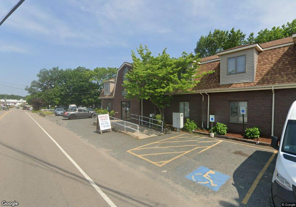
260 Milton St Dedham, MA 02026
Oakdale Neighborhood
--
Bed
6
Baths
6,400
Sq Ft
0.28
Acres
About This Home
This home is located at 260 Milton St, Dedham, MA 02026. 260 Milton St is a home located in Norfolk County with nearby schools including Avery, Dedham Middle School, and Dedham High School.
Ownership History
Date
Name
Owned For
Owner Type
Purchase Details
Closed on
May 23, 1997
Sold by
Hallal Tr Mithcell F
Bought by
Robri Lp
Home Financials for this Owner
Home Financials are based on the most recent Mortgage that was taken out on this home.
Original Mortgage
$255,000
Interest Rate
8.08%
Mortgage Type
Commercial
Purchase Details
Closed on
Apr 6, 1989
Sold by
Desull Rt
Bought by
Fambus Rt
Home Financials for this Owner
Home Financials are based on the most recent Mortgage that was taken out on this home.
Original Mortgage
$600,000
Interest Rate
10.71%
Mortgage Type
Commercial
Create a Home Valuation Report for This Property
The Home Valuation Report is an in-depth analysis detailing your home's value as well as a comparison with similar homes in the area
Home Values in the Area
Average Home Value in this Area
Purchase History
| Date | Buyer | Sale Price | Title Company |
|---|---|---|---|
| Robri Lp | $319,000 | -- | |
| Fambus Rt | $550,000 | -- |
Source: Public Records
Mortgage History
| Date | Status | Borrower | Loan Amount |
|---|---|---|---|
| Open | Fambus Rt | $540,000 | |
| Closed | Fambus Rt | $120,137 | |
| Closed | Fambus Rt | $255,000 | |
| Previous Owner | Fambus Rt | $600,000 |
Source: Public Records
Tax History Compared to Growth
Tax History
| Year | Tax Paid | Tax Assessment Tax Assessment Total Assessment is a certain percentage of the fair market value that is determined by local assessors to be the total taxable value of land and additions on the property. | Land | Improvement |
|---|---|---|---|---|
| 2025 | $27,080 | $1,033,600 | $395,300 | $638,300 |
| 2024 | $25,347 | $979,400 | $376,400 | $603,000 |
| 2023 | $24,264 | $913,900 | $338,800 | $575,100 |
| 2022 | $24,335 | $871,300 | $312,500 | $558,800 |
| 2021 | $23,247 | $805,500 | $282,200 | $523,300 |
| 2020 | $22,484 | $783,400 | $253,600 | $529,800 |
| 2019 | $22,646 | $760,200 | $253,600 | $506,600 |
| 2018 | $22,752 | $741,600 | $253,600 | $488,000 |
| 2017 | $23,003 | $733,500 | $245,500 | $488,000 |
| 2016 | $23,477 | $711,000 | $223,000 | $488,000 |
| 2015 | $23,504 | $692,300 | $223,000 | $469,300 |
| 2014 | $24,037 | $692,300 | $223,000 | $469,300 |
Source: Public Records
Map
Nearby Homes
- 1896 River St
- 1892 River St
- 1886-1888 River St
- 1888 River St Unit front
- 10 Fairview St
- 16 N Stone Mill Dr Unit 1014
- 10 Lewis Farm Rd
- 3 Lewis Farm Rd
- 3 S Stone Mill Dr Unit 221
- 36 N Stone Mill Dr Unit 1224
- 54 Como Rd
- 13 W Milton Place
- 7 S Stone Mill Dr Unit 403
- 98 Chesterfield St
- 000 Danny Rd
- 1816 River St
- 94 Border St
- 38 Fleming St
- 12 Tarbox St
- 15 Bunker St Unit 2
- 260 Milton St Unit 105
- 260 Milton St Unit 200
- 44 River St
- 259 Milton St Unit 6
- 271 Milton St
- 36 River St
- 249 Milton St
- 30 River St
- 46 River St
- 50 River St
- 46 River St
- 34 River St Unit 1
- 280 Milton St Unit A
- 280 Milton St Unit Garage
- 280 Milton St
- 277 Milton St
- 20 River St
- 285 Milton St
- 290 Milton St
- 21 Hidden Terrace