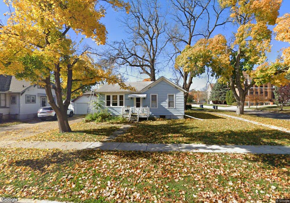
260 Orchard St Elgin, IL 60123
Near West Elgin NeighborhoodEstimated Value: $189,000 - $240,000
2
Beds
1
Bath
916
Sq Ft
$244/Sq Ft
Est. Value
About This Home
This home is located at 260 Orchard St, Elgin, IL 60123 and is currently estimated at $223,197, approximately $243 per square foot. 260 Orchard St is a home located in Kane County with nearby schools including Washington Elementary School, Abbott Middle School, and Larkin High School.
Ownership History
Date
Name
Owned For
Owner Type
Purchase Details
Closed on
May 27, 2025
Sold by
Richards Tom
Bought by
Thomas M Richards Living Trust and Richards
Current Estimated Value
Purchase Details
Closed on
Oct 31, 2011
Sold by
Riebock Ronald R and Hutson Judy
Bought by
Richards Tom
Purchase Details
Closed on
Jul 23, 2003
Sold by
Riebock Floyd T and Riebock Evelyn M
Bought by
Riebock Evelyn M
Purchase Details
Closed on
Jan 12, 2002
Sold by
Riebock Roberta J
Bought by
Riebock Floyd T and Riebock Evelyn M
Purchase Details
Closed on
Jan 11, 2002
Sold by
Riebock Marisa
Bought by
Riebock Roberta J
Create a Home Valuation Report for This Property
The Home Valuation Report is an in-depth analysis detailing your home's value as well as a comparison with similar homes in the area
Home Values in the Area
Average Home Value in this Area
Purchase History
We collect this data history from publicly available records. To have your information removed, we recommend requesting removal directly through your county’s website.
| Date | Buyer | Sale Price | Title Company |
|---|---|---|---|
| Thomas M Richards Living Trust | -- | None Listed On Document | |
| Richards Tom | $47,000 | Chicago Title Insurance Co | |
| Riebock Evelyn M | -- | -- | |
| Riebock Floyd T | -- | -- | |
| Riebock Roberta J | $10,000 | -- |
Source: Public Records
Tax History
| Year | Tax Paid | Tax Assessment Tax Assessment Total Assessment is a certain percentage of the fair market value that is determined by local assessors to be the total taxable value of land and additions on the property. | Land | Improvement |
|---|---|---|---|---|
| 2024 | $4,114 | $51,404 | $11,814 | $39,590 |
| 2023 | $3,959 | $46,440 | $10,673 | $35,767 |
| 2022 | $3,672 | $42,345 | $9,732 | $32,613 |
| 2021 | $3,532 | $39,590 | $9,099 | $30,491 |
| 2020 | $3,447 | $37,794 | $8,686 | $29,108 |
| 2019 | $3,362 | $36,001 | $8,274 | $27,727 |
| 2018 | $3,199 | $32,360 | $7,795 | $24,565 |
| 2017 | $3,147 | $30,592 | $7,369 | $23,223 |
| 2016 | $3,027 | $28,381 | $6,836 | $21,545 |
| 2015 | -- | $26,014 | $6,266 | $19,748 |
| 2014 | -- | $25,693 | $6,189 | $19,504 |
| 2013 | -- | $27,346 | $6,352 | $20,994 |
Source: Public Records
Map
Nearby Homes
- 224 Moseley St
- 208 Moseley St
- 515 Walnut Ave
- 410 Standish St
- 315 Vandalia St
- 515 Oak St
- 63 S Union St
- 216 Wilcox Ave
- 519 W Highland Ave
- 720 Adams St
- 835 Oak St
- 3 National St Unit 3
- 311 Ryerson Ave
- 853 Orange St
- 726 W Highland Ave
- 141 S Grove Ave
- 164 Ludeka Place
- 14 Highland Ave
- 375 S Edison Ave
- 821 Larkin Ave
- 559 Standish St
- 262 Orchard St
- 561 Standish St
- 527 Standish St
- 261 Orchard St
- 264 Orchard St
- 263 Orchard St
- 227 Orchard St
- 220 Orchard St
- 269 Orchard St
- 519 Standish St
- 562 Walnut Ave
- 214 Orchard St
- 520 Standish St
- 566 Walnut Ave
- 566 Walnut Ave Unit 2
- 566 Walnut Ave Unit 1
- 511 Standish St
- 219 Orchard St
- 528 Walnut Ave
Your Personal Tour Guide
Ask me questions while you tour the home.