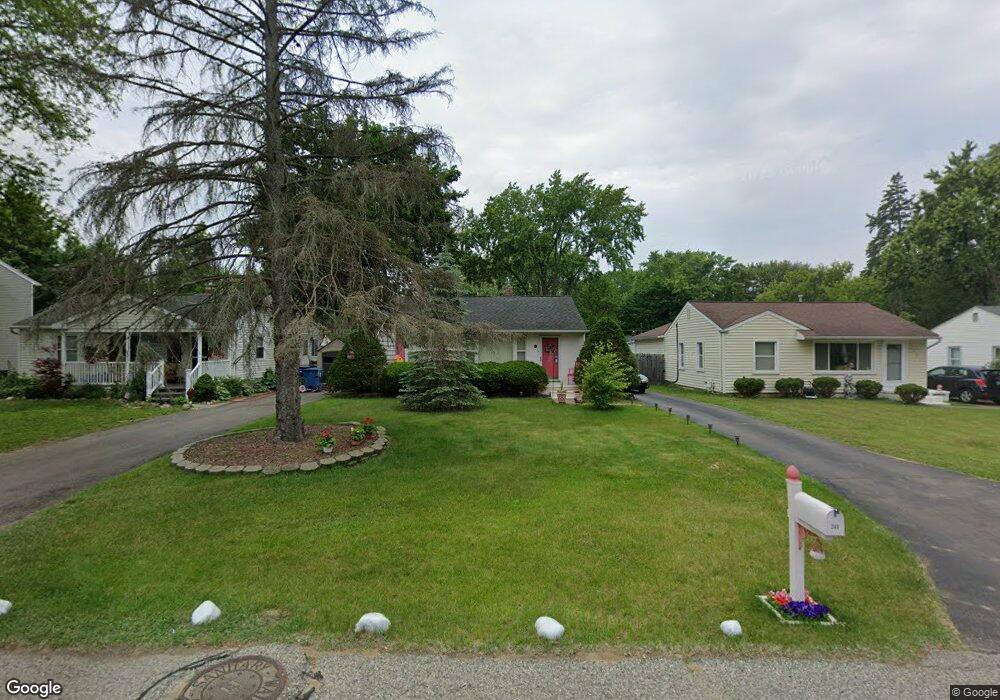
260 Rivard Blvd Waterford, MI 48327
Waterford Township NeighborhoodEstimated Value: $184,000 - $213,000
2
Beds
1
Bath
720
Sq Ft
$276/Sq Ft
Est. Value
About This Home
This home is located at 260 Rivard Blvd, Waterford, MI 48327 and is currently estimated at $198,633, approximately $275 per square foot. 260 Rivard Blvd is a home located in Oakland County with nearby schools including Knudsen Elementary School, Pierce Middle School, and Waterford Mott High School.
Ownership History
Date
Name
Owned For
Owner Type
Purchase Details
Closed on
Aug 20, 2017
Sold by
Sherman Elizabeth Renee and Botsford Elizabeth R
Bought by
Botsford Peter
Current Estimated Value
Purchase Details
Closed on
Oct 13, 2006
Sold by
Baut Scott and Baut Rebecca A
Bought by
Botsford Peter and Botsford Elizabeth R
Home Financials for this Owner
Home Financials are based on the most recent Mortgage that was taken out on this home.
Original Mortgage
$120,547
Outstanding Balance
$72,092
Interest Rate
6.5%
Mortgage Type
FHA
Estimated Equity
$126,541
Purchase Details
Closed on
Jul 30, 1997
Sold by
Gardiner Bryan C
Bought by
Baut Scott
Home Financials for this Owner
Home Financials are based on the most recent Mortgage that was taken out on this home.
Original Mortgage
$76,600
Interest Rate
7.68%
Purchase Details
Closed on
Mar 11, 1997
Sold by
Gardiner Bryan
Bought by
Gardiner Bryan
Create a Home Valuation Report for This Property
The Home Valuation Report is an in-depth analysis detailing your home's value as well as a comparison with similar homes in the area
Home Values in the Area
Average Home Value in this Area
Purchase History
| Date | Buyer | Sale Price | Title Company |
|---|---|---|---|
| Botsford Peter | -- | None Available | |
| Botsford Peter | $121,500 | Multiple | |
| Baut Scott | $79,000 | -- | |
| Gardiner Bryan | -- | -- |
Source: Public Records
Mortgage History
| Date | Status | Borrower | Loan Amount |
|---|---|---|---|
| Open | Botsford Peter | $120,547 | |
| Previous Owner | Baut Scott | $76,600 |
Source: Public Records
Tax History Compared to Growth
Tax History
| Year | Tax Paid | Tax Assessment Tax Assessment Total Assessment is a certain percentage of the fair market value that is determined by local assessors to be the total taxable value of land and additions on the property. | Land | Improvement |
|---|---|---|---|---|
| 2024 | $714 | $67,510 | $0 | $0 |
| 2023 | $681 | $59,090 | $0 | $0 |
| 2022 | $1,305 | $50,840 | $0 | $0 |
| 2021 | $1,225 | $47,950 | $0 | $0 |
| 2020 | $624 | $47,790 | $0 | $0 |
| 2019 | $1,044 | $44,000 | $0 | $0 |
| 2018 | $1,006 | $38,790 | $0 | $0 |
| 2017 | $925 | $38,790 | $0 | $0 |
| 2016 | $929 | $36,210 | $0 | $0 |
| 2015 | -- | $30,980 | $0 | $0 |
| 2014 | -- | $28,620 | $0 | $0 |
| 2011 | -- | $28,180 | $0 | $0 |
Source: Public Records
Map
Nearby Homes
- 5720 Berkley Dr
- 5596 Eldridge Dr
- 5760 Copper Tree Park
- 5745 Copper Tree Park
- 5741 Copper Tree Park
- 000 Elizabeth Lake Rd
- 0000 Tamson St
- Doyon Ct Lot 16 Ct
- 5531 Berkley Dr
- 5510 Berkley Dr
- 5930 Forestal Dr
- 5524 Aylesbury Dr
- 0 Hillson Dr
- 513 River Ridge Dr
- 5835 Forestal Dr
- 70 Fountain Park Dr
- 514 Sulley St
- 59 Lochaven Rd
- 5375 Prentis Rd
- 6600 Doyon Dr S
- 250 Rivard Blvd
- 270 Rivard Blvd
- 259 Clayburn Blvd
- 240 Rivard Blvd
- 280 Rivard Blvd
- 241 Clayburn Blvd
- 230 Rivard Blvd
- 279 Clayburn Blvd
- 290 Rivard Blvd
- 229 Clayburn Blvd
- 289 Clayburn Blvd
- 220 Rivard Blvd
- 251 Rivard Blvd
- 285 Rivard Blvd
- 275 Rivard Blvd
- 304 Rivard Blvd
- 299 Clayburn Blvd
- 231 Rivard Blvd
- 0 Clayburn Blvd
- 51028 Clayburn Blvd