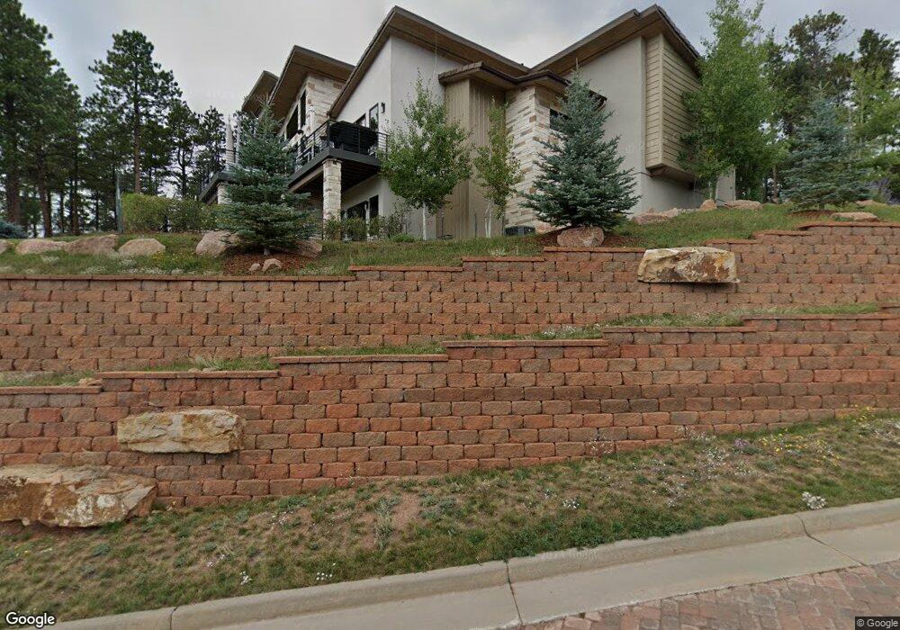
260 Thunder Ridge Dr Woodland Park, CO 80863
Estimated Value: $1,448,000 - $1,711,000
3
Beds
5
Baths
4,536
Sq Ft
$347/Sq Ft
Est. Value
About This Home
This home is located at 260 Thunder Ridge Dr, Woodland Park, CO 80863 and is currently estimated at $1,573,895, approximately $346 per square foot. 260 Thunder Ridge Dr is a home located in Teller County with nearby schools including Woodland Park Junior/Senior High School, Merit Academy, and Colorado Springs Christian School.
Ownership History
Date
Name
Owned For
Owner Type
Purchase Details
Closed on
Aug 14, 2025
Sold by
Carnes Richard and Carnes Marla
Bought by
Carnes Family Trust
Current Estimated Value
Purchase Details
Closed on
Dec 17, 2021
Sold by
Thunder Ridge Haven Llc
Bought by
Carnes Richard and Carnes Marla
Purchase Details
Closed on
Jun 25, 2021
Sold by
Smith Andrew
Bought by
Carnes Richard and Carnes Maria
Purchase Details
Closed on
Jun 28, 2016
Sold by
Park State Bank & Trust
Bought by
Smith Andrew
Home Financials for this Owner
Home Financials are based on the most recent Mortgage that was taken out on this home.
Original Mortgage
$890,500
Interest Rate
3.58%
Mortgage Type
Seller Take Back
Create a Home Valuation Report for This Property
The Home Valuation Report is an in-depth analysis detailing your home's value as well as a comparison with similar homes in the area
Home Values in the Area
Average Home Value in this Area
Purchase History
| Date | Buyer | Sale Price | Title Company |
|---|---|---|---|
| Carnes Family Trust | -- | None Listed On Document | |
| Carnes Family Trust | -- | None Listed On Document | |
| Carnes Richard | $5,000 | Fidelity National Title | |
| Carnes Richard | $2,165,000 | Fidelity National Title | |
| Carnes Richard | $1,375,000 | Unified Title Company | |
| Smith Andrew | $210,000 | Unified Title Company |
Source: Public Records
Mortgage History
| Date | Status | Borrower | Loan Amount |
|---|---|---|---|
| Previous Owner | Smith Andrew | $890,500 |
Source: Public Records
Tax History Compared to Growth
Tax History
| Year | Tax Paid | Tax Assessment Tax Assessment Total Assessment is a certain percentage of the fair market value that is determined by local assessors to be the total taxable value of land and additions on the property. | Land | Improvement |
|---|---|---|---|---|
| 2024 | $10,148 | $97,480 | $15,060 | $82,420 |
| 2023 | $10,148 | $97,480 | $15,060 | $82,420 |
| 2022 | $7,903 | $74,460 | $8,270 | $66,190 |
| 2021 | $8,100 | $76,610 | $8,510 | $68,100 |
| 2020 | $6,796 | $65,410 | $4,660 | $60,750 |
| 2019 | $6,761 | $65,410 | $0 | $0 |
| 2018 | $6,430 | $61,190 | $0 | $0 |
| 2017 | $4,311 | $40,970 | $0 | $0 |
| 2016 | $1,235 | $11,710 | $0 | $0 |
| 2015 | $1,316 | $11,710 | $0 | $0 |
| 2014 | $409 | $3,610 | $0 | $0 |
Source: Public Records
Map
Nearby Homes
- 311 Thunder Ridge Dr
- 270 Thunder Ridge Dr Unit 3R
- 270 Thunder Ridge Dr
- 271 Thunder Ridge Dr
- 201 Fox Mountain Dr
- 620 Skyline Dr
- 1141 Royal Oak Ct
- 311 Panther Ct
- 591 Skyline Dr
- 350 Panther Ct
- 206 Eagles Perch Place
- 10 Blue Haven Place Unit 10
- 303 S Baldwin St
- 580 Greenway Ct Unit B
- 1148 Parkview Rd
- 1148 Park View Rd
- 0 S Baldwin St Unit 8229404
- 0 S Baldwin St Unit 9&10 REC7969394
- 0 S Baldwin St Unit 1739635
- 1030 Locklin Way
- 201 Fox Mountain Dr
- 261 Thunder Ridge Dr
- 202 Fox Mountain Dr
- 241 Thunder Ridge Dr
- 281 Thunder Ridge Dr
- 1030 Skyline Ct
- 1030 Wintergreen Ct
- 220 Thunder Ridge Dr
- 221 Thunder Ridge Dr
- 961 Spacious Skies Dr
- 1035 Skyline Ct
- 301 Thunder Ridge Dr
- 300 Thunder Ridge Dr
- 1040 Wintergreen Ct
- 1010 Skyline Ct
- 960 Spacious Skies Dr
- 200 Thunder Ridge Dr
- 1010 Wintergreen Ct
- 1050 Wintergreen Ct
- 1015 Skyline Ct