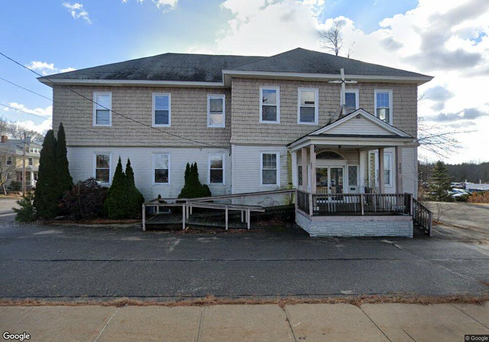
260 Us Route One Scarborough, ME 04074
Estimated Value: $961,466
--
Bed
--
Bath
7,016
Sq Ft
$137/Sq Ft
Est. Value
About This Home
This home is located at 260 Us Route One, Scarborough, ME 04074 and is currently estimated at $961,466, approximately $137 per square foot. 260 Us Route One is a home located in Cumberland County with nearby schools including Scarborough High School and Cornerstone Baptist Academy.
Ownership History
Date
Name
Owned For
Owner Type
Purchase Details
Closed on
Jul 19, 2018
Sold by
Coastal Community Church
Bought by
Joy Re Of Scarborough Llc
Current Estimated Value
Home Financials for this Owner
Home Financials are based on the most recent Mortgage that was taken out on this home.
Original Mortgage
$396,000
Outstanding Balance
$343,193
Interest Rate
4.5%
Mortgage Type
New Conventional
Estimated Equity
$618,273
Purchase Details
Closed on
Jul 8, 2005
Sold by
Bourgoin Gail L and Bourgoin Reginald A
Bought by
Coastal Community Church
Home Financials for this Owner
Home Financials are based on the most recent Mortgage that was taken out on this home.
Original Mortgage
$525,000
Interest Rate
5.71%
Mortgage Type
Commercial
Create a Home Valuation Report for This Property
The Home Valuation Report is an in-depth analysis detailing your home's value as well as a comparison with similar homes in the area
Home Values in the Area
Average Home Value in this Area
Purchase History
| Date | Buyer | Sale Price | Title Company |
|---|---|---|---|
| Joy Re Of Scarborough Llc | -- | -- | |
| Coastal Community Church | -- | -- |
Source: Public Records
Mortgage History
| Date | Status | Borrower | Loan Amount |
|---|---|---|---|
| Open | Joy Re Of Scarborough Llc | $396,000 | |
| Closed | Coastal Community Church | $525,000 |
Source: Public Records
Tax History Compared to Growth
Tax History
| Year | Tax Paid | Tax Assessment Tax Assessment Total Assessment is a certain percentage of the fair market value that is determined by local assessors to be the total taxable value of land and additions on the property. | Land | Improvement |
|---|---|---|---|---|
| 2024 | $7,870 | $720,000 | $262,200 | $457,800 |
| 2023 | $6,966 | $436,200 | $164,800 | $271,400 |
| 2022 | $6,713 | $436,200 | $164,800 | $271,400 |
| 2021 | $6,552 | $436,200 | $164,800 | $271,400 |
| 2020 | $6,482 | $436,200 | $164,800 | $271,400 |
| 2019 | $0 | $608,400 | $164,800 | $443,600 |
| 2017 | $0 | $377,000 | $139,200 | $237,800 |
| 2016 | -- | $377,000 | $139,200 | $237,800 |
| 2015 | -- | $377,000 | $139,200 | $237,800 |
| 2014 | -- | $377,000 | $139,200 | $237,800 |
| 2013 | -- | $377,000 | $139,200 | $237,800 |
Source: Public Records
Map
Nearby Homes
- 11 Westwood Ave
- 14 Herbert Dr
- 8 Ballantyne Dr
- 5 Traditional St
- 19 Millbrook Rd
- 5 Estate Dr
- 30 Stratton Rd Unit 30
- 29 Stratton Rd
- 1 Stratton Rd Unit 1
- 1 Teal Point Dr Unit 1
- 14 Oakdale Dr Unit 14
- 24 Bayberry Ln
- 46 Pacer Way
- 12 Bayberry Ln
- 12 Old Mill Rd
- 4 Perennial Way
- 14 Holbrook Farms Way Unit 1
- 73 Maple Ave
- 1 Cross St Unit 212
- 1 Cross St Unit 213