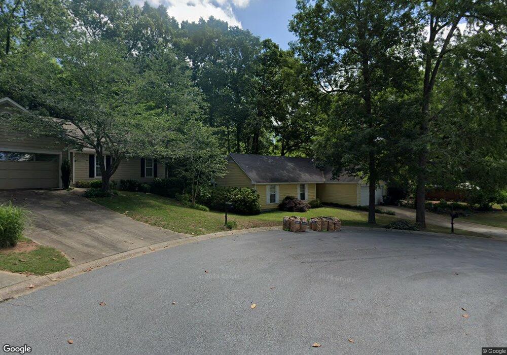
260 Wakefield Trace Athens, GA 30605
Estimated Value: $278,052 - $326,000
3
Beds
2
Baths
1,230
Sq Ft
$240/Sq Ft
Est. Value
About This Home
This home is located at 260 Wakefield Trace, Athens, GA 30605 and is currently estimated at $295,513, approximately $240 per square foot. 260 Wakefield Trace is a home located in Clarke County with nearby schools including Barnett Shoals Elementary School, Hilsman Middle School, and Cedar Shoals High School.
Ownership History
Date
Name
Owned For
Owner Type
Purchase Details
Closed on
Jun 14, 2003
Sold by
Lee D Ronnie
Bought by
Trust Matthew Paul & Christy Lee
Current Estimated Value
Purchase Details
Closed on
Apr 1, 2003
Sold by
Sujan Aparna and Shewak Hingoran
Bought by
Lee D Ronnie
Purchase Details
Closed on
Jun 20, 2000
Sold by
Corcoran Noelle and Kevin Patric
Bought by
Sujan Aparna and Shewak Hingorani
Purchase Details
Closed on
Jul 20, 1998
Sold by
Wells Jennifer L and Epps Aubrey L
Bought by
Corcoran Noelle and Kevin Patrick Har
Purchase Details
Closed on
Aug 1, 1994
Sold by
Whidbee David A and Whidbee Shelley W
Bought by
Wells Jennifer L and Epps Aubrey L
Purchase Details
Closed on
Jul 31, 1990
Sold by
Dearing Development Corp
Bought by
Whidbee David A and Whidbee Shelley W
Create a Home Valuation Report for This Property
The Home Valuation Report is an in-depth analysis detailing your home's value as well as a comparison with similar homes in the area
Home Values in the Area
Average Home Value in this Area
Purchase History
| Date | Buyer | Sale Price | Title Company |
|---|---|---|---|
| Trust Matthew Paul & Christy Lee | $108,600 | -- | |
| Lee D Ronnie | -- | -- | |
| Sujan Aparna | $100,000 | -- | |
| Corcoran Noelle | $89,900 | -- | |
| Wells Jennifer L | $74,000 | -- | |
| Whidbee David A | $72,500 | -- |
Source: Public Records
Tax History Compared to Growth
Tax History
| Year | Tax Paid | Tax Assessment Tax Assessment Total Assessment is a certain percentage of the fair market value that is determined by local assessors to be the total taxable value of land and additions on the property. | Land | Improvement |
|---|---|---|---|---|
| 2025 | $3,163 | $101,882 | $12,000 | $89,882 |
| 2024 | $3,163 | $96,404 | $12,000 | $84,404 |
| 2023 | $3,013 | $90,113 | $12,000 | $78,113 |
| 2022 | $2,528 | $79,262 | $10,400 | $68,862 |
| 2021 | $2,154 | $63,921 | $9,600 | $54,321 |
| 2020 | $1,964 | $58,279 | $8,800 | $49,479 |
| 2019 | $1,776 | $52,307 | $8,800 | $43,507 |
| 2018 | $1,677 | $49,386 | $8,800 | $40,586 |
| 2017 | $1,594 | $46,954 | $8,800 | $38,154 |
| 2016 | $1,482 | $43,644 | $8,800 | $34,844 |
| 2015 | $1,403 | $41,252 | $8,800 | $32,452 |
| 2014 | $1,412 | $41,457 | $8,800 | $32,657 |
Source: Public Records
Map
Nearby Homes
- 126 Winthrop Way
- 268 Wakefield Trace
- 128 Winthrop Way
- 124 Winthrop Way
- 270 Wakefield Trace
- 255 Wakefield Trace
- 259 Wakefield Trace
- 125 Winthrop Way
- 251 Wakefield Trace
- 123 Winthrop Way
- 269 Wakefield Trace
- 265 Wakefield Trace
- 245 Wakefield Trace
- 121 Winthrop Way
- 120 Winthrop Way
- 240 Wakefield Trace
- 114 Wakefield Dr
- 241 Wakefield Trace
- 135 Ansley Dr
- 120 Wakefield Dr