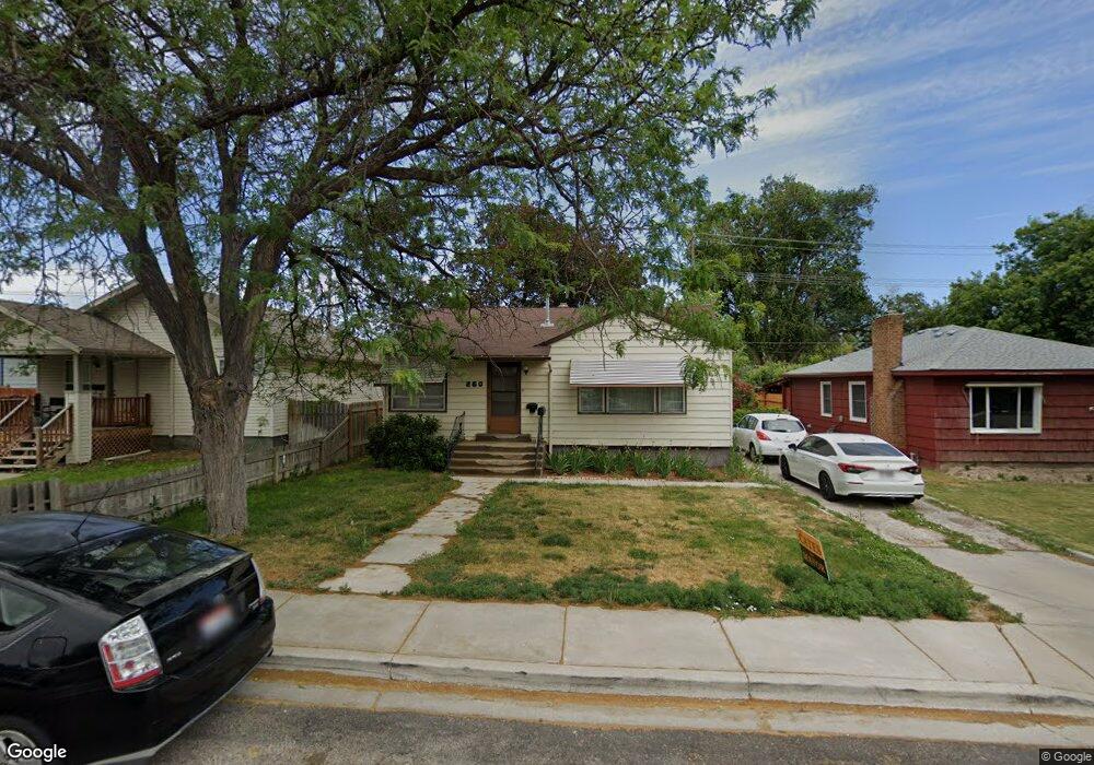
260 Warren Ave Pocatello, ID 83201
Downtown Pocatello NeighborhoodEstimated Value: $232,000 - $274,000
4
Beds
2
Baths
1,684
Sq Ft
$153/Sq Ft
Est. Value
About This Home
This home is located at 260 Warren Ave, Pocatello, ID 83201 and is currently estimated at $258,365, approximately $153 per square foot. 260 Warren Ave is a home located in Bannock County with nearby schools including Lewis & Clark Elementary School, Kinport Academy, and Century High School.
Ownership History
Date
Name
Owned For
Owner Type
Purchase Details
Closed on
Jan 28, 2010
Sold by
Derouen Megan
Bought by
Derouen Wally Paul
Current Estimated Value
Purchase Details
Closed on
Mar 11, 2005
Sold by
Proffitt Palmer and Proffitt Lynnette
Bought by
Derouen W Paul and Derouen Megan
Home Financials for this Owner
Home Financials are based on the most recent Mortgage that was taken out on this home.
Original Mortgage
$73,610
Outstanding Balance
$37,417
Interest Rate
5.65%
Mortgage Type
New Conventional
Estimated Equity
$220,948
Create a Home Valuation Report for This Property
The Home Valuation Report is an in-depth analysis detailing your home's value as well as a comparison with similar homes in the area
Home Values in the Area
Average Home Value in this Area
Purchase History
| Date | Buyer | Sale Price | Title Company |
|---|---|---|---|
| Derouen Wally Paul | -- | -- | |
| Derouen W Paul | -- | -- |
Source: Public Records
Mortgage History
| Date | Status | Borrower | Loan Amount |
|---|---|---|---|
| Open | Derouen W Paul | $73,610 |
Source: Public Records
Tax History Compared to Growth
Tax History
| Year | Tax Paid | Tax Assessment Tax Assessment Total Assessment is a certain percentage of the fair market value that is determined by local assessors to be the total taxable value of land and additions on the property. | Land | Improvement |
|---|---|---|---|---|
| 2024 | $2,324 | $180,698 | $55,000 | $125,698 |
| 2023 | $2,346 | $201,056 | $55,000 | $146,056 |
| 2022 | $2,346 | $143,197 | $30,636 | $112,561 |
| 2021 | $2,425 | $143,197 | $30,636 | $112,561 |
| 2020 | $1,977 | $124,881 | $25,530 | $99,351 |
| 2019 | $2,357 | $121,305 | $25,530 | $95,775 |
| 2018 | $40 | $98,313 | $18,500 | $79,813 |
| 2017 | $40 | $98,313 | $18,500 | $79,813 |
| 2016 | $1,099 | $98,313 | $18,500 | $79,813 |
| 2015 | $1,109 | $0 | $0 | $0 |
| 2012 | -- | $95,592 | $18,500 | $77,092 |
Source: Public Records
Map
Nearby Homes
- 189 Washington Ave
- 173 Wayne Ave
- 241 Wilson Ave
- 129 Wayne Ave
- 227 Park Ave
- 270 Taft Ave
- 168 Park Ave
- 160 Park Ave
- 333 Randolph Ave
- 230 Roosevelt Ave
- TBD Mckinley Ave
- 725 N 10th Ave
- 1124 E Bridger St
- 1121 E Bridger St
- 532 Roosevelt Ave
- 506 E Poplar St
- 611 N 11th Ave
- 687 Warren Ave
- 557 N 9th Ave
- 596 Jefferson Ave
- 272 Warren Ave
- 250 Warren Ave
- 343 E Maple St
- 273 Warren Ave
- 265 Warren Ave
- 246 Warren Ave
- 267 Willard Ave
- 281 Warren Ave
- 275 Willard Ave
- 255 Warren Ave
- 305 E Maple St
- 263 Willard Ave
- 353 E Maple St
- 363 E Maple St
- 293 Warren Ave
- 271 Willard Ave
- 245 Warren Ave
- 257 Willard Ave
- 222 Warren Ave
- 369 E Maple St