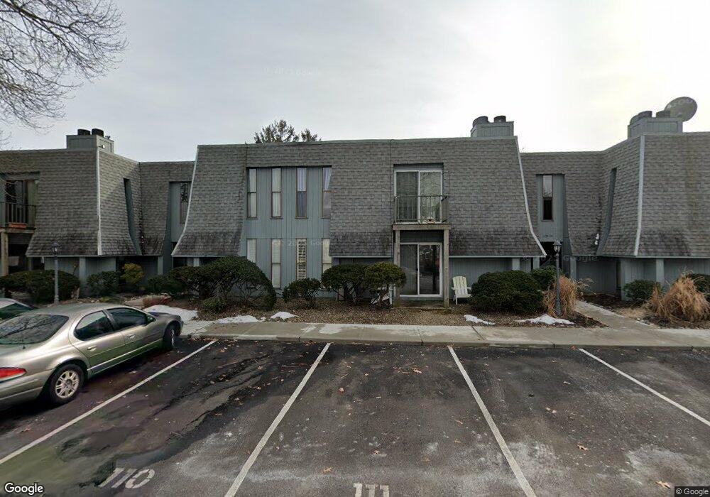
2600 Austin Ave Unit 120 Point Pleasant Boro, NJ 08742
Estimated Value: $297,000 - $375,000
1
Bed
1
Bath
690
Sq Ft
$464/Sq Ft
Est. Value
About This Home
This home is located at 2600 Austin Ave Unit 120, Point Pleasant Boro, NJ 08742 and is currently estimated at $320,041, approximately $463 per square foot. 2600 Austin Ave Unit 120 is a home located in Ocean County with nearby schools including Chillicothe Primary School, Point Pleasant High School, and St Dominic School.
Ownership History
Date
Name
Owned For
Owner Type
Purchase Details
Closed on
Aug 21, 2008
Sold by
Morgan Kristen and Morgan Eric
Bought by
Mcelwee Kimberly
Current Estimated Value
Home Financials for this Owner
Home Financials are based on the most recent Mortgage that was taken out on this home.
Original Mortgage
$176,234
Outstanding Balance
$117,692
Interest Rate
6.69%
Mortgage Type
FHA
Estimated Equity
$202,349
Create a Home Valuation Report for This Property
The Home Valuation Report is an in-depth analysis detailing your home's value as well as a comparison with similar homes in the area
Home Values in the Area
Average Home Value in this Area
Purchase History
| Date | Buyer | Sale Price | Title Company |
|---|---|---|---|
| Mcelwee Kimberly | $179,000 | Fidelity Natl Title Ins Co |
Source: Public Records
Mortgage History
| Date | Status | Borrower | Loan Amount |
|---|---|---|---|
| Open | Mcelwee Kimberly | $176,234 |
Source: Public Records
Tax History Compared to Growth
Tax History
| Year | Tax Paid | Tax Assessment Tax Assessment Total Assessment is a certain percentage of the fair market value that is determined by local assessors to be the total taxable value of land and additions on the property. | Land | Improvement |
|---|---|---|---|---|
| 2025 | $3,099 | $135,500 | $75,000 | $60,500 |
| 2024 | $2,962 | $135,500 | $75,000 | $60,500 |
| 2023 | $2,901 | $135,500 | $75,000 | $60,500 |
| 2022 | $2,901 | $135,500 | $75,000 | $60,500 |
| 2021 | $2,856 | $135,500 | $75,000 | $60,500 |
| 2020 | $2,827 | $135,500 | $75,000 | $60,500 |
| 2019 | $2,789 | $135,500 | $75,000 | $60,500 |
| 2018 | $2,706 | $135,500 | $75,000 | $60,500 |
| 2017 | $2,646 | $135,500 | $75,000 | $60,500 |
| 2016 | $2,626 | $135,500 | $75,000 | $60,500 |
| 2015 | $2,595 | $135,500 | $75,000 | $60,500 |
| 2014 | $2,535 | $135,500 | $75,000 | $60,500 |
Source: Public Records
Map
Nearby Homes
- 519 Curtis Ave
- 2704 Route 88
- 611 Boulton Ave
- 2821 Herbertsville Rd
- 3006 Herbertsville Rd
- 305 Barbara Dr
- 2412 Willow St
- 207 River Ave
- 601 Marshall Dr
- 3105 Cambridge Dr
- 1202 Sunset Ave
- 713 Beaver Dam Rd
- 103 River Ave
- 3000 River Rd Unit 3000 & 3000A
- 512 Oak Terrace
- 221 Ida Dr
- 2001 Veterans Memorial Dr
- 506 Crestview Terrace
- 550 Crestview Terrace
- 1204 Treeneedle Rd
- 2600 Austin Ave Unit 119
- 2600 Austin Ave Unit 118
- 2600 Austin Ave Unit 117
- 2600 Austin Ave Unit 116
- 2600 Austin Ave Unit 115
- 2600 Austin Ave Unit 114
- 2600 Austin Ave Unit 113
- 2600 Austin Ave Unit 112
- 2600 Austin Ave Unit 111
- 2600 Austin Ave Unit 110
- 2600 Austin Ave Unit 109
- 2600 Austin Ave Unit 108
- 2600 Austin Ave Unit 107
- 2600 Austin Ave Unit 106
- 2600 Austin Ave Unit 104
- 2600 Austin Ave Unit 103
- 2600 Austin Ave Unit 102
- 2600 Austin Ave Unit 101
- 2600 Austin Ave Unit 106
- 2609 Austin Ave