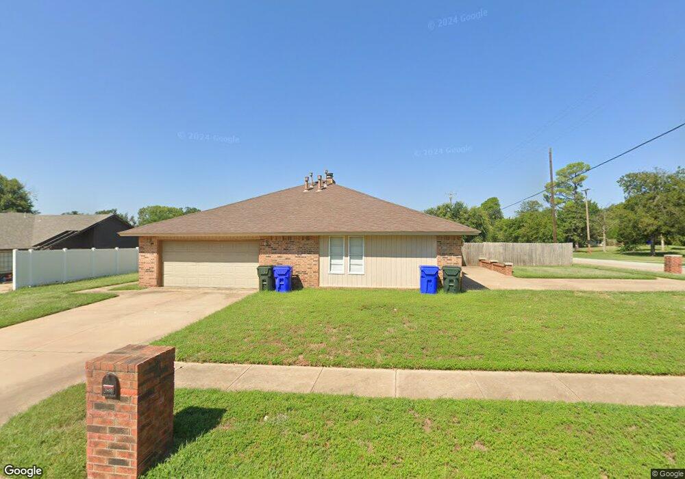
2600 Belknap Ave Norman, OK 73072
Adkins Crossing NeighborhoodEstimated Value: $316,000 - $373,000
6
Beds
4
Baths
2,600
Sq Ft
$131/Sq Ft
Est. Value
About This Home
This home is located at 2600 Belknap Ave, Norman, OK 73072 and is currently estimated at $340,238, approximately $130 per square foot. 2600 Belknap Ave is a home located in Cleveland County with nearby schools including Monroe Elementary School, Alcott Middle School, and Norman High School.
Ownership History
Date
Name
Owned For
Owner Type
Purchase Details
Closed on
Jun 16, 2006
Sold by
Billy Graham Evangelistic Assn
Bought by
Oelke Elton D and Oelke Heather J
Current Estimated Value
Home Financials for this Owner
Home Financials are based on the most recent Mortgage that was taken out on this home.
Original Mortgage
$144,000
Outstanding Balance
$84,613
Interest Rate
6.56%
Mortgage Type
Commercial
Estimated Equity
$255,625
Purchase Details
Closed on
Nov 9, 2005
Sold by
Harris Beth D
Bought by
Billy Graham Evangelistic Assn and Beth Dean Harris Unitrust
Create a Home Valuation Report for This Property
The Home Valuation Report is an in-depth analysis detailing your home's value as well as a comparison with similar homes in the area
Home Values in the Area
Average Home Value in this Area
Purchase History
| Date | Buyer | Sale Price | Title Company |
|---|---|---|---|
| Oelke Elton D | $160,000 | None Available | |
| Billy Graham Evangelistic Assn | -- | None Available |
Source: Public Records
Mortgage History
| Date | Status | Borrower | Loan Amount |
|---|---|---|---|
| Open | Oelke Elton D | $144,000 |
Source: Public Records
Tax History Compared to Growth
Tax History
| Year | Tax Paid | Tax Assessment Tax Assessment Total Assessment is a certain percentage of the fair market value that is determined by local assessors to be the total taxable value of land and additions on the property. | Land | Improvement |
|---|---|---|---|---|
| 2024 | $2,237 | $18,679 | $3,154 | $15,525 |
| 2023 | $2,136 | $17,789 | $2,928 | $14,861 |
| 2022 | $1,950 | $16,942 | $3,000 | $13,942 |
| 2021 | $2,057 | $16,942 | $3,000 | $13,942 |
| 2020 | $2,013 | $16,942 | $3,000 | $13,942 |
| 2019 | $2,048 | $16,942 | $3,000 | $13,942 |
| 2018 | $1,986 | $16,943 | $3,000 | $13,943 |
| 2017 | $2,008 | $16,943 | $0 | $0 |
| 2016 | $2,040 | $16,943 | $3,000 | $13,943 |
| 2015 | -- | $17,472 | $1,946 | $15,526 |
| 2014 | -- | $17,472 | $1,946 | $15,526 |
Source: Public Records
Map
Nearby Homes
- 2520 O J Talley Cir
- 2101 Riverside Dr
- 2301 Mckown Dr
- 2812 Shoreridge Ave Unit 2814, 2812
- 2812 Shoreridge Ave Unit 2814
- 1830 Rolling Hills St
- 2022 Morning Dew Trail
- 2521 McGee Dr Unit 5
- 3001 Marigold Trail
- 1744 Westbrooke Terrace
- 1447 Homeland Ave
- 1711 Westbrooke Terrace
- 1301 24th Ave SW Unit 1305
- 2804 Meadow Ave
- 2720 Cypress Ave
- 1335 Spruce Dr
- 3108 Meadow Ave
- 10 Rustic Hills St
- 1524 Wilshire Ave
- 2704 S Berry Rd
- 2604 Belknap Ave Unit 2606
- 2601 Shoreridge Ave Unit 2603
- 2603 Shoreridge Ave
- 2605 Shoreridge Ave Unit 2607
- 2601 Belknap Ave Unit 2603
- 2605 Belknap Ave Unit 2607
- 2608 Belknap Ave Unit 2610
- 2609 Shoreridge Ave Unit 2611
- 2609 Belknap Ave Unit 2611
- 2612 Belknap Ave Unit 2614
- 2600 Shoreridge Ave Unit 2602
- 2604 Barry Switzer Ave
- 2604 Shoreridge Ave Unit 2606
- 2516 O J Talley Cir
- 2247 Riverside Dr
- 2109 Riverside Dr
- 2600 Barry Switzer Ave
- 2613 Shoreridge Ave Unit 2615
- 2613 Belknap Ave Unit 2615
- 2327 Riverside Dr