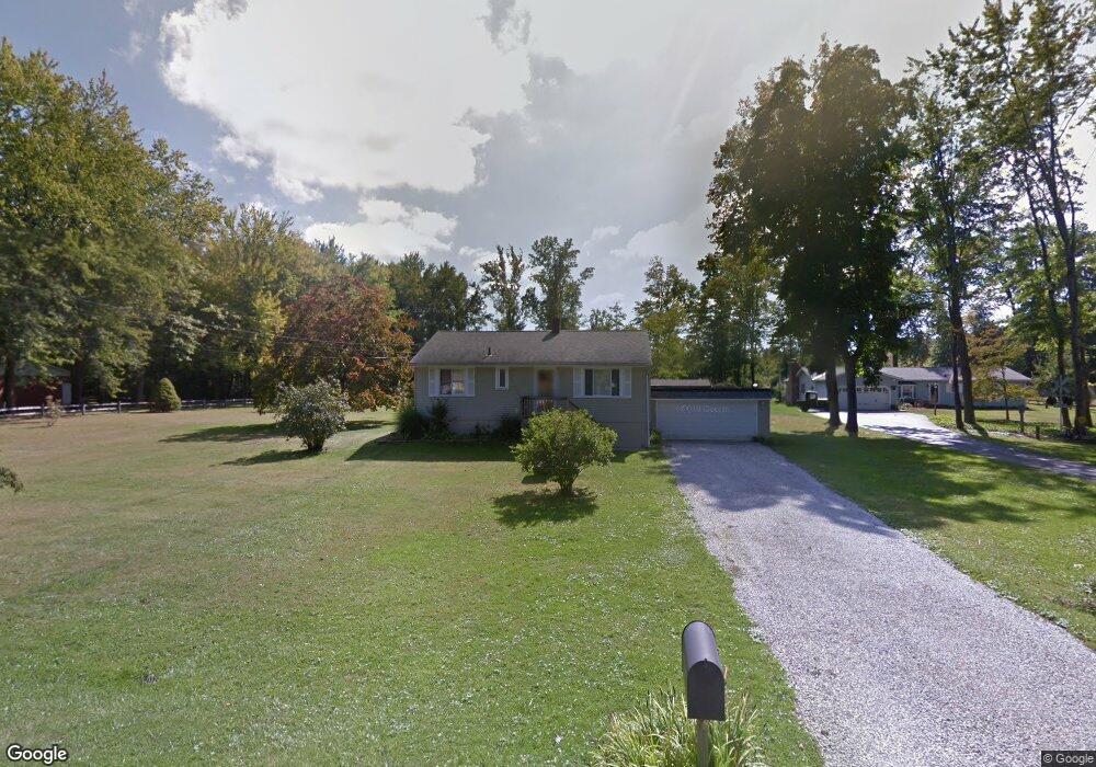
2600 Dorchester Dr Painesville, OH 44077
Estimated Value: $176,851 - $190,000
3
Beds
1
Bath
864
Sq Ft
$213/Sq Ft
Est. Value
About This Home
This home is located at 2600 Dorchester Dr, Painesville, OH 44077 and is currently estimated at $184,463, approximately $213 per square foot. 2600 Dorchester Dr is a home located in Lake County with nearby schools including Perry Elementary School, Perry Middle School, and Perry High School.
Ownership History
Date
Name
Owned For
Owner Type
Purchase Details
Closed on
Jan 24, 2023
Sold by
Harnish Roger A
Bought by
Moore Ethan M
Current Estimated Value
Home Financials for this Owner
Home Financials are based on the most recent Mortgage that was taken out on this home.
Original Mortgage
$113,600
Outstanding Balance
$109,897
Interest Rate
6.31%
Mortgage Type
New Conventional
Estimated Equity
$74,566
Purchase Details
Closed on
Sep 13, 2001
Sold by
Snell Lester J and Snell Anice I
Bought by
Harnish Roger A and Harnish Patricia A
Purchase Details
Closed on
Jan 14, 1985
Bought by
Snell Lester J
Create a Home Valuation Report for This Property
The Home Valuation Report is an in-depth analysis detailing your home's value as well as a comparison with similar homes in the area
Home Values in the Area
Average Home Value in this Area
Purchase History
| Date | Buyer | Sale Price | Title Company |
|---|---|---|---|
| Moore Ethan M | $145,500 | Ohio Real Title | |
| Harnish Roger A | $90,000 | Chicago Title Insurance Comp | |
| Snell Lester J | -- | -- |
Source: Public Records
Mortgage History
| Date | Status | Borrower | Loan Amount |
|---|---|---|---|
| Open | Moore Ethan M | $113,600 |
Source: Public Records
Tax History Compared to Growth
Tax History
| Year | Tax Paid | Tax Assessment Tax Assessment Total Assessment is a certain percentage of the fair market value that is determined by local assessors to be the total taxable value of land and additions on the property. | Land | Improvement |
|---|---|---|---|---|
| 2024 | -- | $55,070 | $15,200 | $39,870 |
| 2023 | $1,761 | $37,080 | $13,200 | $23,880 |
| 2022 | $1,966 | $37,080 | $13,200 | $23,880 |
| 2021 | $1,659 | $37,080 | $13,200 | $23,880 |
| 2020 | $1,575 | $29,670 | $10,560 | $19,110 |
| 2019 | $1,475 | $29,670 | $10,560 | $19,110 |
| 2018 | $1,573 | $26,160 | $9,180 | $16,980 |
| 2017 | $1,296 | $26,160 | $9,180 | $16,980 |
| 2016 | $1,288 | $26,160 | $9,180 | $16,980 |
| 2015 | $1,287 | $26,160 | $9,180 | $16,980 |
| 2014 | $1,264 | $26,160 | $9,180 | $16,980 |
| 2013 | $1,263 | $26,160 | $9,180 | $16,980 |
Source: Public Records
Map
Nearby Homes
- 43 Bristol Ave
- V/L Morgan Dr
- 67 Tanners Farm Dr
- 396 Park Rd
- 65 Tanners Farm Dr
- 525 Morgan Dr
- 5406 Pebble Creek Ln
- 500 Park Rd
- 30 Orton Rd
- 1182 Dalton Dr
- 1172 Dalton Dr
- 4505 Lane Rd
- 58 Deerfield Dr
- 44 Grove Ave
- 269 Hale Rd
- 108 Birch Dr
- 238 Radley Dr
- 1787 Muirfield Ln
- 0 N Ridge Rd Unit 5110949
- 3147 Maine Ave
- 2600 Dorchester Rd
- 2544 Dorchester Dr
- 2574 Dorchester Dr
- V/L Dorchester Rd
- 2555 Dorchester Dr
- 2534 Dorchester Dr
- 2565 Dorchester Dr
- 2535 Dorchester Rd
- 2535 Dorchester Dr
- 2524 Dorchester Dr
- 5074 Klann St
- 2525 Dorchester Dr
- 2584 Dorchester Dr
- 2514 Dorchester Dr
- 5075 Klann St
- 2515 Dorchester Dr
- 2546 Bristol Ave
- 2566 Bristol Ave
- 2544 Bristol Ave
- 2504 Dorchester Dr