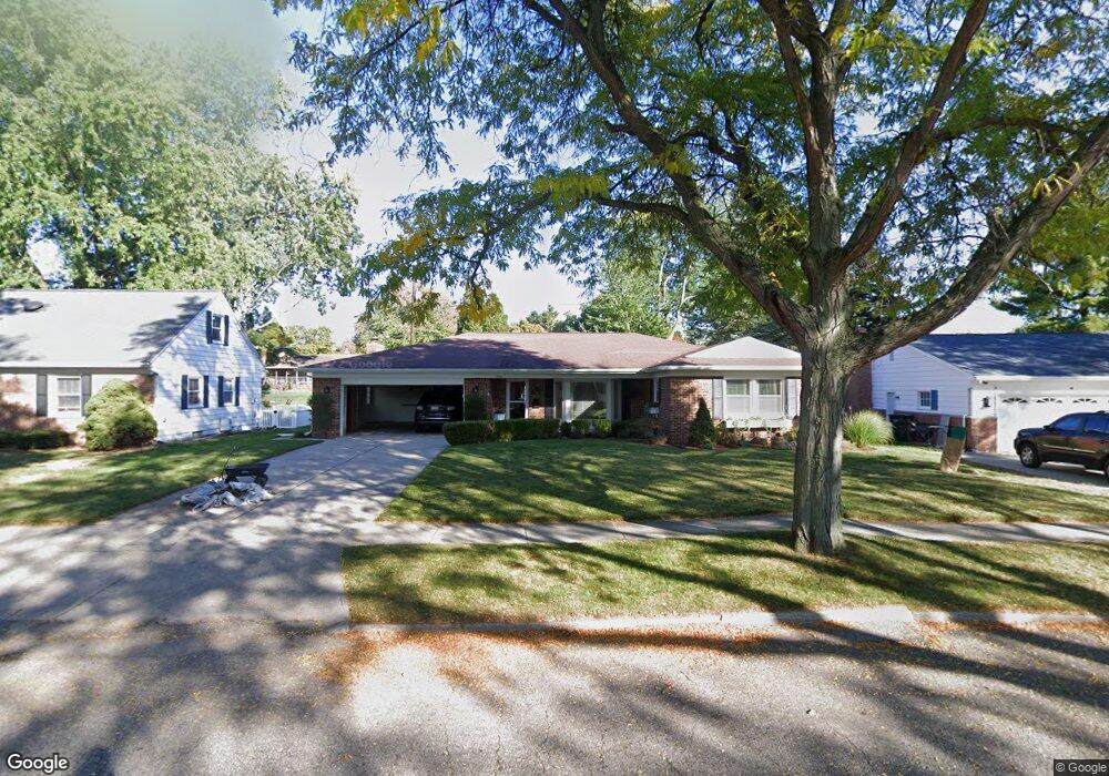
2600 Dunbar Dr Lansing, MI 48906
Northwestside NeighborhoodEstimated Value: $260,494 - $283,000
--
Bed
1
Bath
1,879
Sq Ft
$145/Sq Ft
Est. Value
About This Home
This home is located at 2600 Dunbar Dr, Lansing, MI 48906 and is currently estimated at $271,624, approximately $144 per square foot. 2600 Dunbar Dr is a home located in Ingham County with nearby schools including Cumberland Elementary School, Pattengill Academy, and J.W. Sexton High School.
Ownership History
Date
Name
Owned For
Owner Type
Purchase Details
Closed on
Mar 10, 2000
Sold by
Kowalk Clayton J
Bought by
Charter Sandra L
Current Estimated Value
Home Financials for this Owner
Home Financials are based on the most recent Mortgage that was taken out on this home.
Original Mortgage
$125,000
Outstanding Balance
$41,479
Interest Rate
8%
Mortgage Type
Purchase Money Mortgage
Estimated Equity
$230,145
Purchase Details
Closed on
Sep 23, 1999
Sold by
Kowalk Clayton J and Kowalk Laura Anne
Bought by
Kowalk Clayton J and Kowalk Laura Anne
Create a Home Valuation Report for This Property
The Home Valuation Report is an in-depth analysis detailing your home's value as well as a comparison with similar homes in the area
Home Values in the Area
Average Home Value in this Area
Purchase History
| Date | Buyer | Sale Price | Title Company |
|---|---|---|---|
| Charter Sandra L | $135,000 | -- | |
| Kowalk Clayton J | -- | Metropolitan Title Company |
Source: Public Records
Mortgage History
| Date | Status | Borrower | Loan Amount |
|---|---|---|---|
| Open | Charter Sandra L | $125,000 |
Source: Public Records
Tax History Compared to Growth
Tax History
| Year | Tax Paid | Tax Assessment Tax Assessment Total Assessment is a certain percentage of the fair market value that is determined by local assessors to be the total taxable value of land and additions on the property. | Land | Improvement |
|---|---|---|---|---|
| 2025 | $4,540 | $135,300 | $15,800 | $119,500 |
| 2024 | $36 | $114,600 | $15,800 | $98,800 |
| 2023 | $4,254 | $98,200 | $15,800 | $82,400 |
| 2022 | $3,831 | $87,200 | $13,200 | $74,000 |
| 2021 | $3,751 | $83,600 | $10,200 | $73,400 |
| 2020 | $3,728 | $78,100 | $10,200 | $67,900 |
| 2019 | $3,577 | $73,400 | $10,200 | $63,200 |
| 2018 | $3,348 | $73,400 | $10,200 | $63,200 |
| 2017 | $3,207 | $73,400 | $10,200 | $63,200 |
| 2016 | $3,066 | $62,800 | $10,200 | $52,600 |
| 2015 | $3,066 | $57,500 | $20,301 | $37,199 |
| 2014 | $3,066 | $55,200 | $28,421 | $26,779 |
Source: Public Records
Map
Nearby Homes
- 3500 Colchester Rd
- 3733 Colchester Rd
- 2524 Newport Dr
- 2515 Kuerbitz Dr
- 3031 Amherst Dr
- 3709 Pino Dr
- 3314 Sunnylane
- 3016 Westmont Ave
- 3515 Wilson Ave
- 3116 Colchester Rd
- 2400 Beacon Hill Dr
- 3212 Belgian Dr
- 3319 Westmont Ave
- 2414 Darby Dr
- 3219 Pinto Cir
- 1649 Boynton Dr
- 2400 Leon Ave
- 4320 Mar Moor Dr
- 1610 Ravenswood Dr
- 2722 Tecumseh River Rd
- 2610 Dunbar Dr
- 2530 Dunbar Dr
- 2601 Meadowlane Dr
- 2613 Meadowlane Dr
- 2618 Dunbar Dr
- 2525 Meadowlane Dr
- 2524 Dunbar Dr
- 2601 Dunbar Dr
- 2611 Dunbar Dr
- 2529 Dunbar Dr
- 3623 Gleneden Dr
- 2619 Dunbar Dr
- 2517 Meadowlane Dr
- 2516 Dunbar Dr
- 2521 Dunbar Dr
- 2633 Wyckham Dr
- 2600 Meadowlane Dr
- 2608 Springdale Dr
- 2627 Dunbar Dr