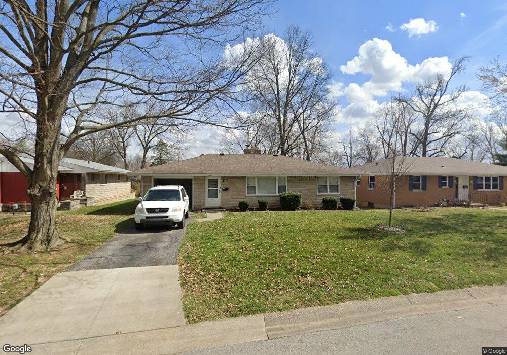
2600 E Robin Rd New Albany, IN 47150
Estimated Value: $199,000 - $217,000
3
Beds
1
Bath
1,222
Sq Ft
$169/Sq Ft
Est. Value
About This Home
This home is located at 2600 E Robin Rd, New Albany, IN 47150 and is currently estimated at $207,128, approximately $169 per square foot. 2600 E Robin Rd is a home located in Floyd County with nearby schools including Fairmont Elementary School, Hazelwood Middle School, and New Albany Senior High School.
Ownership History
Date
Name
Owned For
Owner Type
Purchase Details
Closed on
Jan 3, 2022
Sold by
Grote Mark E
Bought by
Whalin Properties Llc
Current Estimated Value
Home Financials for this Owner
Home Financials are based on the most recent Mortgage that was taken out on this home.
Original Mortgage
$173,178
Outstanding Balance
$148,787
Interest Rate
3.05%
Mortgage Type
New Conventional
Estimated Equity
$58,341
Purchase Details
Closed on
Apr 21, 2010
Sold by
Moore Madelean Wilson and Horton Theresa L
Bought by
Grote Mark E
Create a Home Valuation Report for This Property
The Home Valuation Report is an in-depth analysis detailing your home's value as well as a comparison with similar homes in the area
Home Values in the Area
Average Home Value in this Area
Purchase History
| Date | Buyer | Sale Price | Title Company |
|---|---|---|---|
| Whalin Properties Llc | $338,000 | None Available | |
| Grote Mark E | -- | None Available |
Source: Public Records
Mortgage History
| Date | Status | Borrower | Loan Amount |
|---|---|---|---|
| Open | Whalin Properties Llc | $173,178 |
Source: Public Records
Tax History Compared to Growth
Tax History
| Year | Tax Paid | Tax Assessment Tax Assessment Total Assessment is a certain percentage of the fair market value that is determined by local assessors to be the total taxable value of land and additions on the property. | Land | Improvement |
|---|---|---|---|---|
| 2024 | $3,173 | $149,400 | $13,800 | $135,600 |
| 2023 | $3,308 | $155,000 | $13,800 | $141,200 |
| 2022 | $3,041 | $142,400 | $13,800 | $128,600 |
| 2021 | $2,841 | $132,000 | $13,800 | $118,200 |
| 2020 | $2,628 | $121,900 | $13,800 | $108,100 |
| 2019 | $2,319 | $107,500 | $13,800 | $93,700 |
| 2018 | $2,309 | $106,400 | $13,800 | $92,600 |
| 2017 | $2,244 | $101,600 | $13,800 | $87,800 |
| 2016 | $2,198 | $109,900 | $13,800 | $96,100 |
| 2014 | $2,032 | $101,600 | $13,800 | $87,800 |
| 2013 | -- | $91,000 | $13,800 | $77,200 |
Source: Public Records
Map
Nearby Homes
- 8 Robin Ct
- 1749 McDonald Ln
- 2550 Broadway St
- 2548 Broadway St
- 3105 Murr Ln
- 823 Elmwood Ave
- 1672 Garretson Ln
- 6369 Indiana 111
- 1709 Millerwood Dr
- 805 Elmwood Ave
- 2705 Charlestown Rd
- 2218 Fairmont Ave
- 1324 Roosevelt Ave
- 1655 Harriett Ct
- 2115 Loop Island Way
- 2111 Loop Island Way
- 528 Drawbrook Cir
- 2103 Loop Island Way
- 1651 Summit Ave
- 627 Roseview Terrace
- 2598 E Robin Rd
- 2603 W Robin Rd
- 2603 E Robin Rd
- 2607 W Robin Rd
- 2597 Roanoke Ave
- 2601 E Robin Rd
- 2607 E Robin Rd
- 2595 Roanoke Ave
- 2593 Roanoke Ave
- 2599 E Robin Rd
- 2609 E Robin Rd
- 2601 Roanoke Ave
- 24 Robin Rd
- 2588 E Robin Rd
- 2595 E Robin Rd
- 2591 Roanoke Ave
- 2605 Roanoke Ave
- 2613 E Robin Rd
- 1759 Houston St
- 2602 W Robin Rd