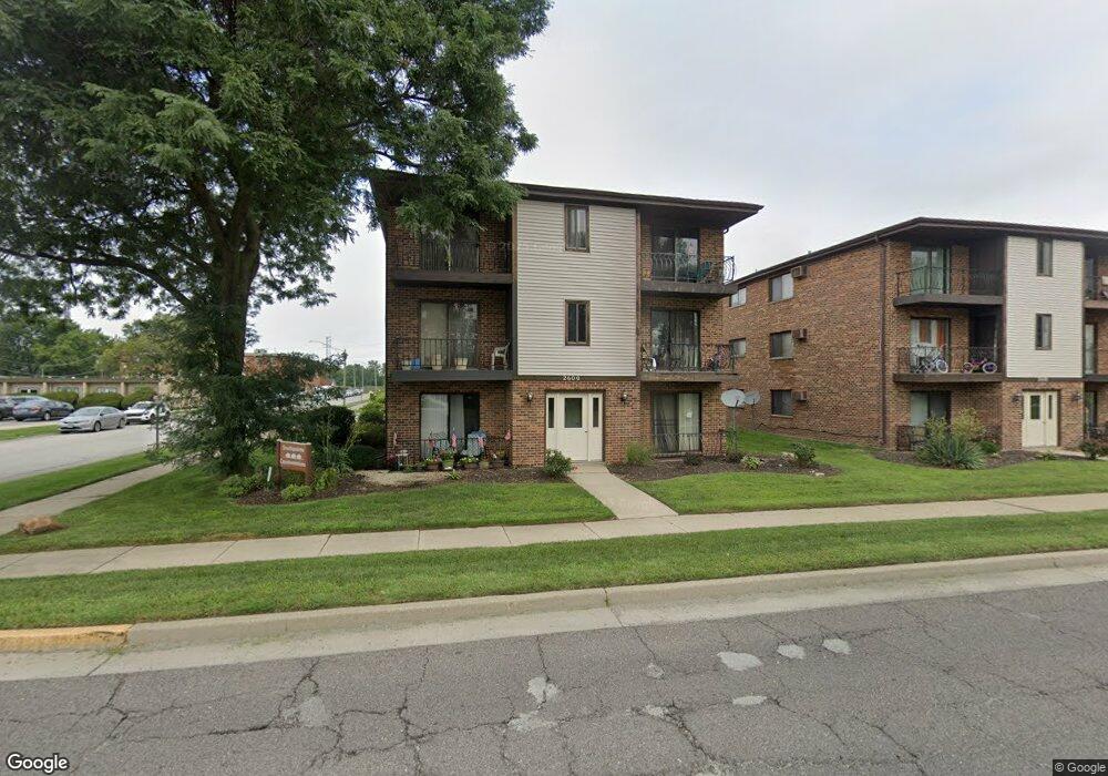
2600 E State St Unit 26001A Chicago, IL 60633
Estimated Value: $55,441 - $78,000
2
Beds
1
Bath
748
Sq Ft
$94/Sq Ft
Est. Value
About This Home
This home is located at 2600 E State St Unit 26001A, Chicago, IL 60633 and is currently estimated at $70,360, approximately $94 per square foot. 2600 E State St Unit 26001A is a home located in Cook County with nearby schools including Wilson Elementary School, Wentworth Intermediate School, and Wentworth Jr High School.
Ownership History
Date
Name
Owned For
Owner Type
Purchase Details
Closed on
Dec 9, 2004
Sold by
Puckett Marilyn
Bought by
Washington Barbara
Current Estimated Value
Home Financials for this Owner
Home Financials are based on the most recent Mortgage that was taken out on this home.
Original Mortgage
$46,930
Outstanding Balance
$25,848
Interest Rate
7.59%
Mortgage Type
Unknown
Estimated Equity
$44,512
Purchase Details
Closed on
Apr 7, 2000
Sold by
Bowers Nanette E
Bought by
Puckett Marilyn D
Home Financials for this Owner
Home Financials are based on the most recent Mortgage that was taken out on this home.
Original Mortgage
$34,500
Interest Rate
8.29%
Mortgage Type
FHA
Create a Home Valuation Report for This Property
The Home Valuation Report is an in-depth analysis detailing your home's value as well as a comparison with similar homes in the area
Home Values in the Area
Average Home Value in this Area
Purchase History
We collect this data history from publicly available records. To have your information removed, we recommend requesting removal directly through your county’s website.
| Date | Buyer | Sale Price | Title Company |
|---|---|---|---|
| Washington Barbara | $49,500 | Stewart Title Guaranty Compa | |
| Puckett Marilyn D | $35,000 | -- |
Source: Public Records
Mortgage History
We collect this data history from publicly available records. To have your information removed, we recommend requesting removal directly through your county’s website.
| Date | Status | Borrower | Loan Amount |
|---|---|---|---|
| Open | Washington Barbara | $46,930 | |
| Previous Owner | Puckett Marilyn D | $34,500 |
Source: Public Records
Tax History
| Year | Tax Paid | Tax Assessment Tax Assessment Total Assessment is a certain percentage of the fair market value that is determined by local assessors to be the total taxable value of land and additions on the property. | Land | Improvement |
|---|---|---|---|---|
| 2025 | -- | $5,523 | $491 | $5,032 |
| 2024 | -- | $5,523 | $491 | $5,032 |
| 2023 | -- | $5,523 | $491 | $5,032 |
| 2022 | $0 | $2,004 | $545 | $1,459 |
| 2021 | $1,554 | $2,004 | $545 | $1,459 |
| 2020 | $1,554 | $2,004 | $545 | $1,459 |
| 2019 | $1,663 | $2,268 | $490 | $1,778 |
| 2018 | $0 | $2,985 | $490 | $2,495 |
| 2017 | $1,554 | $2,985 | $490 | $2,495 |
| 2016 | $3,144 | $5,073 | $436 | $4,637 |
| 2015 | $341 | $5,073 | $436 | $4,637 |
| 2014 | $1,609 | $5,073 | $436 | $4,637 |
| 2013 | $1,198 | $4,976 | $436 | $4,540 |
Source: Public Records
Map
Nearby Homes
- 800 State St
- 14541 S Marquette Ave
- 14522 S Marquette Ave
- 808 State St
- 802 State St
- 812 State St
- 814 State St
- 804 State St
- 806 State St
- 810 State St
- 816 State St
- 295 Saginaw Ave
- 327 Marquette Ave
- 1059 Cleveland Ave
- 2736 E Goodrich Ave
- 281 Hoxie Ave
- 1141 Stewart Ave
- 14315 S Manistee Ave
- 1107 Herbert Breclaw Dr
- 397 Saginaw Ave
- 2606 E State St Unit 1B
- 2606 E State St Unit 26061A
- 2606 E State St Unit 26063B
- 2606 E State St Unit 26063A
- 2606 E State St Unit 26061B
- 2606 E State St Unit 26062B
- 2606 E State St Unit 26062A
- 2606 E State St Unit 2A
- 2606 E State St Unit 1A
- 2604 E State St Unit 2A
- 2604 E State St Unit 3B
- 2604 E State St Unit 26042A
- 2604 E State St Unit 26043B
- 2604 E State St Unit 26043A
- 2604 E State St Unit 26041A
- 2604 E State St Unit 26041B
- 2604 E State St Unit 26042B
- 2604 E State St Unit 2B
- 2604 E State St Unit 1B
- 2604 E State St Unit 3A
Your Personal Tour Guide
Ask me questions while you tour the home.