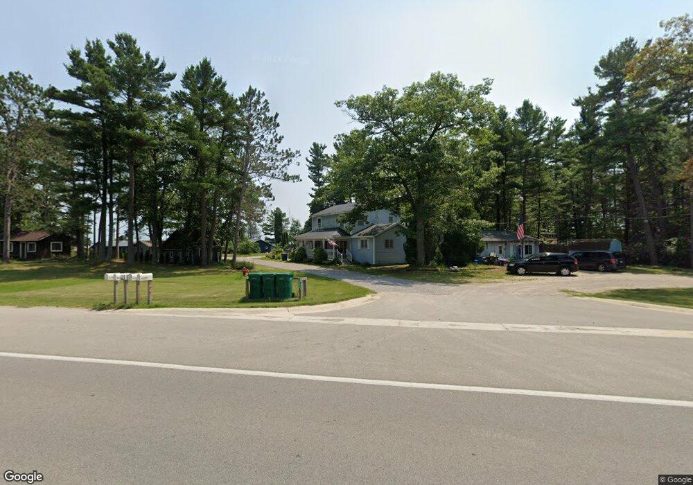
2600 E Us 23 East Tawas, MI 48730
Estimated Value: $219,000 - $303,000
2
Beds
1
Bath
744
Sq Ft
$327/Sq Ft
Est. Value
About This Home
This home is located at 2600 E Us 23, East Tawas, MI 48730 and is currently estimated at $243,407, approximately $327 per square foot. 2600 E Us 23 is a home located in Iosco County with nearby schools including Clara B. Bolen Elementary School, Tawas Area Middle School, and Tawas Area High School.
Ownership History
Date
Name
Owned For
Owner Type
Purchase Details
Closed on
Dec 14, 2023
Sold by
Wandell Jeffrey R and Wandell Karen E
Bought by
Wandell Revocable Living Trust and Wandell
Current Estimated Value
Purchase Details
Closed on
May 29, 2020
Sold by
Vorce Timothy and Vorce Marilyn
Bought by
Wandell Jeffrey R and Wandell Karen E
Home Financials for this Owner
Home Financials are based on the most recent Mortgage that was taken out on this home.
Original Mortgage
$108,000
Interest Rate
3.3%
Mortgage Type
Purchase Money Mortgage
Purchase Details
Closed on
Sep 11, 2017
Sold by
Behnke Andrew Thomas
Bought by
Vorce Timothy and Vorce Marilyn
Home Financials for this Owner
Home Financials are based on the most recent Mortgage that was taken out on this home.
Original Mortgage
$104,000
Interest Rate
3.9%
Mortgage Type
New Conventional
Purchase Details
Closed on
Jan 4, 2011
Sold by
Freshwater Condominium Association
Bought by
Behnke Andrew Thomas
Create a Home Valuation Report for This Property
The Home Valuation Report is an in-depth analysis detailing your home's value as well as a comparison with similar homes in the area
Home Values in the Area
Average Home Value in this Area
Purchase History
| Date | Buyer | Sale Price | Title Company |
|---|---|---|---|
| Wandell Revocable Living Trust | -- | None Listed On Document | |
| Wandell Jeffrey R | $135,000 | None Available | |
| Vorce Timothy | $130,000 | None Available | |
| Behnke Andrew Thomas | -- | -- |
Source: Public Records
Mortgage History
| Date | Status | Borrower | Loan Amount |
|---|---|---|---|
| Previous Owner | Wandell Jeffrey R | $108,000 | |
| Previous Owner | Vorce Timothy | $104,000 |
Source: Public Records
Tax History Compared to Growth
Tax History
| Year | Tax Paid | Tax Assessment Tax Assessment Total Assessment is a certain percentage of the fair market value that is determined by local assessors to be the total taxable value of land and additions on the property. | Land | Improvement |
|---|---|---|---|---|
| 2025 | $2,541 | $73,000 | $73,000 | $0 |
| 2024 | $2,310 | $76,000 | $0 | $0 |
| 2023 | $1,688 | $70,100 | $70,100 | $0 |
| 2022 | $2,154 | $62,500 | $62,500 | $0 |
| 2021 | $2,063 | $52,400 | $52,400 | $0 |
| 2020 | $1,701 | $48,000 | $48,000 | $0 |
| 2019 | $1,671 | $47,500 | $47,500 | $0 |
| 2018 | $1,632 | $42,400 | $42,400 | $0 |
| 2017 | $1,403 | $40,400 | $40,400 | $0 |
| 2016 | $1,389 | $40,400 | $0 | $0 |
| 2015 | -- | $39,500 | $0 | $0 |
| 2014 | -- | $39,000 | $0 | $0 |
| 2013 | -- | $36,300 | $0 | $0 |
Source: Public Records
Map
Nearby Homes
- 1390 N US 23
- 0 Jones St Unit 1933201
- 3644 Crescent Dr
- 0 Wintergreen St Unit 1936431
- 1858 Iris Dr
- 940 Huron St
- 975 N Huron Rd Unit 8
- 000 Ausable Dunes Trail
- 4507 Gowen Rd
- 2765 N Huron Rd
- Vacant Aulerich Rd
- 371 N Baldwin Resort Rd
- 1379 Kunze Rd
- 3497 U S 23
- 3661 Rollin Hill Ct
- 1165 E Lincoln St
- 441 Lakewood Dr
- 3734 U S 23
- 424 Lakewood Dr
- 0 E Lincoln St
- 2600 E Us 23
- 2600 E Us 23 Unit 6
- 2600 E Us 23 Unit 3
- 2600 E Us 23 Unit 7 (CEDAR)
- 2600 E Us 23 Unit 8
- 2600 E Us 23 Unit 4
- 2600 E Us 23
- 2600 E Us 23
- 2600 E Us 23
- 2600 E Us 23
- 2600 E Us 23
- 2600 E Us 23
- 2600 E Us 23
- 2600 E Us 23
- 2600 E Us 23
- 2600 E Us 23
- 2600 E Us 23
- 2599 E Us 23
- 2600 E Us 23
- 2600 E Us 23