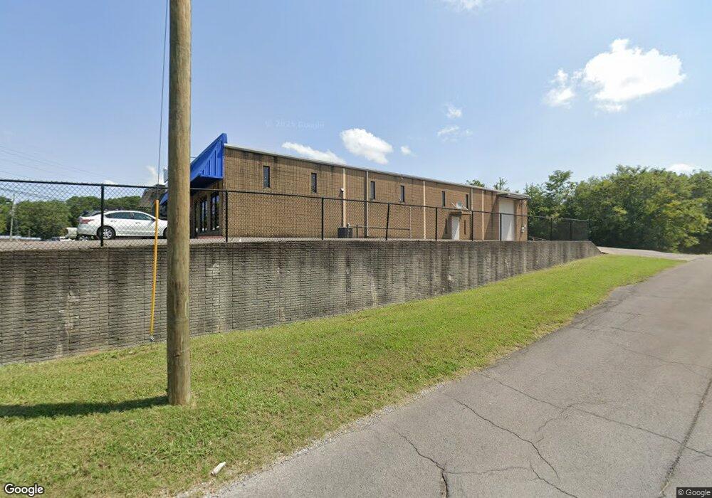
2600 E Walnut Ave Dalton, GA 30719
Studio
4
Baths
14,370
Sq Ft
66,647
Sq Ft Lot
About This Home
This home is located at 2600 E Walnut Ave, Dalton, GA 30719. 2600 E Walnut Ave is a home located in Whitfield County with nearby schools including Eastside Elementary School, Eastbrook Middle School, and Southeast Whitfield County High School.
Ownership History
Date
Name
Owned For
Owner Type
Purchase Details
Closed on
Mar 31, 2023
Sold by
Phillips Don F
Bought by
Altamirano Properties Llc
Home Financials for this Owner
Home Financials are based on the most recent Mortgage that was taken out on this home.
Original Mortgage
$960,000
Outstanding Balance
$879,619
Interest Rate
5.56%
Purchase Details
Closed on
May 23, 2005
Sold by
Not Provided
Bought by
Phillips Troy
Purchase Details
Closed on
May 2, 2000
Sold by
Phillips Troy
Bought by
Phillips Troy and Phillips Don
Purchase Details
Closed on
May 1, 1991
Bought by
Phillips Troy
Create a Home Valuation Report for This Property
The Home Valuation Report is an in-depth analysis detailing your home's value as well as a comparison with similar homes in the area
Purchase History
| Date | Buyer | Sale Price | Title Company |
|---|---|---|---|
| Altamirano Properties Llc | $600,000 | -- | |
| Altamirano Properties Llc | $600,000 | -- | |
| Phillips Troy | -- | -- | |
| Phillips Troy | -- | -- | |
| Phillips Troy | -- | -- |
Source: Public Records
Mortgage History
| Date | Status | Borrower | Loan Amount |
|---|---|---|---|
| Open | Altamirano Properties Llc | $960,000 | |
| Closed | Altamirano Properties Llc | $960,000 |
Source: Public Records
Tax History
| Year | Tax Paid | Tax Assessment Tax Assessment Total Assessment is a certain percentage of the fair market value that is determined by local assessors to be the total taxable value of land and additions on the property. | Land | Improvement |
|---|---|---|---|---|
| 2025 | $7,832 | $284,384 | $56,772 | $227,612 |
| 2024 | $7,832 | $284,384 | $56,772 | $227,612 |
| 2023 | $5,589 | $189,504 | $22,200 | $167,304 |
| 2022 | $3,563 | $120,800 | $22,200 | $98,600 |
| 2021 | $3,564 | $120,800 | $22,200 | $98,600 |
| 2020 | $3,685 | $120,800 | $22,200 | $98,600 |
| 2019 | $3,746 | $120,800 | $22,200 | $98,600 |
| 2018 | $3,806 | $120,800 | $22,200 | $98,600 |
| 2017 | $3,808 | $120,800 | $22,200 | $98,600 |
| 2016 | $3,662 | $120,800 | $22,200 | $98,600 |
| 2014 | $3,252 | $120,800 | $22,200 | $98,600 |
| 2013 | -- | $120,799 | $22,200 | $98,599 |
Source: Public Records
Map
Nearby Homes
- 213 Nashville St
- 359 Pacer Ln Unit 4
- 216 Scobie Ave
- 143 Staten St
- 119 Wooten Dr
- 117 Wooten Dr
- 165 Stanley St Unit 560-561
- 2905 E Walnut Ave
- 0 Old Grade Rd
- 1902 Bartenfield Dr
- 118 Hill Rd
- 119 Eugenia Dr
- 121 Eugenia Dr
- 406 Lester Ave
- 108 Van Buren Dr
- 258 Richardson Dr
- 264 Richardson Dr
- 3407 Airport Rd SE
- 171 Keith St
- 129 Hillwood Dr
- 2600 E Walnut Ave
- 127 Downing St
- 100 Downing St
- 102 Downing St
- 108 Downing St
- 0 Nashville St
- 127D Downing St
- 127C Downing St
- 111 Downing St
- 112 Downing St
- 133 Nashville St
- 117 Scobie Ave
- 205 Nashville St
- 118 Downing St
- 135 Stanley St
- 221 Nashville St
- 200 Scobie Ave
- 109 Stanley St
- 106 Stanley St
- 103 Stanley St
Your Personal Tour Guide
Ask me questions while you tour the home.