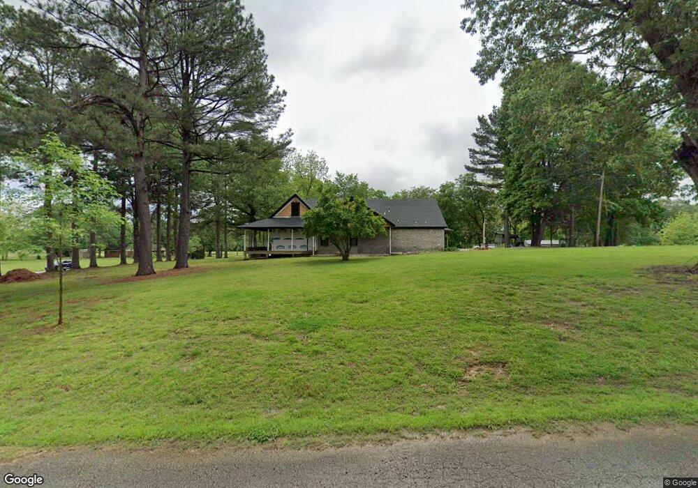
2600 Highway 135 N Paragould, AR 72450
Estimated Value: $129,545 - $173,000
--
Bed
1
Bath
1,189
Sq Ft
$126/Sq Ft
Est. Value
About This Home
This home is located at 2600 Highway 135 N, Paragould, AR 72450 and is currently estimated at $150,136, approximately $126 per square foot. 2600 Highway 135 N is a home located in Greene County with nearby schools including Paragould High School and St. Mary's Catholic School & Preschool.
Ownership History
Date
Name
Owned For
Owner Type
Purchase Details
Closed on
Aug 25, 2012
Sold by
Kelm Debbie and Kelm David C
Bought by
Robinson Chris
Current Estimated Value
Home Financials for this Owner
Home Financials are based on the most recent Mortgage that was taken out on this home.
Original Mortgage
$45,000
Interest Rate
3.49%
Purchase Details
Closed on
Apr 18, 2000
Bought by
Ussery
Purchase Details
Closed on
Oct 22, 1992
Bought by
Ussery
Create a Home Valuation Report for This Property
The Home Valuation Report is an in-depth analysis detailing your home's value as well as a comparison with similar homes in the area
Home Values in the Area
Average Home Value in this Area
Purchase History
| Date | Buyer | Sale Price | Title Company |
|---|---|---|---|
| Robinson Chris | $45,000 | None Available | |
| Ussery | $36,000 | -- | |
| Ussery | -- | -- |
Source: Public Records
Mortgage History
| Date | Status | Borrower | Loan Amount |
|---|---|---|---|
| Closed | Robinson Chris | $45,000 |
Source: Public Records
Tax History Compared to Growth
Tax History
| Year | Tax Paid | Tax Assessment Tax Assessment Total Assessment is a certain percentage of the fair market value that is determined by local assessors to be the total taxable value of land and additions on the property. | Land | Improvement |
|---|---|---|---|---|
| 2025 | $884 | $22,820 | $10,160 | $12,660 |
| 2024 | $844 | $22,820 | $10,160 | $12,660 |
| 2023 | $794 | $17,260 | $7,840 | $9,420 |
| 2022 | $419 | $17,260 | $7,840 | $9,420 |
| 2021 | $419 | $17,260 | $7,840 | $9,420 |
| 2020 | $626 | $13,600 | $5,710 | $7,890 |
| 2019 | $626 | $13,600 | $5,710 | $7,890 |
| 2018 | $626 | $13,600 | $5,710 | $7,890 |
| 2017 | $607 | $13,600 | $5,710 | $7,890 |
| 2016 | $607 | $13,600 | $5,710 | $7,890 |
| 2015 | $605 | $13,470 | $5,510 | $7,960 |
| 2014 | $605 | $13,470 | $5,510 | $7,960 |
Source: Public Records
Map
Nearby Homes
- 5 Arkansas 135
- 1201 William Hall Dr
- 1102 William Hall Dr
- 1110 Roberts Dr
- 1309 Morrow Dr
- 2200 N 8 1/2 St
- 714 Thorne Dr
- Lot 21B N 8 1 2 St
- 604 Elizabeth Dr
- 2903 Purcell Rd
- 3005 Purcell Rd
- 3.09 ac Purcell Rd
- 403 Elizabeth Dr
- 2102 N 22nd St
- 2802 N 4th St
- 106 N 17th St
- 3505 Purcell Rd
- 207 Gavin Dr
- 3 Purcell Rd
- 104 Stacy Dr
- 2612 Highway 135 N
- 2500 Highway 135 N
- 2510 Highway 135 N
- 2614 Highway 135 N
- 2605 Highway 135 N
- 1506 Shady Grove Dr
- 1405 Shady Grove Dr
- 1401 Shady Grove Dr
- 1407 Shady Grove Dr
- 1501 Shady Grove Dr
- 1503 Shady Grove Dr
- 1600 Shady Grove Dr
- 1505 Shady Grove Dr
- 1601 Shady Grove Dr
- 1606 Shady Grove Dr
- 5.38 AC Arkansas 135
- 1301 William Hall Dr
- 1603 Shady Grove Dr
- 1207 William Hall Dr
- 1605 Shady Grove Dr