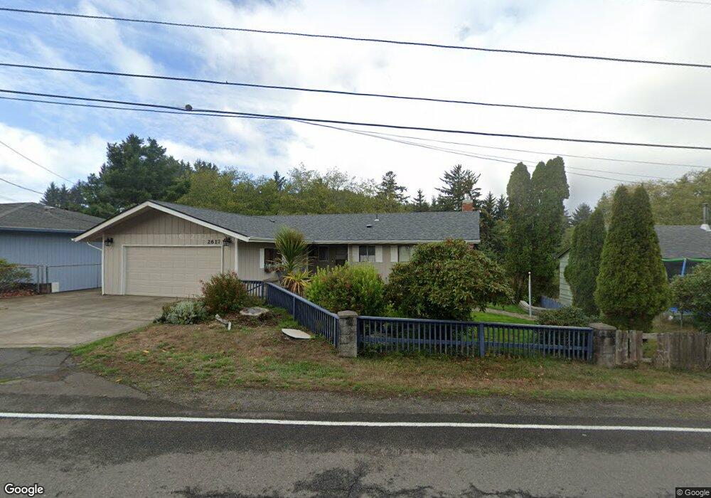
2600 NE 33rd St Lincoln City, OR 97367
Estimated Value: $499,000 - $528,000
3
Beds
2
Baths
1,300
Sq Ft
$391/Sq Ft
Est. Value
About This Home
This home is located at 2600 NE 33rd St, Lincoln City, OR 97367 and is currently estimated at $507,904, approximately $390 per square foot. 2600 NE 33rd St is a home located in Lincoln County with nearby schools including Oceanlake Elementary School, Taft Elementary School, and Taft High School.
Ownership History
Date
Name
Owned For
Owner Type
Purchase Details
Closed on
Mar 5, 2024
Sold by
Greenfield Kelli Sue
Bought by
Kelli Greenfield Revocable Living Trust and Greenfield
Current Estimated Value
Purchase Details
Closed on
Mar 16, 2021
Sold by
Greenfield Kelli Sue and Greenfield Daniel Brian
Bought by
Greenfield Kelli Sue
Purchase Details
Closed on
May 22, 2019
Sold by
Kempter Marianne J
Bought by
Greenfield Kelli Sue and Greenfield Daniel Brian
Purchase Details
Closed on
Dec 5, 2005
Sold by
Martin Scott R and Martin Raymond B
Bought by
Rsj Properties Llc
Purchase Details
Closed on
Aug 11, 2005
Sold by
Bader Properties Llc
Bought by
Martin Scott R and Martin Raymond B
Create a Home Valuation Report for This Property
The Home Valuation Report is an in-depth analysis detailing your home's value as well as a comparison with similar homes in the area
Home Values in the Area
Average Home Value in this Area
Purchase History
| Date | Buyer | Sale Price | Title Company |
|---|---|---|---|
| Kelli Greenfield Revocable Living Trust | -- | None Listed On Document | |
| Greenfield Kelli Sue | $80,000 | None Available | |
| Greenfield Kelli Sue | -- | None Available | |
| Rsj Properties Llc | -- | -- | |
| Martin Scott R | $38,000 | Western Title & Escrow Co |
Source: Public Records
Tax History Compared to Growth
Tax History
| Year | Tax Paid | Tax Assessment Tax Assessment Total Assessment is a certain percentage of the fair market value that is determined by local assessors to be the total taxable value of land and additions on the property. | Land | Improvement |
|---|---|---|---|---|
| 2024 | $3,862 | $224,910 | -- | -- |
| 2023 | $3,755 | $218,360 | $0 | $0 |
| 2022 | $3,651 | $212,000 | $0 | $0 |
| 2021 | $3,478 | $205,830 | $0 | $0 |
| 2020 | $3,398 | $199,840 | $0 | $0 |
| 2019 | $3,282 | $194,020 | $0 | $0 |
| 2018 | $3,208 | $188,370 | $0 | $0 |
| 2017 | $3,071 | $182,890 | $0 | $0 |
| 2016 | $2,881 | $177,570 | $0 | $0 |
| 2015 | $2,809 | $172,400 | $0 | $0 |
| 2014 | $2,696 | $166,840 | $0 | $0 |
| 2013 | -- | $17,550 | $0 | $0 |
Source: Public Records
Map
Nearby Homes
- 0 NE Union Ave
- 2480 NE 29th Dr
- 3449 NE West Devils Lake Rd
- 3030 NE 32nd Dr
- TL NE West Devils Lake Rd
- 3600 Blk NE West Devils Lake Rd
- 2064 NW 33rd St
- TL 1100 NE West Devils Lake Rd
- 1640 NE West Devils Lake Rd
- 3235 NW Quay Dr
- 3522 NE Quay Ave
- 3570 NE Reef Dr
- Parcel 1 NE Surf Ave
- 2930 NE Hwy 101
- 3500 NE West Devils Lake Rd
- 3244 NW Oar Dr
- 3200 NE 30th Dr
- 3595 NE Reef Dr
- 3432 NW Port Ct
- 2820 NE Hwy 101
- 2604 NE 33rd St
- 2558 NE 33rd St
- 2548 NE 33rd St
- 3334 NE Surf Ave
- 2424 NE 33rd St
- 2538 NE 33rd St
- 3324 NE Surf Ave
- 3314 NE Surf Ave
- 2617 NE Holmes Rd
- 2601 NE Holmes Rd
- 2633 NE Holmes Rd
- 2547 NE Holmes Rd
- 3272 NE Surf Ave
- 2531 NE Holmes Rd
- 3332 Surf NE
- 2703 NE Holmes Rd
- 2600 NE Holmes Rd
- 2620 NE Holmes Rd
- 0 NE Holmes Rd Unit 18615480
- 0 NE Holmes Rd