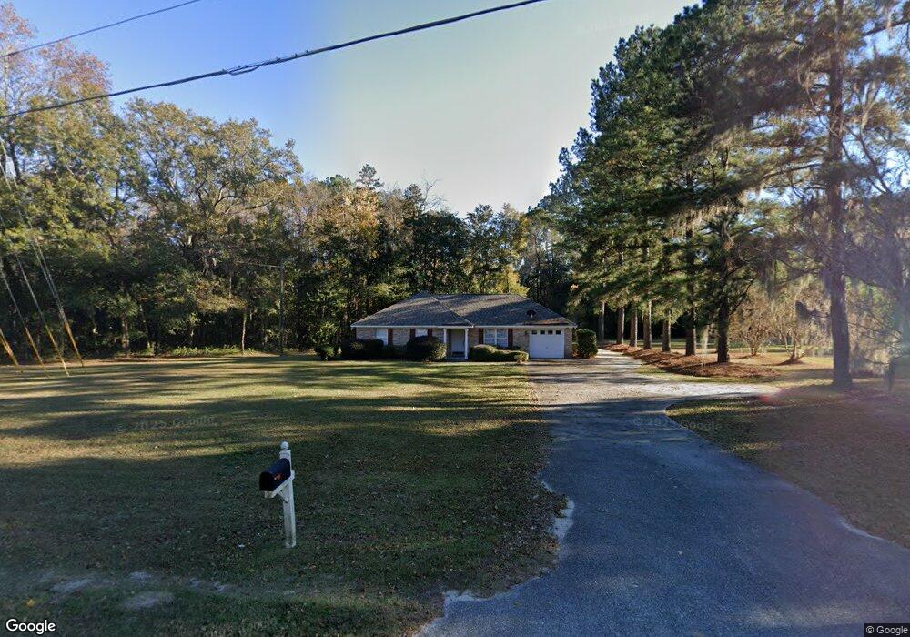
2600 Noel C Conaway Rd Guyton, GA 31312
Estimated Value: $246,107 - $302,000
--
Bed
1
Bath
1,196
Sq Ft
$232/Sq Ft
Est. Value
About This Home
This home is located at 2600 Noel C Conaway Rd, Guyton, GA 31312 and is currently estimated at $277,777, approximately $232 per square foot. 2600 Noel C Conaway Rd is a home located in Effingham County with nearby schools including Marlow Elementary School, South Effingham Middle School, and South Effingham High School.
Ownership History
Date
Name
Owned For
Owner Type
Purchase Details
Closed on
Aug 27, 2021
Sold by
Hayes Carolyn Rae
Bought by
Hayes Carolyn Rae and Barnett Cindy Hayes
Current Estimated Value
Purchase Details
Closed on
Apr 20, 2006
Sold by
Barnett Cindy
Bought by
Hayes Carolyn Rae
Purchase Details
Closed on
Feb 28, 2006
Sold by
Georgia Housing & Financ
Bought by
Barnett Cindy and Barnett Wade
Purchase Details
Closed on
Feb 3, 2004
Sold by
Strickland Mark E
Bought by
Georgia Housing & Finance Au
Create a Home Valuation Report for This Property
The Home Valuation Report is an in-depth analysis detailing your home's value as well as a comparison with similar homes in the area
Home Values in the Area
Average Home Value in this Area
Purchase History
| Date | Buyer | Sale Price | Title Company |
|---|---|---|---|
| Hayes Carolyn Rae | -- | -- | |
| Hayes Carolyn Rae | $150,000 | -- | |
| Barnett Cindy | $105,000 | -- | |
| Georgia Housing & Finance Au | $108,665 | -- |
Source: Public Records
Tax History Compared to Growth
Tax History
| Year | Tax Paid | Tax Assessment Tax Assessment Total Assessment is a certain percentage of the fair market value that is determined by local assessors to be the total taxable value of land and additions on the property. | Land | Improvement |
|---|---|---|---|---|
| 2025 | $1,649 | $94,330 | $22,800 | $71,530 |
| 2024 | $1,649 | $99,703 | $22,800 | $76,903 |
| 2023 | $964 | $71,385 | $17,600 | $53,785 |
| 2022 | $1,474 | $58,129 | $16,000 | $42,129 |
| 2021 | $1,383 | $53,756 | $14,000 | $39,756 |
| 2020 | $1,277 | $51,058 | $14,000 | $37,058 |
| 2019 | $1,336 | $52,458 | $15,400 | $37,058 |
| 2018 | $1,266 | $49,950 | $15,400 | $34,550 |
| 2017 | $1,311 | $51,342 | $14,000 | $37,342 |
| 2016 | $1,205 | $49,258 | $14,000 | $35,258 |
| 2015 | -- | $46,402 | $14,000 | $32,402 |
| 2014 | -- | $42,402 | $10,000 | $32,402 |
| 2013 | -- | $38,001 | $5,600 | $32,401 |
Source: Public Records
Map
Nearby Homes
- 138 Hawthorne Dr
- 105 Homestead Ct
- 438 Kessler Loop
- 102 Winnai Ln
- 1257 Noel C Conaway Rd
- 275 Caribbean Village Dr
- 276 Caribbean Village Dr
- 102 Sam's Dr
- 119 Sams Dr
- 201 Antigua Place
- 178 Tobago Cir
- 247 Caribbean Village Dr
- 144 Tobago Cir
- 404 Banberry Ct
- 126 Tobago Cir
- 225 Caribbean Village Dr
- 107 Tupelo Trail
- 807 Hyacinth Cir
- 259 Zettler Loop
- 100 Butternut Blvd
- 101 Settler's Point Dr
- 2580 Noel C Conaway Rd
- 103 Settlers Point Dr
- 134 Hawthorne Dr
- 2554 Noel C Conaway Rd
- 104 Dover Ct
- 105 Settlers Point Dr
- 2627 Noel C Conaway Rd
- 105 Settler's Point Dr
- 2563 Noel C Conaway Rd
- 136 Hawthorne Dr
- 103 Dover Ct
- 132 Hawthorne Dr
- 107 Settlers Point Dr
- 130 Hawthorne Dr
- 102 Dover Ct
- 128 Hawthorne Dr
- 2545 Noel C Conaway Rd
- 126 Hawthorne Dr
- 109 Settlers Point Dr