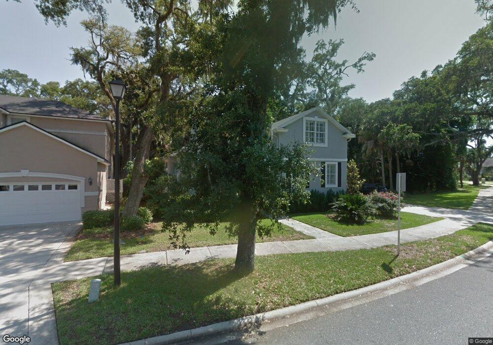
2600 Portside Dr Fernandina Beach, FL 32034
Estimated Value: $781,000 - $1,005,000
3
Beds
3
Baths
2,354
Sq Ft
$370/Sq Ft
Est. Value
About This Home
This home is located at 2600 Portside Dr, Fernandina Beach, FL 32034 and is currently estimated at $871,896, approximately $370 per square foot. 2600 Portside Dr is a home located in Nassau County with nearby schools including Southside Elementary School, Emma Love Hardee Elementary School, and Fernandina Beach Middle School.
Ownership History
Date
Name
Owned For
Owner Type
Purchase Details
Closed on
Sep 28, 2017
Sold by
Norris Patricia Anne and Norris Christopher L
Bought by
Kane Stephen E and Kane Jane E
Current Estimated Value
Purchase Details
Closed on
Apr 28, 2005
Sold by
Wagner Paul J
Bought by
Norris Patricia Anne
Home Financials for this Owner
Home Financials are based on the most recent Mortgage that was taken out on this home.
Original Mortgage
$150,000
Interest Rate
5.88%
Mortgage Type
Fannie Mae Freddie Mac
Purchase Details
Closed on
Aug 20, 2004
Sold by
Green Henry B
Bought by
Wagner Paul J
Purchase Details
Closed on
May 18, 2001
Sold by
Beazer Homes Corp
Bought by
Green Henry B
Home Financials for this Owner
Home Financials are based on the most recent Mortgage that was taken out on this home.
Original Mortgage
$161,856
Interest Rate
7.11%
Mortgage Type
Stand Alone First
Create a Home Valuation Report for This Property
The Home Valuation Report is an in-depth analysis detailing your home's value as well as a comparison with similar homes in the area
Home Values in the Area
Average Home Value in this Area
Purchase History
| Date | Buyer | Sale Price | Title Company |
|---|---|---|---|
| Kane Stephen E | $400,000 | Attorney | |
| Norris Patricia Anne | $372,000 | First American Title Ins Co | |
| Wagner Paul J | -- | -- | |
| Green Henry B | $202,400 | -- | |
| Green Henry B | -- | -- |
Source: Public Records
Mortgage History
| Date | Status | Borrower | Loan Amount |
|---|---|---|---|
| Previous Owner | Norris Patricia Anne | $150,000 | |
| Previous Owner | Green Henry B | $161,856 |
Source: Public Records
Tax History Compared to Growth
Tax History
| Year | Tax Paid | Tax Assessment Tax Assessment Total Assessment is a certain percentage of the fair market value that is determined by local assessors to be the total taxable value of land and additions on the property. | Land | Improvement |
|---|---|---|---|---|
| 2024 | $6,993 | $425,947 | -- | -- |
| 2023 | $6,993 | $413,541 | $0 | $0 |
| 2022 | $6,598 | $401,496 | $0 | $0 |
| 2021 | $6,607 | $389,802 | $0 | $0 |
| 2020 | $6,672 | $384,420 | $0 | $0 |
| 2019 | $6,866 | $375,777 | $95,000 | $280,777 |
| 2018 | $7,145 | $351,551 | $0 | $0 |
| 2017 | $4,614 | $273,222 | $0 | $0 |
| 2016 | $4,576 | $267,602 | $0 | $0 |
| 2015 | $4,603 | $265,742 | $0 | $0 |
| 2014 | $4,592 | $263,633 | $0 | $0 |
Source: Public Records
Map
Nearby Homes
- 0 Gregor McGregor Blvd Unit 114011
- 0 Gregor McGregor Blvd Unit 113468
- 382 S Fletcher Ave Unit 101
- 382 S Fletcher Ave Unit 306
- 382 S Fletcher Ave Unit 302
- 348-B S Fletcher Ave
- 454 S Fletcher Ave
- Lot 5 S Fletcher Ave
- 32 S Fletcher Ave Unit 101
- 32 S Fletcher Ave Unit 105
- 991 Ocean Bluff Dr
- 669 S Fletcher Ave
- 412 Citrona Dr
- 794 S Fletcher Ave
- 855 S Fletcher Ave
- 342 Tarpon Ave Unit 1
- 2019 Atlantic Ave
- 344 Tarpon Ave
- 2101 Shell Cove Cir
- 348 Tarpon Ave
- 2602 Portside Dr
- 2604 Portside Dr
- 2606 Portside Dr
- 2603 Portside Dr
- 474 Starboard Landing
- 478 Crosswind Dr
- 2601 Portside Dr
- 2605 Portside Dr
- 2607 Portside Dr
- 2608 Portside Dr
- 480 Crosswind Dr
- 2609 Portside Dr
- 480 Starboard Landing
- 475 Starboard Landing
- 2611 Portside Dr
- 395 Portside Dr
- 2613 Portside Dr
- 397 Portside Dr
- 482 Crosswind Dr
- 212 Jean Lafitte Blvd