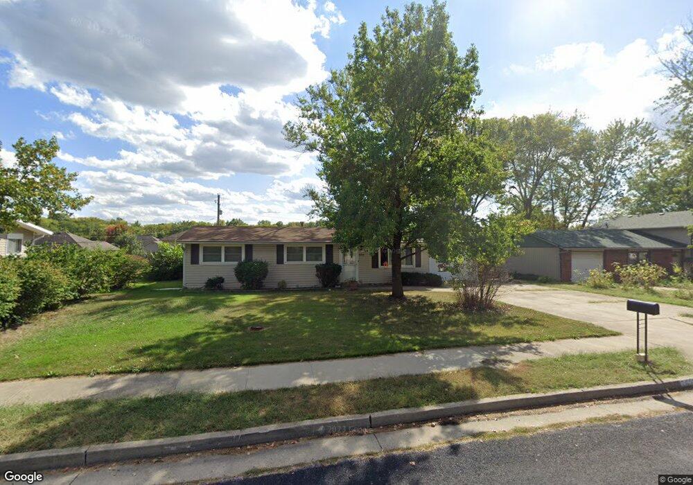
2600 Spruce Dr Columbia, MO 65202
Estimated Value: $183,000 - $233,000
3
Beds
1
Bath
1,008
Sq Ft
$200/Sq Ft
Est. Value
About This Home
This home is located at 2600 Spruce Dr, Columbia, MO 65202 and is currently estimated at $201,418, approximately $199 per square foot. 2600 Spruce Dr is a home located in Boone County with nearby schools including Blue Ridge Elementary School, Oakland Middle School, and Muriel W. Battle High School.
Ownership History
Date
Name
Owned For
Owner Type
Purchase Details
Closed on
Nov 21, 2011
Sold by
Duren Oliver Nina and Duren Oliver Nina
Bought by
Jennings Sheryl L
Current Estimated Value
Home Financials for this Owner
Home Financials are based on the most recent Mortgage that was taken out on this home.
Original Mortgage
$72,990
Outstanding Balance
$49,700
Interest Rate
3.99%
Mortgage Type
New Conventional
Estimated Equity
$151,718
Purchase Details
Closed on
Oct 18, 2011
Sold by
Long Richard N and Long Jocelyn
Bought by
Oliver Nina
Home Financials for this Owner
Home Financials are based on the most recent Mortgage that was taken out on this home.
Original Mortgage
$72,990
Outstanding Balance
$49,700
Interest Rate
3.99%
Mortgage Type
New Conventional
Estimated Equity
$151,718
Create a Home Valuation Report for This Property
The Home Valuation Report is an in-depth analysis detailing your home's value as well as a comparison with similar homes in the area
Home Values in the Area
Average Home Value in this Area
Purchase History
| Date | Buyer | Sale Price | Title Company |
|---|---|---|---|
| Jennings Sheryl L | -- | Boone Central Title Company | |
| Oliver Nina | -- | Boone Central Title Company |
Source: Public Records
Mortgage History
| Date | Status | Borrower | Loan Amount |
|---|---|---|---|
| Open | Jennings Sheryl L | $72,990 |
Source: Public Records
Tax History Compared to Growth
Tax History
| Year | Tax Paid | Tax Assessment Tax Assessment Total Assessment is a certain percentage of the fair market value that is determined by local assessors to be the total taxable value of land and additions on the property. | Land | Improvement |
|---|---|---|---|---|
| 2025 | $1,040 | $17,651 | $2,736 | $14,915 |
| 2024 | $1,040 | $15,409 | $2,736 | $12,673 |
| 2023 | $1,031 | $15,409 | $2,736 | $12,673 |
| 2022 | $954 | $14,269 | $2,736 | $11,533 |
| 2021 | $955 | $14,269 | $2,736 | $11,533 |
| 2020 | $942 | $13,214 | $2,736 | $10,478 |
| 2019 | $942 | $13,214 | $2,736 | $10,478 |
| 2018 | $878 | $0 | $0 | $0 |
| 2017 | $867 | $12,236 | $2,736 | $9,500 |
| 2016 | $890 | $12,236 | $2,736 | $9,500 |
| 2015 | $821 | $12,236 | $2,736 | $9,500 |
| 2014 | $826 | $12,236 | $2,736 | $9,500 |
Source: Public Records
Map
Nearby Homes
- 2600 E Oakland Ridge Dr
- 2600 Oakfield Dr
- 2304 Grizzly Ct
- 2203 Grizzly Ct
- 3001 Brown Station Rd
- 2607 Mcclure Dr
- 0 Paris Rd
- 3901 Bragg Ct
- 3913 Bragg Ct
- 3905 Bragg Ct
- 3921 Bragg Ct
- 2808 Pine Dr
- 1912 Lovejoy Ln
- 2501 Nest Ct
- 1809 Blue Ridge Rd
- 2809 Shingo Ct
- 0 Vandiver Dr
- 1709 Blue Ridge Rd
- 4204 Fourwinds Dr
- 1100 Kennesaw Unit 301
- 2604 Spruce Dr
- 2514 Spruce Dr
- 2505 Oakfield Dr
- 2507 Oakfield Dr
- 2512 Spruce Dr
- 2503 Oakfield Dr
- 2509 Oakfield Dr
- 2608 Spruce Dr
- L 19 Spruce Dr
- 2601 Spruce Dr
- 2513 Spruce Dr
- 2603 Spruce Dr
- 2501 Oakfield Dr
- 2508 Spruce Dr
- 2601 Oakfield Dr
- 2511 Spruce Dr
- 2607 Spruce Dr
- 2411 Oakfield Dr
- 2612 Spruce Dr
- 2506 Oakfield Dr