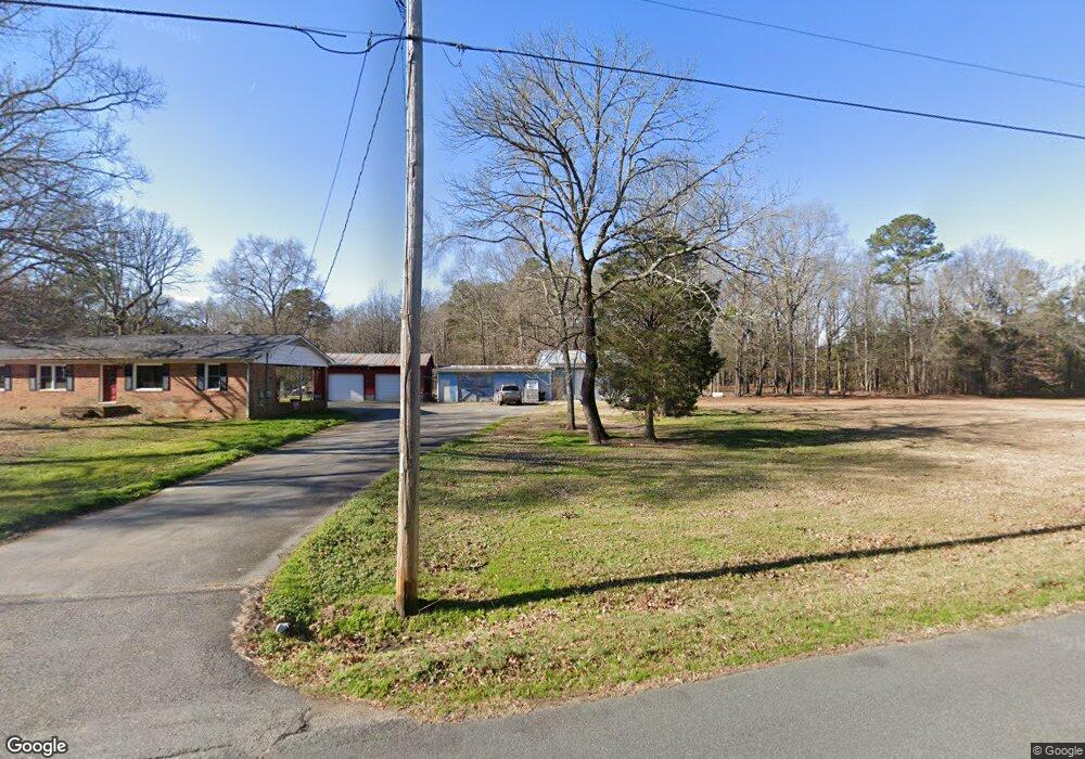
2600 Tilley Rd Concord, NC 28025
Estimated Value: $269,000 - $310,000
2
Beds
1
Bath
1,204
Sq Ft
$235/Sq Ft
Est. Value
About This Home
This home is located at 2600 Tilley Rd, Concord, NC 28025 and is currently estimated at $283,354, approximately $235 per square foot. 2600 Tilley Rd is a home located in Cabarrus County with nearby schools including A.T. Allen Elementary School, Mount Pleasant Middle School, and Mount Pleasant High School.
Ownership History
Date
Name
Owned For
Owner Type
Purchase Details
Closed on
Nov 2, 2017
Sold by
Simpson Barbara G
Bought by
Ridenhour Billy Joe and Ridenhour Rhonda Dean
Current Estimated Value
Home Financials for this Owner
Home Financials are based on the most recent Mortgage that was taken out on this home.
Original Mortgage
$130,100
Outstanding Balance
$108,960
Interest Rate
3.83%
Mortgage Type
New Conventional
Estimated Equity
$174,394
Purchase Details
Closed on
Apr 21, 2011
Sold by
Simpson Torrence and Simpson Barbara
Bought by
Simpson Torrence and Simpson Barbara
Create a Home Valuation Report for This Property
The Home Valuation Report is an in-depth analysis detailing your home's value as well as a comparison with similar homes in the area
Home Values in the Area
Average Home Value in this Area
Purchase History
| Date | Buyer | Sale Price | Title Company |
|---|---|---|---|
| Ridenhour Billy Joe | $150,000 | None Available | |
| Simpson Torrence | -- | None Available |
Source: Public Records
Mortgage History
| Date | Status | Borrower | Loan Amount |
|---|---|---|---|
| Open | Ridenhour Billy Joe | $130,100 |
Source: Public Records
Tax History Compared to Growth
Tax History
| Year | Tax Paid | Tax Assessment Tax Assessment Total Assessment is a certain percentage of the fair market value that is determined by local assessors to be the total taxable value of land and additions on the property. | Land | Improvement |
|---|---|---|---|---|
| 2025 | $1,619 | $235,960 | $39,700 | $196,260 |
| 2024 | $1,619 | $235,960 | $39,700 | $196,260 |
| 2023 | $1,258 | $148,010 | $27,160 | $120,850 |
| 2022 | $1,228 | $148,010 | $27,160 | $120,850 |
| 2021 | $1,206 | $148,010 | $27,160 | $120,850 |
| 2020 | $1,206 | $148,010 | $27,160 | $120,850 |
| 2019 | $939 | $115,250 | $22,990 | $92,260 |
| 2018 | $916 | $115,250 | $22,990 | $92,260 |
| 2017 | $870 | $115,250 | $22,990 | $92,260 |
| 2016 | $870 | $110,740 | $22,990 | $87,750 |
| 2015 | -- | $110,740 | $22,990 | $87,750 |
| 2014 | -- | $110,740 | $22,990 | $87,750 |
Source: Public Records
Map
Nearby Homes
- 1695 Lemming Dr
- 1665 Red Bird Cir
- 1930 Cold Springs Rd
- 3261 Fairmead Dr
- 5200 Fieldstone Dr
- 2909 Arbor Knoll
- 2365 Baxter Place SE
- 2369 Baxter Place SE
- 2314 Fairport Dr SE
- 3109 Fairmead Dr
- 1300 Hess Rd
- 2628 State Highway 49
- 5607 Historic Springs Dr
- 2625 Old Airport Rd
- 3350 Miami Church Rd
- 1830 Lake Lynn Rd
- 1508 Thompson Dr
- 1121 Setter Ln SE
- 1076 Tangle Ridge Dr SE
- 153 Cottontail Ln SE Unit 46