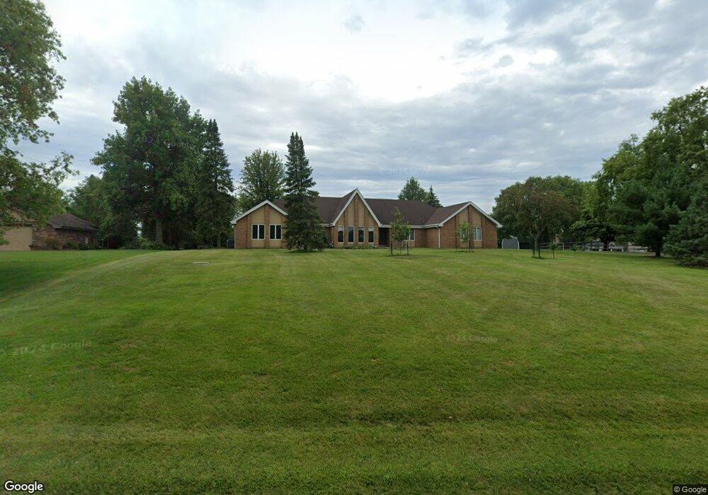
2600 Walter Dr New Lenox, IL 60451
Estimated Value: $621,632 - $671,000
--
Bed
--
Bath
--
Sq Ft
1.43
Acres
About This Home
This home is located at 2600 Walter Dr, New Lenox, IL 60451 and is currently estimated at $641,658. 2600 Walter Dr is a home located in Will County with nearby schools including Spencer Trail, Spencer Pointe, and Spencer Crossing Intermediate School.
Ownership History
Date
Name
Owned For
Owner Type
Purchase Details
Closed on
Apr 6, 2021
Sold by
Phillips Sean
Bought by
Phillips Sean and Phillips Lauren
Current Estimated Value
Purchase Details
Closed on
Jan 8, 2018
Sold by
Schegrens Rita and Walter Drive Trust
Bought by
Phillips Sean
Home Financials for this Owner
Home Financials are based on the most recent Mortgage that was taken out on this home.
Original Mortgage
$200,000
Outstanding Balance
$109,424
Interest Rate
3.12%
Mortgage Type
New Conventional
Estimated Equity
$532,234
Purchase Details
Closed on
Oct 3, 2009
Sold by
Phillips Thomas R and Estate Of Mary C Phillips
Bought by
Schergen Rita and 2600 Walter Drive Trust
Purchase Details
Closed on
Feb 26, 1993
Bought by
2600 Walter Driv
Create a Home Valuation Report for This Property
The Home Valuation Report is an in-depth analysis detailing your home's value as well as a comparison with similar homes in the area
Home Values in the Area
Average Home Value in this Area
Purchase History
| Date | Buyer | Sale Price | Title Company |
|---|---|---|---|
| Phillips Sean | -- | None Available | |
| Phillips Sean | $319,000 | Proper Title Llc | |
| Schergen Rita | -- | None Available | |
| 2600 Walter Driv | $262,000 | -- |
Source: Public Records
Mortgage History
| Date | Status | Borrower | Loan Amount |
|---|---|---|---|
| Open | Phillips Sean | $200,000 |
Source: Public Records
Tax History Compared to Growth
Tax History
| Year | Tax Paid | Tax Assessment Tax Assessment Total Assessment is a certain percentage of the fair market value that is determined by local assessors to be the total taxable value of land and additions on the property. | Land | Improvement |
|---|---|---|---|---|
| 2024 | $15,368 | $203,201 | $53,581 | $149,620 |
| 2023 | $15,368 | $185,233 | $48,843 | $136,390 |
| 2022 | $13,850 | $170,643 | $44,996 | $125,647 |
| 2021 | $13,171 | $160,484 | $42,317 | $118,167 |
| 2020 | $12,805 | $154,758 | $40,807 | $113,951 |
| 2019 | $12,257 | $149,960 | $39,542 | $110,418 |
| 2018 | $11,978 | $144,791 | $38,179 | $106,612 |
| 2017 | $11,377 | $140,628 | $37,081 | $103,547 |
| 2016 | $11,054 | $136,865 | $36,089 | $100,776 |
| 2015 | $10,554 | $132,557 | $34,953 | $97,604 |
| 2014 | $10,554 | $130,920 | $34,521 | $96,399 |
| 2013 | $10,554 | $132,684 | $34,986 | $97,698 |
Source: Public Records
Map
Nearby Homes
- 2609 Walter Dr
- 12415 Foxborough Dr
- 19909 Foxborough Dr
- 12417 Lajunta Ct
- 12526 Surrey Ct
- 501 Bryan Trail
- 12118 Sarkis Dr
- 12752 Berkshire Dr
- 19418 Boulder Ridge Dr
- 1920 Tessington Ct
- 1931 Tessington Ct
- 12932 Carrington Ct
- 19411 Baron Rd
- 821 Chatfield Rd
- 621 Chatfield Rd
- 11966 Duchess Ave
- 11525 Edgewood Dr
- 11420 Kluth Dr
- 19502 115th Ave Unit A
- 1245 Georgias Way
- 2604 Walter Dr
- 900 Walter Dr
- 2608 Walter Dr
- 850 Walter Dr
- 2605 Walter Dr
- 165 Alison Trail
- 2601 Walter Dr
- 800 Walter Dr
- 2701 Walter Dr
- 760 Walter Dr
- 2704 Walter Dr
- 705 Bryan Trail
- 908 Shelly Ln
- 709 Bryan Trail
- 901 Walter Dr
- 2705 Walter Dr
- 713 Bryan Trail
- 716 Walter Dr
- 12305 Foxborough Dr
- 901 Shelly Ln