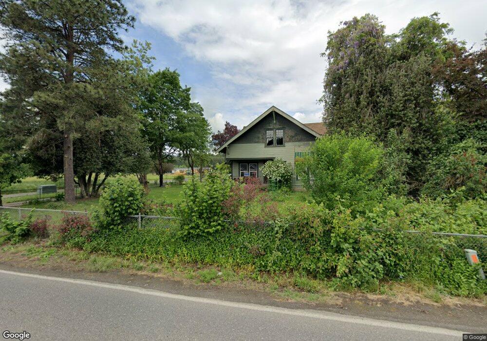
26002 NE 84th Ave Unit 1 Battle Ground, WA 98604
Estimated Value: $2,963,000 - $4,951,000
5
Beds
3
Baths
4,476
Sq Ft
$914/Sq Ft
Est. Value
About This Home
This home is located at 26002 NE 84th Ave Unit 1, Battle Ground, WA 98604 and is currently estimated at $4,089,377, approximately $913 per square foot. 26002 NE 84th Ave Unit 1 is a home located in Clark County with nearby schools including Daybreak Primary School, Daybreak Middle School, and Battle Ground High School.
Ownership History
Date
Name
Owned For
Owner Type
Purchase Details
Closed on
Jul 11, 2025
Sold by
Defrees Michael J
Bought by
Glasswing Investments Llc
Current Estimated Value
Purchase Details
Closed on
Jan 30, 2003
Sold by
First Independent Bank
Bought by
Defrees Michael J and Defrees Cristi D
Home Financials for this Owner
Home Financials are based on the most recent Mortgage that was taken out on this home.
Original Mortgage
$322,700
Interest Rate
5.83%
Mortgage Type
Purchase Money Mortgage
Create a Home Valuation Report for This Property
The Home Valuation Report is an in-depth analysis detailing your home's value as well as a comparison with similar homes in the area
Home Values in the Area
Average Home Value in this Area
Purchase History
| Date | Buyer | Sale Price | Title Company |
|---|---|---|---|
| Glasswing Investments Llc | $3,477,286 | Wfg National Title | |
| Defrees Michael J | $420,000 | Stewart Title | |
| Defrees Michael J | -- | Stewart Title | |
| Realty Exchangers Inc | -- | Stewart Title |
Source: Public Records
Mortgage History
| Date | Status | Borrower | Loan Amount |
|---|---|---|---|
| Previous Owner | Defrees Michael J | $322,700 | |
| Closed | Defrees Michael J | $51,800 |
Source: Public Records
Tax History Compared to Growth
Tax History
| Year | Tax Paid | Tax Assessment Tax Assessment Total Assessment is a certain percentage of the fair market value that is determined by local assessors to be the total taxable value of land and additions on the property. | Land | Improvement |
|---|---|---|---|---|
| 2025 | $5,702 | $1,323,211 | $728,744 | $594,467 |
| 2024 | $4,958 | $1,262,979 | $728,744 | $534,235 |
| 2023 | $5,264 | $1,241,725 | $721,826 | $519,899 |
| 2022 | $5,006 | $941,120 | $411,928 | $529,192 |
| 2021 | $5,002 | $814,870 | $349,994 | $464,876 |
| 2020 | $4,966 | $734,576 | $312,833 | $421,743 |
| 2019 | $4,353 | $703,282 | $292,188 | $411,094 |
| 2018 | $5,050 | $477,768 | $0 | $0 |
| 2017 | $4,293 | $424,350 | $0 | $0 |
| 2016 | $4,130 | $390,743 | $0 | $0 |
| 2015 | $4,282 | $346,192 | $0 | $0 |
| 2014 | -- | $342,362 | $0 | $0 |
| 2013 | -- | $307,607 | $0 | $0 |
Source: Public Records
Map
Nearby Homes
- 26619 NE 77th Ave
- 8110 NE 272nd Cir
- 9606 NE 255th Cir
- 28108 NE 82nd Ave
- 7003 NE 279th St
- 27203 NE 103rd Ave
- 23615 NE 92nd Ave
- 23403 NE 92nd Ave
- 11200 NE Gren Fels Dr
- 23001 NE 82nd Ave
- 23422 NE 72nd Ave
- 5911 NE 289th St
- 1718 NW 25th Ave
- 1410 NW 30th Ave
- 11221 NE 279th St
- 2812 NW 14th St
- 1523 NW 25th Ave
- 2144 NW 18th Ave
- 24706 NE 117th Ct
- 2038 NW 18th Ave
- 26002 NE 84th Ave Unit 2
- 26002 NE 84th Ave
- 8401 NE 259th St
- 8505 NE 257th St
- 25805 NE Manley Rd
- 8313 NE 257th St
- 8201 NE 257th St
- 8103 NE 257th St
- 8008 NE 257th St
- 7807 NE 259th St
- 26829 NE 82nd Ave
- 8215 NE 269th St
- 26618 NE Daybreak Rd
- 26703 NE 77th Ave
- 7612 NE 259th St
- 26600 NE Mckenzie Rd
- 25521 NE 74th Ct
- 25705 NE 74th Ct
- 27010 NE 82nd Ave
- 25615 NE 74th Ct