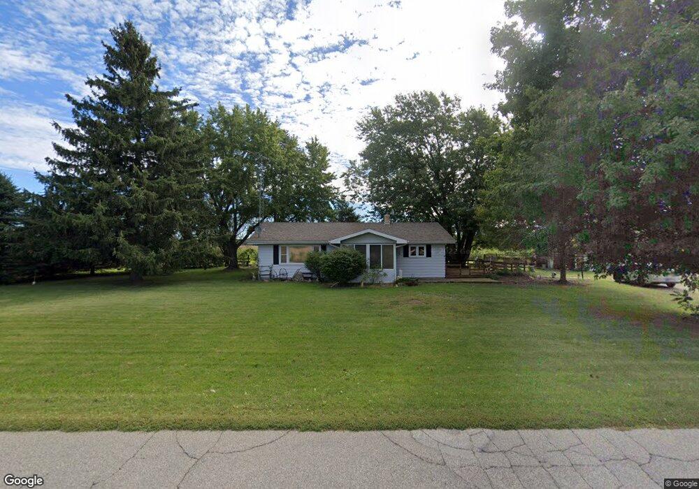
2601 N 600 E Rolling Prairie, IN 46371
Estimated Value: $182,000 - $290,000
3
Beds
2
Baths
1,288
Sq Ft
$189/Sq Ft
Est. Value
About This Home
This home is located at 2601 N 600 E, Rolling Prairie, IN 46371 and is currently estimated at $243,557, approximately $189 per square foot. 2601 N 600 E is a home located in LaPorte County with nearby schools including New Prairie High School and Sacred Heart Apostolic School.
Ownership History
Date
Name
Owned For
Owner Type
Purchase Details
Closed on
Aug 22, 2014
Sold by
Haverstock Georgiana
Bought by
Haverstock Scott A
Current Estimated Value
Home Financials for this Owner
Home Financials are based on the most recent Mortgage that was taken out on this home.
Original Mortgage
$96,750
Outstanding Balance
$73,716
Interest Rate
4.09%
Mortgage Type
New Conventional
Estimated Equity
$169,841
Purchase Details
Closed on
Dec 27, 2013
Sold by
Haverstock James L
Bought by
Haverstock Georgiana
Purchase Details
Closed on
Oct 3, 2007
Sold by
Haverstock Georgiana
Bought by
Haverstock James L
Create a Home Valuation Report for This Property
The Home Valuation Report is an in-depth analysis detailing your home's value as well as a comparison with similar homes in the area
Home Values in the Area
Average Home Value in this Area
Purchase History
| Date | Buyer | Sale Price | Title Company |
|---|---|---|---|
| Haverstock Scott A | -- | None Available | |
| Haverstock Georgiana | -- | None Available | |
| Haverstock James L | -- | None Available |
Source: Public Records
Mortgage History
| Date | Status | Borrower | Loan Amount |
|---|---|---|---|
| Open | Haverstock Scott A | $96,750 |
Source: Public Records
Tax History Compared to Growth
Tax History
| Year | Tax Paid | Tax Assessment Tax Assessment Total Assessment is a certain percentage of the fair market value that is determined by local assessors to be the total taxable value of land and additions on the property. | Land | Improvement |
|---|---|---|---|---|
| 2024 | $1,390 | $154,100 | $41,600 | $112,500 |
| 2023 | $1,311 | $153,600 | $41,300 | $112,300 |
| 2022 | $1,526 | $158,200 | $41,000 | $117,200 |
| 2021 | $1,570 | $151,700 | $40,800 | $110,900 |
| 2020 | $1,624 | $151,700 | $40,800 | $110,900 |
| 2019 | $1,763 | $158,800 | $47,700 | $111,100 |
| 2018 | $1,353 | $138,500 | $36,000 | $102,500 |
| 2017 | $1,205 | $127,300 | $32,500 | $94,800 |
| 2016 | $1,353 | $130,900 | $32,500 | $98,400 |
| 2014 | $1,461 | $156,800 | $24,000 | $132,800 |
Source: Public Records
Map
Nearby Homes
- 67 Acres E 300 N
- 7428 E 400 N
- 4271 E 50 N
- 3803 E State Road 2
- 5303 E Bootjack Rd
- 4222 N 400 E
- 6798 E 350 N
- 2692 N Morning Glory Ave
- 3429 E Sand Ridge Rd
- 2945 N Morning Glory Ave Unit 73
- 2983 N Morning Glory Ave Unit 72
- 2979 N Morning Glory Ave
- 2893 N Morning Glory Ave
- 2897 N Morning Glory Ave
- 109 N Depot St
- 2952 N Morning Glory Ave
- 7674 Potato Hole Ct
- 3202 N 300 E
- 345 S 600 E
- 8196 E Walnut Ridge