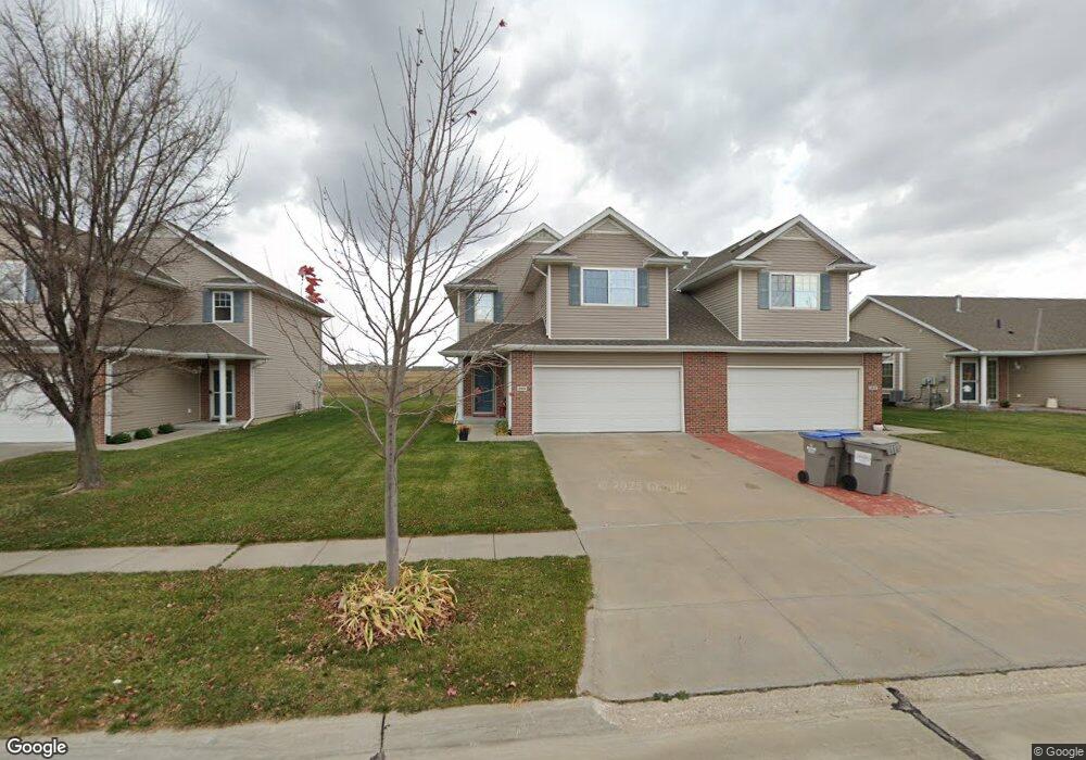
2601 N 91st St Lincoln, NE 68507
Estimated Value: $267,563 - $295,000
3
Beds
3
Baths
1,700
Sq Ft
$163/Sq Ft
Est. Value
About This Home
This home is located at 2601 N 91st St, Lincoln, NE 68507 and is currently estimated at $276,891, approximately $162 per square foot. 2601 N 91st St is a home located in Lancaster County with nearby schools including Kahoa Elementary School, Mickle Middle School, and Lincoln Northeast High School.
Ownership History
Date
Name
Owned For
Owner Type
Purchase Details
Closed on
Sep 25, 2014
Sold by
Kant Jodi R and Kant Charles R
Bought by
Laswell Richard L and Laswell Sue F
Current Estimated Value
Home Financials for this Owner
Home Financials are based on the most recent Mortgage that was taken out on this home.
Original Mortgage
$114,320
Outstanding Balance
$87,519
Interest Rate
4.14%
Mortgage Type
New Conventional
Estimated Equity
$189,372
Purchase Details
Closed on
May 20, 2010
Sold by
Cedar Cove Townhomes Llc
Bought by
Wills Jodi R
Home Financials for this Owner
Home Financials are based on the most recent Mortgage that was taken out on this home.
Original Mortgage
$107,920
Interest Rate
5%
Mortgage Type
New Conventional
Purchase Details
Closed on
Apr 4, 2009
Sold by
Lancaster County School District #001
Bought by
Cedar Cove Townhomes Llc
Create a Home Valuation Report for This Property
The Home Valuation Report is an in-depth analysis detailing your home's value as well as a comparison with similar homes in the area
Home Values in the Area
Average Home Value in this Area
Purchase History
| Date | Buyer | Sale Price | Title Company |
|---|---|---|---|
| Laswell Richard L | $143,000 | Union Title Company Llc | |
| Wills Jodi R | $135,000 | Ntc | |
| Cedar Cove Townhomes Llc | -- | None Available |
Source: Public Records
Mortgage History
| Date | Status | Borrower | Loan Amount |
|---|---|---|---|
| Open | Laswell Richard L | $114,320 | |
| Previous Owner | Wills Jodi R | $107,920 |
Source: Public Records
Tax History Compared to Growth
Tax History
| Year | Tax Paid | Tax Assessment Tax Assessment Total Assessment is a certain percentage of the fair market value that is determined by local assessors to be the total taxable value of land and additions on the property. | Land | Improvement |
|---|---|---|---|---|
| 2025 | $3,188 | $253,300 | $55,000 | $198,300 |
| 2024 | $3,188 | $232,800 | $35,000 | $197,800 |
| 2023 | $3,875 | $232,800 | $35,000 | $197,800 |
| 2022 | $3,697 | $186,300 | $30,000 | $156,300 |
| 2021 | $3,496 | $186,300 | $30,000 | $156,300 |
| 2020 | $3,290 | $173,400 | $30,000 | $143,400 |
| 2019 | $3,254 | $173,400 | $30,000 | $143,400 |
| 2018 | $3,007 | $160,800 | $25,000 | $135,800 |
| 2017 | $3,047 | $160,800 | $25,000 | $135,800 |
| 2016 | $2,720 | $143,000 | $25,000 | $118,000 |
| 2015 | $2,771 | $143,000 | $25,000 | $118,000 |
| 2014 | $2,593 | $133,500 | $25,000 | $108,500 |
| 2013 | -- | $133,500 | $25,000 | $108,500 |
Source: Public Records
Map
Nearby Homes
- 2800 N 91st St
- 2707 N 91st St
- 2660 N 91st St
- 9051 Kinzie St
- 8938 Kinzie St
- 2735 Kinzie Cir
- 2745 Kinzie Cir
- 2827 N 90th St
- 2810 N 91st St
- 2833 N 90th St
- 8918 Kinzie St
- 2820 N 91st Ct
- 2830 N 91st Ct
- 2838 N 90th St
- 2655 N 89th St
- 2705 N 89th St
- 2911 N 91st Ct
- 2721 N 89th St
- 8911 Broken Spoke Dr
- 2821 N 90th St
- 2543 Cedar Cove Rd
- 2607 N 91st St
- 2535 Cedar Cove Rd
- 2615 N 91st St
- 2527 Cedar Cove Rd
- 2621 N 91st St
- 2519 Cedar Cove Rd
- 2534 Cedar Cove Rd
- 2610 N 91st St
- 2530 Cedar Cove Rd
- 2616 N 91st St
- 2509 Cedar Cove Rd
- 2622 N 91st St
- 2524 Cedar Cove Rd
- 2628 N 91st St
- 2501 Cedar Cove Rd
- 2520 Cedar Cove Rd
- 2634 N 91st St
- 2514 Cedar Cove Rd
- 2467 Cedar Cove Rd