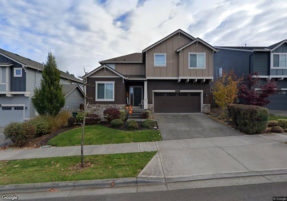
2601 Windstream St Forest Grove, OR 97116
Estimated Value: $617,520 - $667,000
4
Beds
3
Baths
2,557
Sq Ft
$250/Sq Ft
Est. Value
About This Home
This home is located at 2601 Windstream St, Forest Grove, OR 97116 and is currently estimated at $638,630, approximately $249 per square foot. 2601 Windstream St is a home with nearby schools including Dilley Elementary School, Tom McCall Upper Elementary School, and Neil Armstrong Middle School.
Ownership History
Date
Name
Owned For
Owner Type
Purchase Details
Closed on
Nov 11, 2024
Sold by
Fitzpatrick Adam E
Bought by
Fitzpatrick Adam E and Fitzpatrick Vashta Ranae
Current Estimated Value
Purchase Details
Closed on
Apr 1, 2014
Sold by
D R Horton Inc Portland
Bought by
Fitzpatrick Adam E
Home Financials for this Owner
Home Financials are based on the most recent Mortgage that was taken out on this home.
Original Mortgage
$254,396
Interest Rate
4.32%
Mortgage Type
New Conventional
Create a Home Valuation Report for This Property
The Home Valuation Report is an in-depth analysis detailing your home's value as well as a comparison with similar homes in the area
Home Values in the Area
Average Home Value in this Area
Purchase History
| Date | Buyer | Sale Price | Title Company |
|---|---|---|---|
| Fitzpatrick Adam E | -- | None Listed On Document | |
| Fitzpatrick Adam E | -- | None Listed On Document | |
| Fitzpatrick Adam E | $317,995 | First American |
Source: Public Records
Mortgage History
| Date | Status | Borrower | Loan Amount |
|---|---|---|---|
| Previous Owner | Fitzpatrick Adam E | $254,396 |
Source: Public Records
Tax History Compared to Growth
Tax History
| Year | Tax Paid | Tax Assessment Tax Assessment Total Assessment is a certain percentage of the fair market value that is determined by local assessors to be the total taxable value of land and additions on the property. | Land | Improvement |
|---|---|---|---|---|
| 2026 | $6,685 | $375,420 | -- | -- |
| 2025 | $6,685 | $364,490 | -- | -- |
| 2024 | $6,450 | $353,880 | -- | -- |
| 2023 | $6,450 | $343,580 | $0 | $0 |
| 2022 | $5,639 | $343,580 | $0 | $0 |
| 2021 | $5,567 | $323,870 | $0 | $0 |
| 2020 | $5,536 | $314,440 | $0 | $0 |
| 2019 | $5,413 | $305,290 | $0 | $0 |
| 2018 | $5,247 | $296,400 | $0 | $0 |
| 2017 | $5,085 | $287,770 | $0 | $0 |
| 2016 | $4,942 | $279,390 | $0 | $0 |
| 2015 | $4,752 | $271,260 | $0 | $0 |
| 2014 | $1,401 | $79,600 | $0 | $0 |
Source: Public Records
Map
Nearby Homes
- 1222 Brookside Ave
- 1315 Begonia Ave
- 2517 Sweetwood Ct
- 1078 Vista Oaks Dr
- 1104 Magnolia Way
- 2440 Heather Way
- 1609 Camino Dr
- 1611 Camino Dr
- 1425 Willamina Ave
- 2108 D St
- 1316 19th Place
- 2341 Turnbull Ct
- 1224 Alyssum Ave
- 2327 Turnbull Ct
- 1718 23rd Ave
- 1294 19th Ave
- 922 Rosebud Ct
- 918 Rosebud Ct
- 2819 Buxton St
- 1419 19th Ave
- 2609 Windstream St
- 2557 Windstream St
- 2545 Windstream St
- 1224 Parkside Ave
- 1127 Stonewall Ave
- 2533 Windstream St
- 1122 Parkside Ave
- 1121 Stonewall Ave
- 2430 Goff Place
- 2521 Windstream St
- 1115 Stonewall Ave
- 1118 Stonewall Ave
- 1135 Parkside Ave
- 1237 Parkside Ave
- 1143 Parkside Ave
- 1110 Parkside Ave
- 1225 Parkside Ave
- 1109 Stonewall Ave
- 1123 Parkside Ave