Estimated Value: $16,776 - $198,000
Studio
--
Bath
--
Sq Ft
19,994
Sq Ft Lot
About This Home
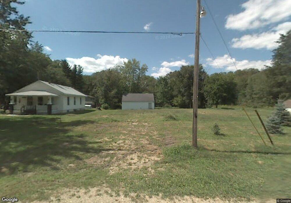
This home is located at 2602 Adams Rd, Niles, MI 49120 and is currently estimated at $118,444. 2602 Adams Rd is a home located in Berrien County with nearby schools including Merritt Elementary School, Brandywine Elementary School, and Brandywine Middle School.
Ownership History
Date
Name
Owned For
Owner Type
Purchase Details
Closed on
Jan 21, 2021
Sold by
The Plank Family Trust
Bought by
Murphy Brandon J and Murphy Janna M
Current Estimated Value
Purchase Details
Closed on
May 17, 2019
Sold by
Plank Family Trust
Bought by
Murphy Brandon J and Murphy Janna M
Purchase Details
Closed on
May 15, 2019
Sold by
The Plank Family Trust
Bought by
Murphy Brandon J and Murphy Janna M
Purchase Details
Closed on
Feb 13, 2008
Sold by
Plank Lon K and Plank Kristin S
Bought by
Plank Lon Kent and Plank Kristin Sue
Purchase Details
Closed on
Oct 28, 2005
Sold by
Noe Eunice A
Bought by
Plank Lon K and Plank Kristin S
Home Financials for this Owner
Home Financials are based on the most recent Mortgage that was taken out on this home.
Original Mortgage
$15,750
Interest Rate
6.48%
Mortgage Type
Fannie Mae Freddie Mac
Purchase Details
Closed on
May 20, 1987
Create a Home Valuation Report for This Property
The Home Valuation Report is an in-depth analysis detailing your home's value as well as a comparison with similar homes in the area
Home Values in the Area
Average Home Value in this Area
Purchase History
| Date | Buyer | Sale Price | Title Company |
|---|---|---|---|
| Murphy Brandon J | $11,000 | Chicago Title Of Mi Inc | |
| Murphy Brandon J | $8,000 | New Title Company Name | |
| Murphy Brandon J | $8,000 | None Available | |
| Plank Lon Kent | -- | None Available | |
| Plank Lon K | $26,000 | None Available | |
| -- | $100 | -- |
Source: Public Records
Mortgage History
| Date | Status | Borrower | Loan Amount |
|---|---|---|---|
| Previous Owner | Plank Lon K | $15,750 |
Source: Public Records
Tax History
| Year | Tax Paid | Tax Assessment Tax Assessment Total Assessment is a certain percentage of the fair market value that is determined by local assessors to be the total taxable value of land and additions on the property. | Land | Improvement |
|---|---|---|---|---|
| 2025 | $309 | $13,900 | $0 | $0 |
| 2024 | $185 | $20,000 | $0 | $0 |
| 2023 | $176 | $14,000 | $0 | $0 |
| 2022 | $169 | $11,700 | $0 | $0 |
| 2021 | $245 | $8,000 | $8,000 | $0 |
| 2020 | $391 | $8,000 | $0 | $0 |
| 2019 | $391 | $8,000 | $8,000 | $0 |
Source: Public Records
Map
Nearby Homes
- 2618 Bond St
- 2816 Madison St
- 242 Higgins St
- 2639 S 3rd St
- 317 E Bertrand Rd
- 321 E Bertrand Rd
- 1610 Whitetail Cir
- 1640 Forest St
- 1650 Whitetail Cir
- 1680 River Bend Blvd
- 1670 River Bend Blvd
- 2142 S 11 Th St
- 2325 Fair Oaks St E
- 2710 Weaver Rd
- 2120 S 3rd St
- 2420 Floral Dr
- 1355 Honeysuckle Ln
- 1404 Mould Ave
- 2807 S 13th St
- 2762 Sugarberry Ln Unit 84
Your Personal Tour Guide
Ask me questions while you tour the home.