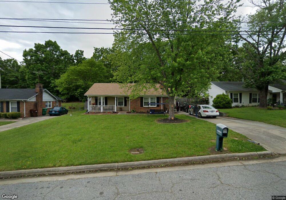
2602 Ernest St High Point, NC 27263
Greater High Point NeighborhoodEstimated Value: $169,690 - $215,000
3
Beds
1
Bath
1,330
Sq Ft
$139/Sq Ft
Est. Value
About This Home
This home is located at 2602 Ernest St, High Point, NC 27263 and is currently estimated at $184,423, approximately $138 per square foot. 2602 Ernest St is a home located in Guilford County with nearby schools including Allen Jay Elementary School, Southern Guilford Middle, and Southern Guilford High School.
Ownership History
Date
Name
Owned For
Owner Type
Purchase Details
Closed on
Feb 25, 2005
Sold by
Waldroup Melia W
Bought by
Wall Willie D and Randleman Antoinette
Current Estimated Value
Home Financials for this Owner
Home Financials are based on the most recent Mortgage that was taken out on this home.
Original Mortgage
$82,650
Outstanding Balance
$51,452
Interest Rate
9.25%
Mortgage Type
Fannie Mae Freddie Mac
Estimated Equity
$132,971
Create a Home Valuation Report for This Property
The Home Valuation Report is an in-depth analysis detailing your home's value as well as a comparison with similar homes in the area
Home Values in the Area
Average Home Value in this Area
Purchase History
| Date | Buyer | Sale Price | Title Company |
|---|---|---|---|
| Wall Willie D | $87,000 | -- |
Source: Public Records
Mortgage History
| Date | Status | Borrower | Loan Amount |
|---|---|---|---|
| Open | Wall Willie D | $82,650 |
Source: Public Records
Tax History
| Year | Tax Paid | Tax Assessment Tax Assessment Total Assessment is a certain percentage of the fair market value that is determined by local assessors to be the total taxable value of land and additions on the property. | Land | Improvement |
|---|---|---|---|---|
| 2025 | $1,596 | $115,800 | $20,000 | $95,800 |
| 2024 | $1,596 | $115,800 | $20,000 | $95,800 |
| 2023 | $1,596 | $115,800 | $20,000 | $95,800 |
| 2022 | $1,561 | $115,800 | $20,000 | $95,800 |
| 2021 | $965 | $70,000 | $17,000 | $53,000 |
| 2020 | $965 | $70,000 | $17,000 | $53,000 |
| 2019 | $965 | $70,000 | $0 | $0 |
| 2018 | $960 | $70,000 | $0 | $0 |
| 2017 | $960 | $70,000 | $0 | $0 |
| 2016 | $1,133 | $80,800 | $0 | $0 |
| 2015 | $1,139 | $80,800 | $0 | $0 |
| 2014 | $1,159 | $80,800 | $0 | $0 |
Source: Public Records
Map
Nearby Homes
- 1105 E Springfield Rd
- 914 Nance Ave
- 717 Belmont Dr
- 921 Norton St
- 715 Baker Rd
- 600 E Fairfield Rd
- 611 Liberty Rd
- 000 Liberty Rd
- 1535 E Fairfield Rd
- 609 Martha Place
- 1501 Cox Ct
- 607 Martha Place
- 126 Apollo Cir
- 312 Model Farm Rd
- 1900-1922 Baker Rd
- 312 Playground Rd
- 206 E Moore Ave
- 1638 Kersey Valley Rd
- 206 Model Farm Rd
- 335 Nathan Hunt Dr
- 2600 Ernest St
- 2604 Ernest St
- 2606 Ernest St
- 1066 E Springfield Rd
- 1100 E Springfield Rd
- 1064 E Springfield Rd
- 2608 Ernest St
- 2603 Ernest St
- 2605 Ernest St
- 1104 E Springfield Rd
- 2610 Ernest St
- 800 Ernest Ct
- 2612 Ernest St
- 1106 E Springfield Rd
- 1101 E Springfield Rd
- 2611 Ernest St
- 805 Ernest Ct
- 1108 E Springfield Rd
- 802 Ernest Ct
- 2614 Ernest St
Your Personal Tour Guide
Ask me questions while you tour the home.