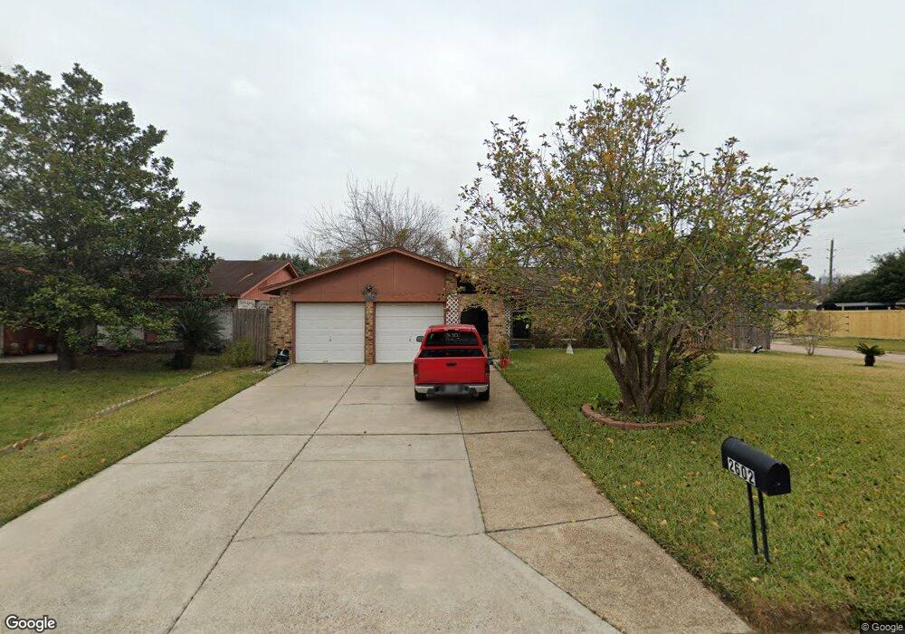
2602 Lemonwood Ln Houston, TX 77038
North Houston NeighborhoodEstimated Value: $216,004 - $260,000
3
Beds
2
Baths
1,724
Sq Ft
$139/Sq Ft
Est. Value
About This Home
This home is located at 2602 Lemonwood Ln, Houston, TX 77038 and is currently estimated at $239,751, approximately $139 per square foot. 2602 Lemonwood Ln is a home located in Harris County with nearby schools including Gloria B. Sammons Elementary School, Stovall School, and Dr. Viola K. Garcia Middle School.
Ownership History
Date
Name
Owned For
Owner Type
Purchase Details
Closed on
May 28, 2004
Sold by
Pok Tap and Sek Sok Phin
Bought by
Flores Antonio and Flores Guadalupe B
Current Estimated Value
Home Financials for this Owner
Home Financials are based on the most recent Mortgage that was taken out on this home.
Original Mortgage
$92,150
Outstanding Balance
$44,956
Interest Rate
5.97%
Mortgage Type
Purchase Money Mortgage
Estimated Equity
$194,795
Create a Home Valuation Report for This Property
The Home Valuation Report is an in-depth analysis detailing your home's value as well as a comparison with similar homes in the area
Home Values in the Area
Average Home Value in this Area
Purchase History
| Date | Buyer | Sale Price | Title Company |
|---|---|---|---|
| Flores Antonio | -- | Stewart Title Houston Divisi |
Source: Public Records
Mortgage History
| Date | Status | Borrower | Loan Amount |
|---|---|---|---|
| Open | Flores Antonio | $92,150 |
Source: Public Records
Tax History Compared to Growth
Tax History
| Year | Tax Paid | Tax Assessment Tax Assessment Total Assessment is a certain percentage of the fair market value that is determined by local assessors to be the total taxable value of land and additions on the property. | Land | Improvement |
|---|---|---|---|---|
| 2025 | $1,241 | $200,351 | $36,713 | $163,638 |
| 2024 | $1,241 | $195,539 | $36,713 | $158,826 |
| 2023 | $1,241 | $195,539 | $36,713 | $158,826 |
| 2022 | $3,882 | $176,575 | $36,713 | $139,862 |
| 2021 | $3,656 | $143,423 | $22,028 | $121,395 |
| 2020 | $3,523 | $143,423 | $22,028 | $121,395 |
| 2019 | $3,322 | $133,209 | $22,028 | $111,181 |
| 2018 | $539 | $99,287 | $22,028 | $77,259 |
| 2017 | $2,792 | $125,639 | $22,028 | $103,611 |
| 2016 | $2,539 | $101,808 | $22,028 | $79,780 |
| 2015 | $922 | $104,668 | $22,028 | $82,640 |
| 2014 | $922 | $68,196 | $14,685 | $53,511 |
Source: Public Records
Map
Nearby Homes
- 2614 Lemonwood Ln
- 2719 Magnolia Hill Trail
- 2811 Oakland Brook St
- 2831 Oakland Brook St
- 2835 Oakland Brook St
- 2838 Packard Elm St
- 2530 Woodtown Dr
- 2203 Chalet Rd
- 2115 Havencrest Dr
- 12718 Sai Baba Dr
- 3127 Frick Rd
- 0 W Mt Houston Rd Unit 90464120
- 00 Fallbrook Dr
- 13308 Ann Louise Rd
- Whitetail Plan at Forestwood
- Kitson Plan at Forestwood
- Pinehollow Plan at Forestwood
- 12530 Wild Strawberry Rd
- Idlewood Plan at Forestwood
- Oakridge Plan at Forestwood
- 2606 Lemonwood Ln
- 2603 Woodsdale Blvd
- 2526 Lemonwood Ln
- 2607 Woodsdale Blvd
- 2610 Lemonwood Ln
- 2539 Woodsdale Blvd
- 2611 Woodsdale Blvd
- 2603 Lemonwood Ln
- 2607 Lemonwood Ln
- 2531 Lemonwood Ln
- 2522 Lemonwood Ln
- 2615 Woodsdale Blvd
- 2535 Woodsdale Blvd
- 2527 Lemonwood Ln
- 2611 Lemonwood Ln
- 2615 Lemonwood Ln
- 2619 Woodsdale Bl
- 2518 Lemonwood Ln
- 2523 Lemonwood Ln
- 2531 Woodsdale Blvd