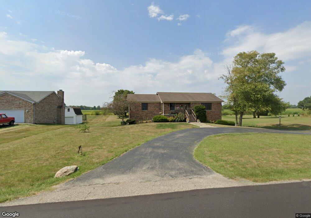
2602 S 500 W New Palestine, IN 46163
Estimated Value: $344,000 - $418,000
3
Beds
3
Baths
1,552
Sq Ft
$244/Sq Ft
Est. Value
About This Home
This home is located at 2602 S 500 W, New Palestine, IN 46163 and is currently estimated at $379,288, approximately $244 per square foot. 2602 S 500 W is a home located in Hancock County with nearby schools including Sugar Creek Elementary School, New Palestine Jr High School, and New Palestine High School.
Ownership History
Date
Name
Owned For
Owner Type
Purchase Details
Closed on
Nov 9, 2007
Sold by
Forville Todd W
Bought by
Fagan Allen and Fagan Kimberly
Current Estimated Value
Home Financials for this Owner
Home Financials are based on the most recent Mortgage that was taken out on this home.
Original Mortgage
$140,000
Outstanding Balance
$88,990
Interest Rate
6.47%
Mortgage Type
New Conventional
Estimated Equity
$290,298
Create a Home Valuation Report for This Property
The Home Valuation Report is an in-depth analysis detailing your home's value as well as a comparison with similar homes in the area
Home Values in the Area
Average Home Value in this Area
Purchase History
| Date | Buyer | Sale Price | Title Company |
|---|---|---|---|
| Fagan Allen | -- | None Available |
Source: Public Records
Mortgage History
| Date | Status | Borrower | Loan Amount |
|---|---|---|---|
| Open | Fagan Allen | $140,000 |
Source: Public Records
Tax History Compared to Growth
Tax History
| Year | Tax Paid | Tax Assessment Tax Assessment Total Assessment is a certain percentage of the fair market value that is determined by local assessors to be the total taxable value of land and additions on the property. | Land | Improvement |
|---|---|---|---|---|
| 2024 | $2,758 | $330,300 | $56,700 | $273,600 |
| 2023 | $2,758 | $295,900 | $56,700 | $239,200 |
| 2022 | $2,025 | $246,500 | $40,200 | $206,300 |
| 2021 | $1,864 | $207,900 | $40,200 | $167,700 |
| 2020 | $1,649 | $198,700 | $40,200 | $158,500 |
| 2019 | $1,699 | $197,400 | $34,700 | $162,700 |
| 2018 | $1,589 | $194,700 | $34,700 | $160,000 |
| 2017 | $1,539 | $185,600 | $34,700 | $150,900 |
| 2016 | $1,570 | $179,300 | $32,400 | $146,900 |
| 2014 | $1,618 | $173,800 | $31,200 | $142,600 |
| 2013 | $1,618 | $170,500 | $31,200 | $139,300 |
Source: Public Records
Map
Nearby Homes
- 2775 High Acres East St
- 4967 Morenci Ct
- 4625 W Otway Ln
- 1905 Reilly Ln
- 3313 S Cordell Rd
- 3233 S Courtney Dr
- 3317 S Ansley Dr
- 3228 S Overlook Pass
- 4407 W Wandalee Ct
- 4942 W Congress Cove
- 4908 W Harrisburg Ct
- 4980 S Canton Cir
- 2433 S Copperstone Dr
- The Nantucket Plan at The Overlook
- The Asheville Plan at The Overlook
- The Flatrock Plan at The Overlook
- The Milner Plan at The Overlook
- The Aspen Plan at The Overlook
- The Nashville Plan at The Overlook
- The Everton Plan at The Overlook
- 2602 S 500 W Np
- 2602 S 500 W
- 2626 S 500 W
- 2566 S 500 W
- 2709 S 500 W
- 2675 S 500 W
- 2712 S 500 W
- 4971 W Burrel Ln
- 864 S Waterway Dr
- 872 S Waterway Dr
- 850 S Waterway Dr
- 894 S Waterway Dr
- 867 S Waterway Dr
- 843 S Waterway Dr
- 820 S Waterway Dr
- 922 S Waterway Dr
- 934 S Waterway Dr
- 879 S Waterway Dr
- 855 S Waterway Dr
- 939 S Waterway Dr