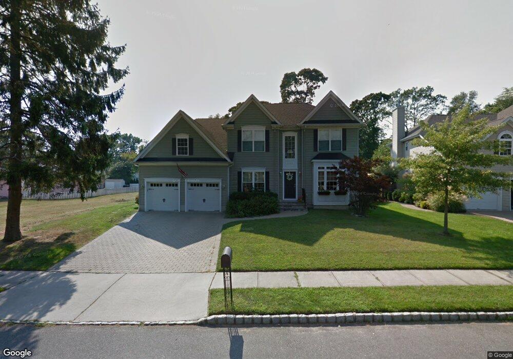
2603 Kipling Ave Spring Lake, NJ 07762
Estimated Value: $1,406,000 - $1,493,000
5
Beds
2
Baths
2,822
Sq Ft
$512/Sq Ft
Est. Value
About This Home
This home is located at 2603 Kipling Ave, Spring Lake, NJ 07762 and is currently estimated at $1,445,753, approximately $512 per square foot. 2603 Kipling Ave is a home located in Monmouth County with nearby schools including Wall High School and The Brookside School.
Ownership History
Date
Name
Owned For
Owner Type
Purchase Details
Closed on
Feb 23, 2010
Sold by
Tombasco Joseph and Tombasco Eileen
Bought by
Bozza Joseph D and Bozza Marianne
Current Estimated Value
Purchase Details
Closed on
Mar 10, 2003
Sold by
Silverwood Associates Inc
Bought by
Tombasco Joseph and Tombasco Eileen
Home Financials for this Owner
Home Financials are based on the most recent Mortgage that was taken out on this home.
Original Mortgage
$260,000
Interest Rate
5.91%
Purchase Details
Closed on
May 10, 2002
Sold by
Kipling Woods Llc
Bought by
Silverwood Assoc Inc
Home Financials for this Owner
Home Financials are based on the most recent Mortgage that was taken out on this home.
Original Mortgage
$352,000
Interest Rate
7.15%
Create a Home Valuation Report for This Property
The Home Valuation Report is an in-depth analysis detailing your home's value as well as a comparison with similar homes in the area
Home Values in the Area
Average Home Value in this Area
Purchase History
| Date | Buyer | Sale Price | Title Company |
|---|---|---|---|
| Bozza Joseph D | $700,000 | Old Republic National Title | |
| Tombasco Joseph | $574,900 | -- | |
| Silverwood Assoc Inc | $630,000 | -- |
Source: Public Records
Mortgage History
| Date | Status | Borrower | Loan Amount |
|---|---|---|---|
| Previous Owner | Tombasco Joseph | $260,000 | |
| Previous Owner | Silverwood Assoc Inc | $352,000 |
Source: Public Records
Tax History Compared to Growth
Tax History
| Year | Tax Paid | Tax Assessment Tax Assessment Total Assessment is a certain percentage of the fair market value that is determined by local assessors to be the total taxable value of land and additions on the property. | Land | Improvement |
|---|---|---|---|---|
| 2025 | $15,013 | $700,900 | $291,300 | $409,600 |
| 2024 | $14,642 | $700,900 | $291,300 | $409,600 |
| 2023 | $14,642 | $700,900 | $291,300 | $409,600 |
| 2022 | $13,136 | $700,900 | $291,300 | $409,600 |
| 2021 | $13,136 | $700,900 | $291,300 | $409,600 |
| 2020 | $14,004 | $700,900 | $291,300 | $409,600 |
| 2019 | $13,843 | $700,900 | $291,300 | $409,600 |
| 2018 | $13,689 | $700,900 | $291,300 | $409,600 |
| 2017 | $13,415 | $700,900 | $291,300 | $409,600 |
| 2016 | $13,086 | $700,900 | $291,300 | $409,600 |
| 2015 | $12,474 | $419,000 | $123,100 | $295,900 |
| 2014 | $12,266 | $421,800 | $125,900 | $295,900 |
Source: Public Records
Map
Nearby Homes
- 1838 State Route 35 Unit 80
- 1820 New Jersey 35 Unit 34
- 1820 New Jersey 35 Unit Home Site 26
- 2412 Homestead Ave
- 1211 18th Ave
- 2217 Old Mill Rd
- 1722 M St
- 1027 2nd Ave
- 1727 Elizabeth Ct
- 1213 17th Ave
- 12 Wyckham Rd
- 15 Wyckham Rd
- 74 Linden Ct Unit 12A
- 909 3rd Ave
- 1335 State Route 138
- 1331 New Jersey 138
- 16 Devon Ct
- 1014 Glenn St
- 1012 Glenn St
- 1024 17th Ave
- 2605 Kipling Ave
- 1300 Hawthorne Pkwy
- 2607 Kipling Ave
- 1098 Hawthorne Pkwy
- 1838 State Route 35 Unit 2
- 1838 State Route 35 Unit 29
- 1838 State Route 35 Unit 4
- 1838 State Route 35 Unit 70
- 1838 State Route 35 Unit 34
- 1838 State Route 35 Unit 96
- 1838 State Route 35 Unit 28
- 1838 State Route 35 Unit 90
- 1838 State Route 35 Unit 92
- 1838 State Route 35 Unit 73
- 1838 State Route 35 Unit 8
- 1838 State Route 35 Unit 15
- 1838 State Route 35 Unit 50
- 1838 State Route 35 Unit 25
- 1838 State Route 35 Unit 79
- 1838 State Route 35 Unit 24