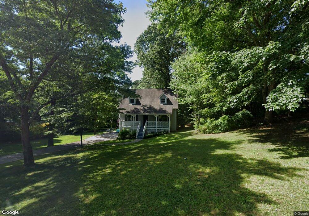
2603 Mountain Brook Rd Unit 2 Canton, GA 30114
Estimated Value: $392,697 - $404,000
3
Beds
2
Baths
1,826
Sq Ft
$218/Sq Ft
Est. Value
About This Home
This home is located at 2603 Mountain Brook Rd Unit 2, Canton, GA 30114 and is currently estimated at $398,349, approximately $218 per square foot. 2603 Mountain Brook Rd Unit 2 is a home located in Cherokee County with nearby schools including Sixes Elementary School, Freedom Middle School, and Woodstock High School.
Ownership History
Date
Name
Owned For
Owner Type
Purchase Details
Closed on
Oct 13, 2021
Sold by
Opendoor Property J Llc
Bought by
Fkh Sfr Propco H Lp
Current Estimated Value
Purchase Details
Closed on
Sep 1, 2021
Sold by
Lon William Kennebeck Rev Liv Trust
Bought by
Opendoor Property J Llc
Purchase Details
Closed on
Oct 29, 2019
Sold by
Kennebeck Lon
Bought by
William Lon and William Marie Kennebeck R
Purchase Details
Closed on
Oct 28, 1997
Sold by
Martin Lawrence J and Martin Debra J
Bought by
Kennebeck Lon W and Kennebeck Kathy
Home Financials for this Owner
Home Financials are based on the most recent Mortgage that was taken out on this home.
Original Mortgage
$93,252
Interest Rate
7.27%
Mortgage Type
FHA
Create a Home Valuation Report for This Property
The Home Valuation Report is an in-depth analysis detailing your home's value as well as a comparison with similar homes in the area
Home Values in the Area
Average Home Value in this Area
Purchase History
| Date | Buyer | Sale Price | Title Company |
|---|---|---|---|
| Fkh Sfr Propco H Lp | $310,600 | -- | |
| Opendoor Property J Llc | $292,600 | -- | |
| William Lon | -- | -- | |
| Kennebeck Lon W | $95,500 | -- |
Source: Public Records
Mortgage History
| Date | Status | Borrower | Loan Amount |
|---|---|---|---|
| Previous Owner | Kennebeck Lon W | $93,252 |
Source: Public Records
Tax History Compared to Growth
Tax History
| Year | Tax Paid | Tax Assessment Tax Assessment Total Assessment is a certain percentage of the fair market value that is determined by local assessors to be the total taxable value of land and additions on the property. | Land | Improvement |
|---|---|---|---|---|
| 2025 | $4,128 | $157,175 | $24,000 | $133,175 |
| 2024 | $4,085 | $157,175 | $24,000 | $133,175 |
| 2023 | $4,085 | $157,175 | $24,000 | $133,175 |
| 2022 | $3,237 | $123,144 | $24,000 | $99,144 |
| 2021 | $2,352 | $90,472 | $18,240 | $72,232 |
| 2020 | $2,122 | $80,444 | $16,000 | $64,444 |
| 2019 | $1,948 | $72,960 | $15,200 | $57,760 |
| 2018 | $1,633 | $60,800 | $14,000 | $46,800 |
| 2017 | $1,359 | $135,700 | $12,800 | $41,480 |
| 2016 | $1,359 | $122,500 | $11,200 | $37,800 |
| 2015 | $1,239 | $111,100 | $10,800 | $33,640 |
| 2014 | $871 | $79,700 | $6,000 | $25,880 |
Source: Public Records
Map
Nearby Homes
- 2623 Mountain Brook Rd
- 5010 Shadowood Dr
- 2653 Mountain Brook Rd
- 5030 Shadowood Dr
- 2600 Mountain Brook Rd
- 2610 Mountain Brook Rd
- 2590 Mountain Brook Rd
- 5050 Shadowood Dr
- 2630 Mountain Brook Rd
- 2620 Mountain Brook Rd Unit 2
- 5015 Shadowood Dr
- 2580 Mountain Brook Rd Unit 2
- 3181 Misty Trace Unit 2
- 2693 Mountain Brook Rd
- 5045 Shadowood Dr
- 5070 Shadowood Dr
- 3180 Misty Trace
- 2560 Mountain Brook Rd
- 2543 Mountain Brook Rd
- 706 Creekwood Ln