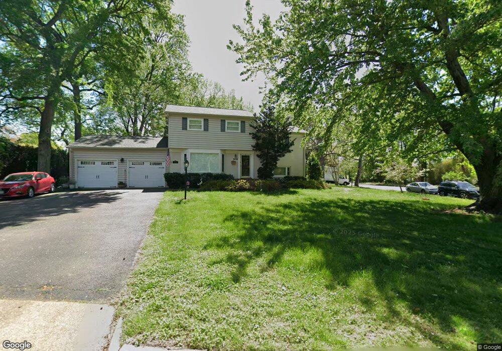
2603 Turbridge Ln Alexandria, VA 22308
Fort Hunt NeighborhoodEstimated Value: $832,521 - $1,015,000
3
Beds
3
Baths
--
Sq Ft
0.31
Acres
About This Home
This home is located at 2603 Turbridge Ln, Alexandria, VA 22308 and is currently estimated at $895,880. 2603 Turbridge Ln is a home located in Fairfax County with nearby schools including Fort Hunt Elementary School, Sandburg Middle, and West Potomac High School.
Ownership History
Date
Name
Owned For
Owner Type
Purchase Details
Closed on
Dec 27, 2007
Sold by
Radoski Derek P
Bought by
Lisecki Cleve
Current Estimated Value
Home Financials for this Owner
Home Financials are based on the most recent Mortgage that was taken out on this home.
Original Mortgage
$417,000
Outstanding Balance
$264,724
Interest Rate
6.27%
Mortgage Type
New Conventional
Estimated Equity
$631,156
Purchase Details
Closed on
Sep 25, 2000
Sold by
Radoski Henry R
Bought by
Radoski Derek P
Create a Home Valuation Report for This Property
The Home Valuation Report is an in-depth analysis detailing your home's value as well as a comparison with similar homes in the area
Home Values in the Area
Average Home Value in this Area
Purchase History
| Date | Buyer | Sale Price | Title Company |
|---|---|---|---|
| Lisecki Cleve | $731,000 | -- | |
| Radoski Derek P | $250,000 | -- |
Source: Public Records
Mortgage History
| Date | Status | Borrower | Loan Amount |
|---|---|---|---|
| Open | Lisecki Cleve | $417,000 |
Source: Public Records
Tax History Compared to Growth
Tax History
| Year | Tax Paid | Tax Assessment Tax Assessment Total Assessment is a certain percentage of the fair market value that is determined by local assessors to be the total taxable value of land and additions on the property. | Land | Improvement |
|---|---|---|---|---|
| 2025 | $8,140 | $687,840 | $347,000 | $340,840 |
| 2024 | $8,140 | $654,730 | $327,000 | $327,730 |
| 2023 | $7,993 | $664,870 | $327,000 | $337,870 |
| 2022 | $8,019 | $659,730 | $332,000 | $327,730 |
| 2021 | $7,673 | $619,730 | $332,000 | $287,730 |
| 2020 | $7,254 | $581,660 | $305,000 | $276,660 |
| 2019 | $7,130 | $569,920 | $296,000 | $273,920 |
| 2018 | $6,336 | $550,940 | $285,000 | $265,940 |
| 2017 | $6,741 | $550,940 | $285,000 | $265,940 |
| 2016 | $6,728 | $550,940 | $285,000 | $265,940 |
| 2015 | $6,485 | $550,200 | $285,000 | $265,200 |
| 2014 | $6,548 | $557,090 | $269,000 | $288,090 |
Source: Public Records
Map
Nearby Homes
- 8705 Stockton Pkwy
- 2308 Creek Dr
- 8518 Riverside Rd
- 3108 Battersea Ln
- 3301 Battersea Ln
- 8407 Brewster Dr
- 3207 Cunningham Dr
- 8352 Orange Ct
- 3026 Battersea Ln
- 9016 Greylock St
- 8917 Linton Ln
- 8531 Mount Vernon Hwy
- 3017 Battersea Ln
- 2408 William And Mary Dr
- 8827 Camfield Dr
- 8647 Braddock Ave
- 8413 Wagon Wheel Rd
- 2000 Volley Ct
- 2757 Carter Farm Ct
- 2008 Kenley Ct
- 2601 Turbridge Ln
- 8714 Thomas J Stockton Pkwy
- 8714 Stockton Pkwy
- 8710 Waterford Rd
- 2602 Turbridge Ln
- 8719 Stockton Pkwy
- 8706 Waterford Rd
- 8710 Stockton Pkwy
- 8712 Waterford Rd
- 8721 Stockton Pkwy
- 8709 Stockton Pkwy
- 8704 Waterford Rd
- 2509 Turbridge Ln
- 8714 Waterford Rd
- 8709 Waterford Rd
- 8705 Waterford Rd
- 8711 Waterford Rd
- 8702 Waterford Rd
- 8723 Stockton Pkwy
- 8707 Stockton Pkwy