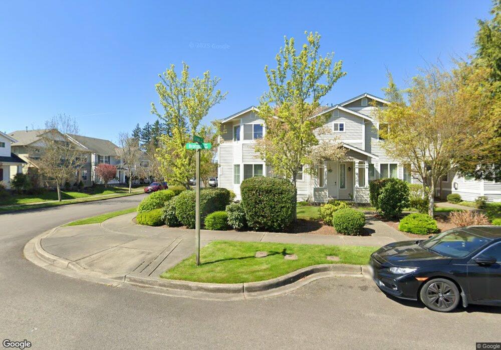
2605 Bronson Ave Unit 2605 Dupont, WA 98327
Estimated Value: $421,000 - $454,000
3
Beds
2
Baths
1,739
Sq Ft
$252/Sq Ft
Est. Value
About This Home
This home is located at 2605 Bronson Ave Unit 2605, Dupont, WA 98327 and is currently estimated at $437,556, approximately $251 per square foot. 2605 Bronson Ave Unit 2605 is a home located in Pierce County with nearby schools including Chloe Clark Elementary School, Saltars Point Elementary School, and Pioneer Middle School.
Ownership History
Date
Name
Owned For
Owner Type
Purchase Details
Closed on
Dec 8, 2021
Sold by
Evans Bruce F
Bought by
Aaron Dwayne R and Aaron Susan D
Current Estimated Value
Purchase Details
Closed on
Mar 3, 2005
Sold by
Dupont Landing Llc
Bought by
Evans Marie J
Home Financials for this Owner
Home Financials are based on the most recent Mortgage that was taken out on this home.
Original Mortgage
$148,213
Interest Rate
5.65%
Mortgage Type
Purchase Money Mortgage
Create a Home Valuation Report for This Property
The Home Valuation Report is an in-depth analysis detailing your home's value as well as a comparison with similar homes in the area
Home Values in the Area
Average Home Value in this Area
Purchase History
| Date | Buyer | Sale Price | Title Company |
|---|---|---|---|
| Aaron Dwayne R | -- | None Available | |
| Evans Marie J | $185,266 | Chicago Title Insurance Co |
Source: Public Records
Mortgage History
| Date | Status | Borrower | Loan Amount |
|---|---|---|---|
| Previous Owner | Evans Marie J | $148,213 |
Source: Public Records
Tax History Compared to Growth
Tax History
| Year | Tax Paid | Tax Assessment Tax Assessment Total Assessment is a certain percentage of the fair market value that is determined by local assessors to be the total taxable value of land and additions on the property. | Land | Improvement |
|---|---|---|---|---|
| 2025 | $2,995 | $399,200 | $199,800 | $199,400 |
| 2024 | $2,995 | $388,800 | $192,500 | $196,300 |
| 2023 | $2,995 | $371,800 | $176,500 | $195,300 |
| 2022 | $3,019 | $381,000 | $176,500 | $204,500 |
| 2021 | $2,861 | $283,900 | $112,100 | $171,800 |
| 2019 | $2,465 | $256,800 | $93,400 | $163,400 |
| 2018 | $2,538 | $240,800 | $93,400 | $147,400 |
| 2017 | $2,176 | $217,200 | $78,000 | $139,200 |
| 2016 | $1,944 | $172,600 | $65,800 | $106,800 |
| 2014 | $2,050 | $172,500 | $65,800 | $106,700 |
| 2013 | $2,050 | $165,100 | $67,600 | $97,500 |
Source: Public Records
Map
Nearby Homes
- 1285 Griggs St
- 1331 Rowan Ct Unit 1331
- 1263 Hudson St
- 1373 Hudson St Unit 1373
- 2699 Erwin Ave Unit 2699
- 2237 Tolmie St
- 2176 Palisade Blvd Unit F-3
- 2147 Hammond Ave Unit B10
- 2176 McDonald Ave
- 1607 Kincaid St Unit E-8
- 1856 Spencer Ct Unit 12F
- 605 Louviers Ave
- 1680 Kennedy Place Unit A4
- 504 Dupont Ave
- 403 Louviers Ave
- 2055 Garry Oaks Ave Unit B
- 1975 Garry Oaks Ave Unit C
- 205 Brandywine Ave
- 2420 Simmons St Unit B
- 3114 Walker Rd
- 2617 Bronson Ave Unit 2617
- 2637 Bronson Ave Unit 2637
- 2629 Bronson Ave Unit 2629
- 2661 Bronson Ave Unit 2661
- 2649 Bronson Ave Unit 2649
- 1324 Griggs St
- 2673 Bronson Ave Unit 2673
- 3571 Griggs St
- 1305 Griggs St
- 1296 Griggs St
- 2697 Bronson Ave Unit 2697
- 2685 Bronson Ave Unit B
- 2685 Bronson Ave Unit 2685
- 1321 Griggs St
- 1328 Griggs St
- 1319 Hudson St
- 1297 Griggs St
- 1327 Griggs St
- 1292 Griggs St
- 1299 Hudson St