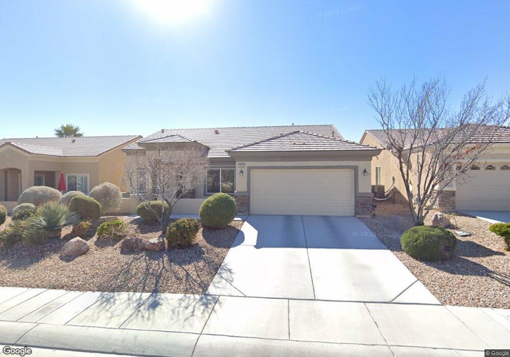
2605 Lark Sparrow St Unit 10 North Las Vegas, NV 89084
Aliante NeighborhoodEstimated Value: $457,684 - $507,000
2
Beds
2
Baths
2,104
Sq Ft
$229/Sq Ft
Est. Value
About This Home
This home is located at 2605 Lark Sparrow St Unit 10, North Las Vegas, NV 89084 and is currently estimated at $481,671, approximately $228 per square foot. 2605 Lark Sparrow St Unit 10 is a home located in Clark County with nearby schools including Vincent L. Triggs Elementary School, Anthony Saville Middle School, and Shadow Ridge High School.
Ownership History
Date
Name
Owned For
Owner Type
Purchase Details
Closed on
Apr 4, 2012
Sold by
Malouf Edward J
Bought by
Malouf Edward J and The Malouf Family Trust
Current Estimated Value
Purchase Details
Closed on
Mar 29, 2011
Sold by
Harris Leslie R and Harris Debra L
Bought by
Malouf Edward J
Purchase Details
Closed on
Aug 25, 2006
Sold by
Pn Ii Inc
Bought by
Harris Leslie R and Harris Debra L
Home Financials for this Owner
Home Financials are based on the most recent Mortgage that was taken out on this home.
Original Mortgage
$303,402
Interest Rate
6.76%
Mortgage Type
Unknown
Purchase Details
Closed on
May 22, 2006
Sold by
North Valley Enterprises Llc
Bought by
Pn Ii Inc
Create a Home Valuation Report for This Property
The Home Valuation Report is an in-depth analysis detailing your home's value as well as a comparison with similar homes in the area
Home Values in the Area
Average Home Value in this Area
Purchase History
| Date | Buyer | Sale Price | Title Company |
|---|---|---|---|
| Malouf Edward J | -- | None Available | |
| Malouf Edward J | $165,000 | Ticor Title Las Vegas | |
| Harris Leslie R | $379,253 | Lawyers Title Of Nevada | |
| Pn Ii Inc | $2,778,784 | First Amer Title Co Of Nv |
Source: Public Records
Mortgage History
| Date | Status | Borrower | Loan Amount |
|---|---|---|---|
| Previous Owner | Harris Leslie R | $303,402 |
Source: Public Records
Tax History Compared to Growth
Tax History
| Year | Tax Paid | Tax Assessment Tax Assessment Total Assessment is a certain percentage of the fair market value that is determined by local assessors to be the total taxable value of land and additions on the property. | Land | Improvement |
|---|---|---|---|---|
| 2025 | $2,600 | $120,901 | $28,000 | $92,901 |
| 2024 | $2,525 | $120,901 | $28,000 | $92,901 |
| 2023 | $2,525 | $117,483 | $30,100 | $87,383 |
| 2022 | $2,348 | $105,646 | $25,900 | $79,746 |
| 2021 | $2,380 | $98,809 | $23,100 | $75,709 |
| 2020 | $2,304 | $97,195 | $22,400 | $74,795 |
| 2019 | $2,237 | $93,612 | $20,300 | $73,312 |
| 2018 | $2,172 | $86,409 | $16,100 | $70,309 |
| 2017 | $2,898 | $85,540 | $15,400 | $70,140 |
| 2016 | $2,057 | $83,580 | $13,475 | $70,105 |
| 2015 | $2,053 | $67,382 | $10,780 | $56,602 |
| 2014 | $1,992 | $56,928 | $7,700 | $49,228 |
Source: Public Records
Map
Nearby Homes
- 7469 Crested Quail St
- 7453 Widewing Dr
- 7465 Widewing Dr
- 7429 Widewing Dr
- 2508 Mourning Warbler Ave
- 2525 Great Auk Ave
- 7556 Wingspread St
- 7617 Fieldfare Dr
- 2509 Great Auk Ave
- 7713 Songster St
- 3109 Frigate Way
- 7757 Coast Jay St
- 7751 Widewing Dr
- 7831 Nestor Creek Ln
- 7543 Marie Brook Ln
- 1885 Vass Springs Place
- 7804 Island Rail Dr
- 7509 Chaffinch St
- 7773 Wading Bird Way
- 7741 Fruit Dove St Unit 4
- 2521 Lark Sparrow St
- 2609 Lark Sparrow St
- 2620 Cornish Hen Ave
- 2624 Cornish Hen Ave Unit n/a
- 2616 Cornish Hen Ave
- 2517 Lark Sparrow St
- 2613 Lark Sparrow St Unit 10
- 2628 Cornish Hen Ave
- 2612 Cornish Hen Ave
- 2524 Lark Sparrow St
- 2604 Lark Sparrow St
- 2632 Cornish Hen Ave Unit 10
- 2520 Lark Sparrow St
- 2608 Lark Sparrow St Unit n/a
- 2608 Cornish Hen Ave
- 2617 Lark Sparrow St
- 2636 Cornish Hen Ave Unit 10
- 2513 Lark Sparrow St
- 2612 Lark Sparrow St