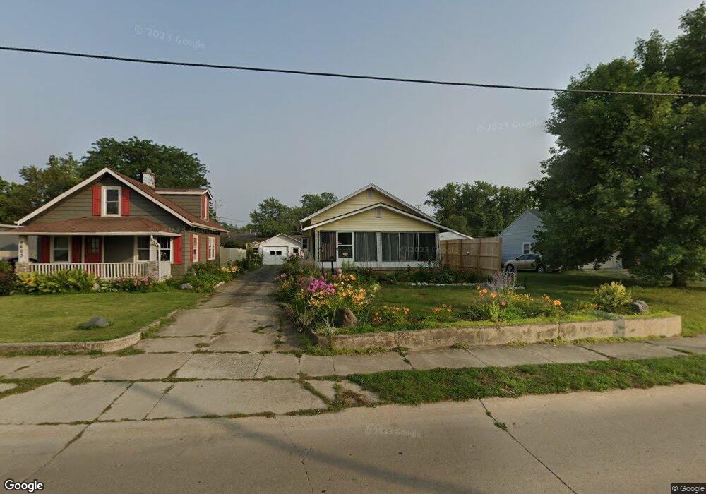
2605 Mcarthur Dr Fort Wayne, IN 46809
Southwest Fort Wayne NeighborhoodEstimated Value: $129,000 - $151,000
3
Beds
2
Baths
968
Sq Ft
$147/Sq Ft
Est. Value
About This Home
This home is located at 2605 Mcarthur Dr, Fort Wayne, IN 46809 and is currently estimated at $142,633, approximately $147 per square foot. 2605 Mcarthur Dr is a home located in Allen County with nearby schools including Waynedale Elementary School, Portage Middle School, and Wayne High School.
Ownership History
Date
Name
Owned For
Owner Type
Purchase Details
Closed on
Sep 26, 2003
Sold by
Abn Amro Mortgage Group Inc
Bought by
Reed Carol L
Current Estimated Value
Home Financials for this Owner
Home Financials are based on the most recent Mortgage that was taken out on this home.
Original Mortgage
$55,000
Interest Rate
6.33%
Mortgage Type
Purchase Money Mortgage
Purchase Details
Closed on
May 22, 2003
Sold by
Abn Amro Mortgage Group Inc
Bought by
Hud
Purchase Details
Closed on
May 14, 2003
Sold by
Acutin Joel L
Bought by
Abn Amro Mortgage Group Inc
Purchase Details
Closed on
Apr 30, 2001
Sold by
Sanders Roger Wayne
Bought by
Acutin Joel L
Home Financials for this Owner
Home Financials are based on the most recent Mortgage that was taken out on this home.
Original Mortgage
$67,439
Interest Rate
6.95%
Mortgage Type
FHA
Purchase Details
Closed on
Apr 4, 1991
Sold by
Homes For All Inc
Bought by
Ebbing James E
Create a Home Valuation Report for This Property
The Home Valuation Report is an in-depth analysis detailing your home's value as well as a comparison with similar homes in the area
Home Values in the Area
Average Home Value in this Area
Purchase History
| Date | Buyer | Sale Price | Title Company |
|---|---|---|---|
| Reed Carol L | -- | -- | |
| Hud | -- | -- | |
| Abn Amro Mortgage Group Inc | $53,000 | -- | |
| Acutin Joel L | -- | Commonwealth/Dreibelbiss Tit | |
| Ebbing James E | -- | Metropolitan Title Of In |
Source: Public Records
Mortgage History
| Date | Status | Borrower | Loan Amount |
|---|---|---|---|
| Previous Owner | Reed Carol L | $55,000 | |
| Previous Owner | Acutin Joel L | $67,439 |
Source: Public Records
Tax History Compared to Growth
Tax History
| Year | Tax Paid | Tax Assessment Tax Assessment Total Assessment is a certain percentage of the fair market value that is determined by local assessors to be the total taxable value of land and additions on the property. | Land | Improvement |
|---|---|---|---|---|
| 2024 | $752 | $93,400 | $16,200 | $77,200 |
| 2022 | $600 | $84,700 | $14,600 | $70,100 |
| 2021 | $458 | $74,800 | $8,000 | $66,800 |
| 2020 | $409 | $66,100 | $8,000 | $58,100 |
| 2019 | $415 | $64,800 | $8,000 | $56,800 |
| 2018 | $363 | $57,200 | $8,000 | $49,200 |
| 2017 | $342 | $52,900 | $8,000 | $44,900 |
| 2016 | $298 | $47,400 | $8,000 | $39,400 |
| 2014 | $358 | $55,900 | $8,000 | $47,900 |
| 2013 | $345 | $55,200 | $8,000 | $47,200 |
Source: Public Records
Map
Nearby Homes
- 2702 Westward Dr
- 3015 Mcarthur Dr
- 6510 Old Trail Rd
- 7101 Baer Rd
- 7324 Springhill Dr
- 3412 Mcarthur Dr
- 2707 Prairie Grove Dr
- 6706 Fernwood Ave
- 6305 Bluffton Rd
- 3013 Prairie Grove Dr
- 1627 Saint Louis Ave
- 1805 Lakewood Dr
- 2904 Pinewood Dr
- 2908 Pinewood Dr
- 6725 Lakewood Ct
- 2600 Blk Timbers Dr
- 97?? Bluffton Rd
- 3001 Sandpoint Rd
- 5137 Tyrone Rd
- 924 Winchester Ln
- 2603 Mcarthur Dr
- 2609 Mcarthur Dr
- 2601 Mcarthur Dr
- 7202 Old Trail Rd
- 7214 Old Trail Rd
- 2611 Mcarthur Dr
- 7216 Old Trail Rd
- 7218 Old Trail Rd
- 2617 Mcarthur Dr
- 7220 Old Trail Rd
- 7313 Burnsdale Ave
- 7222 Old Trail Rd
- 7217 Old Trail Rd
- 7315 Burnsdale Ave
- 7311 Burnsdale Ave
- 7304 Old Trail Rd
- 7221 Old Trail Rd
- 7317 Burnsdale Ave
- 7111 Old Trail Rd
- 2701 Mcarthur Dr