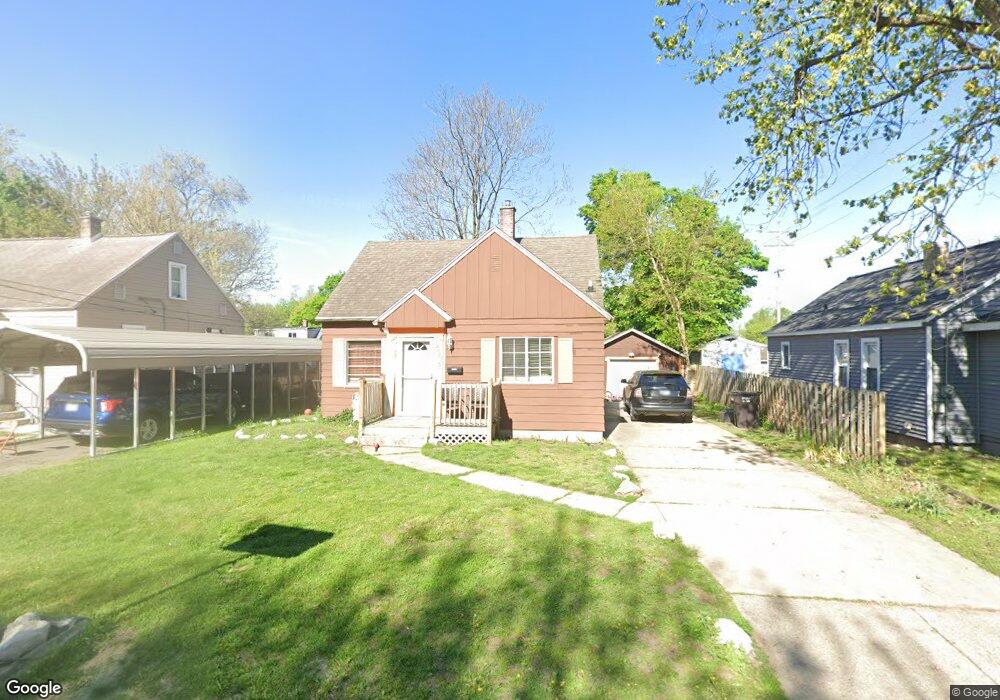
2605 Noel Ave SW Wyoming, MI 49509
Urbandale NeighborhoodEstimated Value: $201,000 - $242,000
3
Beds
1
Bath
1,000
Sq Ft
$223/Sq Ft
Est. Value
About This Home
This home is located at 2605 Noel Ave SW, Wyoming, MI 49509 and is currently estimated at $222,879, approximately $222 per square foot. 2605 Noel Ave SW is a home located in Kent County with nearby schools including Oriole Park Elementary School, Wyoming Intermediate School, and Parkview Elementary School.
Ownership History
Date
Name
Owned For
Owner Type
Purchase Details
Closed on
Jul 26, 2006
Sold by
Mcgowan Donna J
Bought by
Hill Lisa L
Current Estimated Value
Home Financials for this Owner
Home Financials are based on the most recent Mortgage that was taken out on this home.
Original Mortgage
$98,000
Outstanding Balance
$67,040
Interest Rate
9.5%
Mortgage Type
Purchase Money Mortgage
Estimated Equity
$155,839
Purchase Details
Closed on
Mar 31, 1992
Purchase Details
Closed on
Aug 6, 1984
Create a Home Valuation Report for This Property
The Home Valuation Report is an in-depth analysis detailing your home's value as well as a comparison with similar homes in the area
Home Values in the Area
Average Home Value in this Area
Purchase History
| Date | Buyer | Sale Price | Title Company |
|---|---|---|---|
| Hill Lisa L | $98,000 | Metropolitan Title Company | |
| -- | $47,500 | -- | |
| -- | $30,000 | -- |
Source: Public Records
Mortgage History
| Date | Status | Borrower | Loan Amount |
|---|---|---|---|
| Open | Hill Lisa L | $98,000 |
Source: Public Records
Tax History Compared to Growth
Tax History
| Year | Tax Paid | Tax Assessment Tax Assessment Total Assessment is a certain percentage of the fair market value that is determined by local assessors to be the total taxable value of land and additions on the property. | Land | Improvement |
|---|---|---|---|---|
| 2025 | $2,170 | $87,000 | $0 | $0 |
| 2024 | $2,170 | $75,500 | $0 | $0 |
| 2023 | $2,187 | $72,700 | $0 | $0 |
| 2022 | $2,035 | $62,200 | $0 | $0 |
| 2021 | $1,982 | $55,500 | $0 | $0 |
| 2020 | $1,854 | $49,000 | $0 | $0 |
| 2019 | $1,917 | $41,200 | $0 | $0 |
| 2018 | $1,889 | $39,200 | $0 | $0 |
| 2017 | $1,845 | $33,300 | $0 | $0 |
| 2016 | $1,795 | $30,900 | $0 | $0 |
| 2015 | $1,220 | $30,900 | $0 | $0 |
| 2013 | -- | $32,300 | $0 | $0 |
Source: Public Records
Map
Nearby Homes
- 2556 Longstreet Ave SW
- 2541 Noel Ave SW
- 818 Aldon St SW
- 2620 Riley Ave SW
- 2746 Tennyson Dr SW
- 2831 Charlesgate Ave SW
- 2142 Saint Charles Ave SW
- 2185 Clyde Park Ave SW
- 2221 Palace Ave SW
- 2140 Banner Dr SW
- 2151 Banner Dr SW Unit F
- 2517 Newstead Ave SW
- 2621 Doncaster Ave SW
- 2201 Darwin Ave SW
- 886 Belfield St SW Unit 7
- 918 Buckingham St SW
- 817 Blanchard St SW
- 2050 Arnold Ave SW
- 100 Colrain St SW
- 66 Sutton St SW
- 2603 Noel Ave SW
- 2613 Noel Ave SW
- 2619 Noel Ave SW
- 2606 Longstreet Ave SW
- 2610 Longstreet Ave SW
- 2600 Longstreet Ave SW
- 0 Noel Ave SW
- 590 26th St SW
- 2614 Longstreet Ave SW
- 2621 Noel Ave SW
- 2610 Noel Ave SW
- 2561 Noel Ave SW
- 2560 Longstreet Ave SW
- 2555 Noel Ave SW
- 2603 Charlesgate Ave SW
- 2622 Longstreet Ave SW
- 2620 Noel Ave SW
- 2619 Charlesgate Ave SW
- 2625 Noel Ave SW
- 2551 Noel Ave SW