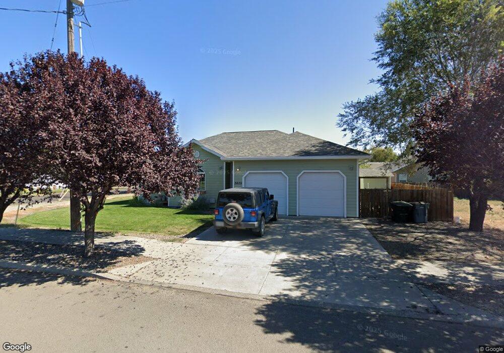
2605 Watson Rd La Grande, OR 97850
Estimated Value: $372,830 - $387,000
4
Beds
2
Baths
1,620
Sq Ft
$235/Sq Ft
Est. Value
About This Home
This home is located at 2605 Watson Rd, La Grande, OR 97850 and is currently estimated at $379,915, approximately $234 per square foot. 2605 Watson Rd is a home located in Union County with nearby schools including La Grande High School, The Marian Academy, and Lighthouse Apostolic Academy.
Ownership History
Date
Name
Owned For
Owner Type
Purchase Details
Closed on
Nov 25, 2019
Sold by
Chandler Glen and Chandler Summer
Bought by
Weatherspoon Aaron C
Current Estimated Value
Home Financials for this Owner
Home Financials are based on the most recent Mortgage that was taken out on this home.
Original Mortgage
$197,437
Outstanding Balance
$173,726
Interest Rate
3.5%
Mortgage Type
New Conventional
Estimated Equity
$206,189
Purchase Details
Closed on
Jan 25, 2008
Sold by
Lund Michael F
Bought by
Chandler Glen and Chandler Summer
Purchase Details
Closed on
Mar 14, 2007
Sold by
Haberlach Anthony and Haberlach Joy C
Bought by
Lund Michael F
Create a Home Valuation Report for This Property
The Home Valuation Report is an in-depth analysis detailing your home's value as well as a comparison with similar homes in the area
Home Values in the Area
Average Home Value in this Area
Purchase History
| Date | Buyer | Sale Price | Title Company |
|---|---|---|---|
| Weatherspoon Aaron C | $255,000 | Eastern Oregon Title Inc | |
| Chandler Glen | $34,000 | Atco | |
| Lund Michael F | $32,000 | Atco |
Source: Public Records
Mortgage History
| Date | Status | Borrower | Loan Amount |
|---|---|---|---|
| Open | Weatherspoon Aaron C | $197,437 |
Source: Public Records
Tax History Compared to Growth
Tax History
| Year | Tax Paid | Tax Assessment Tax Assessment Total Assessment is a certain percentage of the fair market value that is determined by local assessors to be the total taxable value of land and additions on the property. | Land | Improvement |
|---|---|---|---|---|
| 2024 | $4,222 | $237,010 | $45,270 | $191,740 |
| 2023 | $4,148 | $230,110 | $43,950 | $186,160 |
| 2022 | $4,037 | $223,417 | $42,675 | $180,742 |
| 2021 | $3,935 | $216,910 | $41,951 | $174,959 |
| 2020 | $3,776 | $210,593 | $40,755 | $169,838 |
| 2019 | $3,698 | $204,460 | $39,803 | $164,657 |
| 2018 | $3,600 | $198,505 | $38,948 | $159,557 |
| 2017 | $3,498 | $192,724 | $34,242 | $158,482 |
| 2016 | $3,393 | $187,111 | $33,313 | $153,798 |
| 2015 | $3,270 | $181,662 | $32,238 | $149,424 |
| 2014 | $2,838 | $176,371 | $31,461 | $144,910 |
| 2013 | -- | $171,234 | $30,684 | $140,550 |
Source: Public Records
Map
Nearby Homes
- 2505 Starlight Dr
- 61988 West Rd
- 62123 Chandler Loop
- 1705 Z Ave
- 1809 26th St Unit 21
- 1809 26th St Unit 12
- 2303 N Spruce St
- 62077 Evergreen Rd
- 2903 N Spruce St
- 1520 V Ave
- 2501 Cove Ave
- 2505 Cove Ave
- 0 Walton Rd Unit 546563801
- 1906 Island Ave
- 1903 N Spruce St
- 2107 Cove Ave
- 3111 E Q Ave Unit 3
- 3111 E Q Ave Unit 1
- 62218 Robin Rd Unit 34
- 2417 N Fir St
- 2605 Watson St
- 2601 Watson Rd
- 2606 Starlight Dr
- 2602 Starlight Dr
- 2509 Watson Rd
- 2604 Watson St
- 2409 May Ln
- 2604 Watson Rd
- 0 09s4523bd Lot 102 Unit 9035846
- 2510 Starlight Dr
- 2605 Starlight Dr
- 2413 May Ln
- 2505 Watson Rd
- 2601 Starlight Dr
- 2506 Starlight Dr
- 2511 Starlight Dr
- 2501 May Ln
- 2509 Starlight Dr
- 2407 Starlight Dr
- 2315 Michaelson Ln