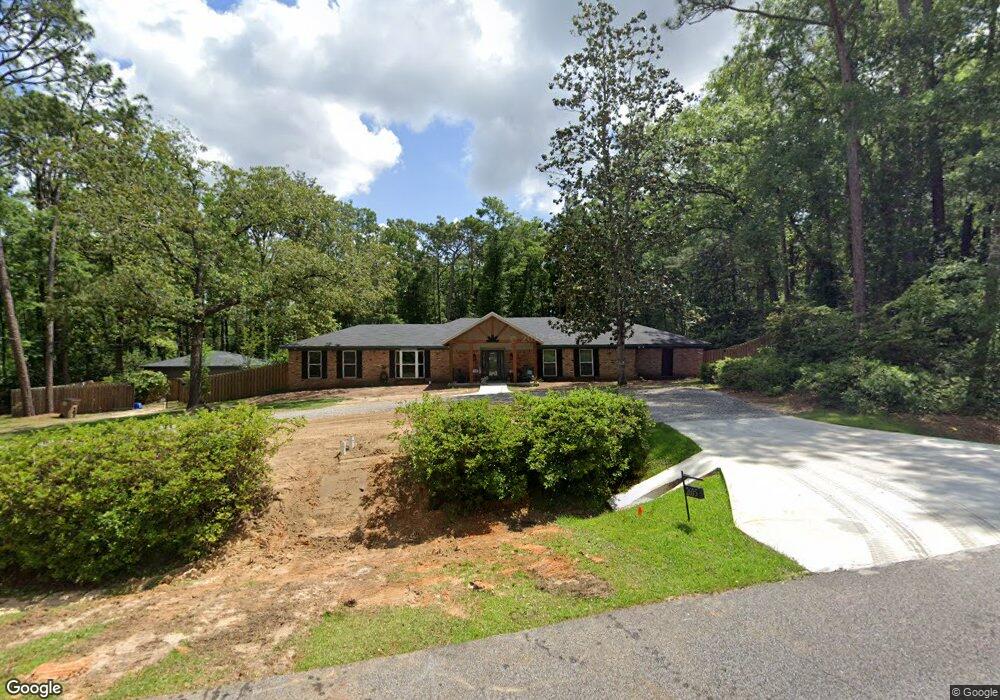
2605 West Rd Mobile, AL 36693
Rolling Acres NeighborhoodEstimated Value: $367,859 - $397,000
3
Beds
3
Baths
2,936
Sq Ft
$130/Sq Ft
Est. Value
About This Home
This home is located at 2605 West Rd, Mobile, AL 36693 and is currently estimated at $382,465, approximately $130 per square foot. 2605 West Rd is a home located in Mobile County with nearby schools including Olive J. Dodge Elementary School, Burns Middle School, and Murphy High School.
Ownership History
Date
Name
Owned For
Owner Type
Purchase Details
Closed on
Dec 21, 2018
Sold by
Whitten Vivian and Whitten Norris D
Bought by
Mcgowan Paul Edward and Mcgowan Katherine Elizabeth
Current Estimated Value
Purchase Details
Closed on
Nov 21, 2011
Sold by
Tierce Vilda Ann and Tierce Vilda B
Bought by
Whitten Vivian and Whitten Norris D
Home Financials for this Owner
Home Financials are based on the most recent Mortgage that was taken out on this home.
Original Mortgage
$262,180
Interest Rate
4.17%
Mortgage Type
FHA
Create a Home Valuation Report for This Property
The Home Valuation Report is an in-depth analysis detailing your home's value as well as a comparison with similar homes in the area
Home Values in the Area
Average Home Value in this Area
Purchase History
| Date | Buyer | Sale Price | Title Company |
|---|---|---|---|
| Mcgowan Paul Edward | $265,000 | None Available | |
| Whitten Vivian | $269,180 | None Available |
Source: Public Records
Mortgage History
| Date | Status | Borrower | Loan Amount |
|---|---|---|---|
| Previous Owner | Whitten Vivian | $262,180 |
Source: Public Records
Tax History
| Year | Tax Paid | Tax Assessment Tax Assessment Total Assessment is a certain percentage of the fair market value that is determined by local assessors to be the total taxable value of land and additions on the property. | Land | Improvement |
|---|---|---|---|---|
| 2025 | -- | $33,190 | $7,200 | $25,990 |
| 2024 | -- | $35,250 | $6,000 | $29,250 |
| 2023 | $0 | $29,200 | $6,000 | $23,200 |
| 2022 | $0 | $28,430 | $6,000 | $22,430 |
| 2021 | $0 | $26,240 | $6,000 | $20,240 |
| 2020 | $3,213 | $26,470 | $6,000 | $20,470 |
| 2019 | $3,213 | $25,300 | $6,000 | $19,300 |
| 2018 | $1,444 | $23,800 | $0 | $0 |
| 2017 | $1,430 | $23,580 | $0 | $0 |
| 2016 | $1,443 | $23,780 | $0 | $0 |
| 2013 | $2,830 | $22,100 | $0 | $0 |
Source: Public Records
Map
Nearby Homes
- 2605 Woodland Rd
- 6009 Oak Harbor Ct
- 5908 Rio Vista Dr
- 2401 Huffman Dr W
- 2403 West Rd
- 2404 Pavan Dr
- 2629 Mountbrook Dr
- 5734 Ramada Dr S
- 2333 Huffman Dr W
- 2858 Post Oak Cir
- 2555 East Rd
- 5721 Blue Ridge Dr N Unit 2
- 5808 Appomattox Ct
- 2478 Ashbury Place
- 2705 Charlestowne Dr W
- 2298 Snowden Place
- 2286 Snowden Place
- 3001 Blue Ridge Dr E
- 5421 Windmill Dr
- 2551 Muir Woods Ct S
- 2619 West Rd
- 2634 West Rd
- 2601 West Rd
- 2608 West Rd
- 2612 West Rd
- 5770 Mal Dr
- 2604 West Rd
- 0 Ramada Dr W
- 0 Ramada Dr W Unit 514877
- 0 Ramada Dr W Unit 522980
- 0 Ramada Dr W Unit 31 0642122
- 0 Ramada Dr W Unit 31 0650561
- 0 Ramada Dr W Unit 31 0606223
- 5766 Mal Dr
- 5800 Mal Dr
- 2600 West Rd
- 2608 Sedgefield Place
- 2612 Sedgefield Place
- 5820 Mal Dr
- 2604 Sedgefield Place
Your Personal Tour Guide
Ask me questions while you tour the home.