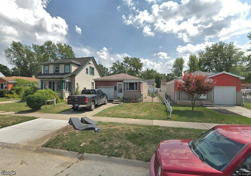
26057 Eton Ave Dearborn Heights, MI 48125
Estimated Value: $143,000 - $151,143
3
Beds
1
Bath
919
Sq Ft
$161/Sq Ft
Est. Value
About This Home
This home is located at 26057 Eton Ave, Dearborn Heights, MI 48125 and is currently estimated at $147,786, approximately $160 per square foot. 26057 Eton Ave is a home located in Wayne County with nearby schools including Quest Charter Academy, West Village Academy, and Peterson-Warren Academy.
Ownership History
Date
Name
Owned For
Owner Type
Purchase Details
Closed on
Apr 16, 2012
Sold by
Wendler Elizabeth and Alexander Elizabeth
Bought by
Miley Amber
Current Estimated Value
Purchase Details
Closed on
May 18, 2009
Sold by
Wendler Elizabeth and Alexander Elizabeth
Bought by
Alexander Elizabeth
Home Financials for this Owner
Home Financials are based on the most recent Mortgage that was taken out on this home.
Original Mortgage
$102,764
Interest Rate
4.84%
Mortgage Type
FHA
Purchase Details
Closed on
Jul 10, 2001
Sold by
Wendler Timothy M
Bought by
Wendler Elizabeth A
Create a Home Valuation Report for This Property
The Home Valuation Report is an in-depth analysis detailing your home's value as well as a comparison with similar homes in the area
Home Values in the Area
Average Home Value in this Area
Purchase History
| Date | Buyer | Sale Price | Title Company |
|---|---|---|---|
| Miley Amber | $27,000 | Progressive Title | |
| Alexander Elizabeth | -- | None Available | |
| Wendler Elizabeth A | -- | -- |
Source: Public Records
Mortgage History
| Date | Status | Borrower | Loan Amount |
|---|---|---|---|
| Previous Owner | Alexander Elizabeth | $102,764 |
Source: Public Records
Tax History Compared to Growth
Tax History
| Year | Tax Paid | Tax Assessment Tax Assessment Total Assessment is a certain percentage of the fair market value that is determined by local assessors to be the total taxable value of land and additions on the property. | Land | Improvement |
|---|---|---|---|---|
| 2025 | $1,330 | $71,400 | $0 | $0 |
| 2024 | $1,330 | $60,000 | $0 | $0 |
| 2023 | $1,194 | $51,500 | $0 | $0 |
| 2022 | $1,619 | $43,100 | $0 | $0 |
| 2021 | $1,910 | $37,700 | $0 | $0 |
| 2019 | $3,111 | $30,700 | $0 | $0 |
| 2018 | $1,364 | $31,300 | $0 | $0 |
| 2017 | $1,404 | $30,500 | $0 | $0 |
| 2016 | $2,020 | $31,500 | $0 | $0 |
| 2015 | $3,030 | $30,300 | $0 | $0 |
| 2013 | $3,400 | $34,800 | $0 | $0 |
| 2010 | -- | $38,200 | $0 | $0 |
Source: Public Records
Map
Nearby Homes
- 26106 Powers Ave
- 26225 McDonald St
- 25926 Powers Ave
- 25895 Annapolis St
- 25965 Currier St
- 26532 Powers Ave
- 25628 Powers Ave
- 26439 Hopkins St
- 26159 Stanford St
- 26458 Hopkins St
- 4863 Glenis St
- 25474 McDonald St
- 26202 Colgate St
- 26231 Andover St
- 5845 Beech Daly Rd
- 5118 Michael St
- 25866 Andover St
- 5842 Janet St
- 5961 Marvin St
- 4110 John Daly St
- 26069 Eton Ave
- 26045 Eton Ave
- 26033 Eton Ave
- 26062 Pennie St
- 26021 Eton Ave Unit Bldg-Unit
- 26021 Eton Ave
- 26054 Pennie St Unit Bldg-Unit
- 26054 Pennie St
- 26072 Pennie St
- 26054 Pennie
- 26105 Eton Ave
- 26046 Pennie St
- 26009 Eton Ave
- 26038 Pennie St
- 26104 Pennie St
- 26056 Eton Ave
- 26044 Eton Ave
- 26068 Eton Ave
- 26016 Pennie St
- 25975 Eton Ave