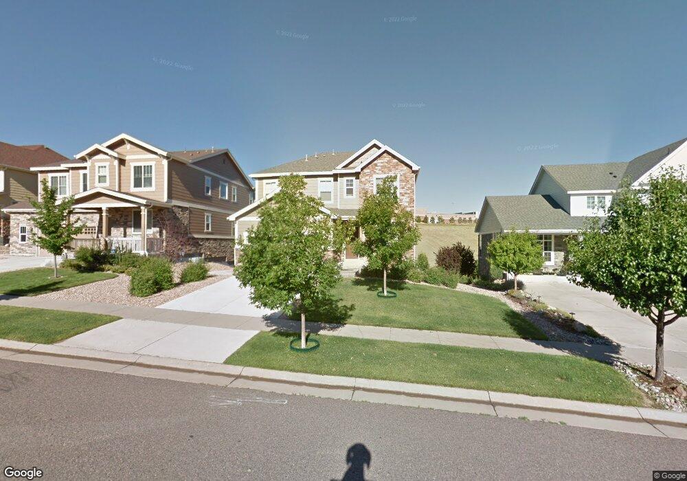
26059 E Davies Dr Aurora, CO 80016
Southeast Aurora NeighborhoodEstimated Value: $634,000 - $669,000
About This Home
Property Id: 1311793
This beautiful 4-bedroom, 3.5 -bathroom house located in the desirable city of Aurora, CO. This spacious home offers a comfortable and inviting living space for you to call your own. With four bedrooms, there is plenty of room for everyone to have their own private space. The 3.5 bathrooms ensure that there is never a wait, making mornings a breeze. The house is situated in a convenient location, providing easy access to nearby amenities, schools, and attractions. Whether you enjoy shopping, dining, or outdoor activities, you will find everything you need just a short distance away. The house offers a blank canvas for you to personalize and make your own. With its neutral color palette and ample natural light, the possibilities are endless. The open floor plan creates a seamless flow between the living, dining, and kitchen areas, perfect for entertaining guests or spending quality time with loved ones. The kitchen is equipped with modern appliances and plenty of cabinet space
Ownership History
Purchase Details
Home Financials for this Owner
Home Financials are based on the most recent Mortgage that was taken out on this home.Purchase Details
Home Financials for this Owner
Home Financials are based on the most recent Mortgage that was taken out on this home.Home Values in the Area
Average Home Value in this Area
Purchase History
| Date | Buyer | Sale Price | Title Company |
|---|---|---|---|
| Gadipalli Raviraj | -- | Ascendant Title Co | |
| Gadipalli Raviraj | $314,500 | None Available |
Mortgage History
| Date | Status | Borrower | Loan Amount |
|---|---|---|---|
| Open | Gadipalli Raviraj | $480,000 | |
| Closed | Gadipalli Raviraj | $309,290 |
Property History
| Date | Event | Price | List to Sale | Price per Sq Ft |
|---|---|---|---|---|
| 03/17/2026 03/17/26 | Off Market | $3,400 | -- | -- |
| 02/02/2026 02/02/26 | Price Changed | $3,400 | -4.2% | $1 / Sq Ft |
| 01/12/2026 01/12/26 | For Rent | $3,550 | -- | -- |
Tax History
| Year | Tax Paid | Tax Assessment Tax Assessment Total Assessment is a certain percentage of the fair market value that is determined by local assessors to be the total taxable value of land and additions on the property. | Land | Improvement |
|---|---|---|---|---|
| 2025 | $5,400 | $45,925 | -- | -- |
| 2024 | $4,983 | $44,093 | -- | -- |
| 2023 | $4,983 | $44,093 | $0 | $0 |
| 2022 | $4,263 | $35,709 | $0 | $0 |
| 2021 | $3,993 | $35,709 | $0 | $0 |
| 2020 | $4,289 | $34,313 | $0 | $0 |
| 2019 | $4,127 | $34,313 | $0 | $0 |
| 2018 | $3,672 | $29,441 | $0 | $0 |
| 2017 | $3,736 | $29,441 | $0 | $0 |
| 2016 | $3,597 | $27,701 | $0 | $0 |
| 2015 | $3,485 | $27,701 | $0 | $0 |
| 2014 | $3,025 | $22,359 | $0 | $0 |
| 2013 | -- | $4,710 | $0 | $0 |
Map
- 7243 S Millbrook Ct Unit E
- 25983 E Geddes Cir
- 26053 E Geddes Cir
- 7242 S Old Hammer Ct
- 7159 S Riverwood Way
- 6977 S Riverwood Way
- 6988 S Riverwood Way
- 7234 S Kellerman Way
- 7190 S Riverwood Way
- 7240 S Riverwood Way
- 7045 S Robertsdale Way
- 25203 E Indore Dr
- 6769 S Old Hammer Ct
- 25150 E Ottawa Dr
- 25338 E Costilla Place
- 6646 S Patsburg St
- 2132 S Irvington Ct
- 26962 E Ottawa Place
- 26923 E Ottawa Place
- 7028 S Irvington Ct
- 26049 E Davies Dr
- 26069 E Davies Dr
- 26039 E Davies Dr
- 26079 E Davies Dr
- 26060 E Davies Dr
- 26070 E Davies Dr
- 26050 E Davies Dr
- 26029 E Davies Dr
- 26089 E Davies Dr
- 26080 E Davies Dr
- 26040 E Davies Dr
- 26019 E Davies Dr
- 26099 E Davies Dr
- 26030 E Davies Dr
- 26090 E Davies Dr
- 7101 S Oak Hill Cir
- 7111 S Oak Hill Cir
- 26020 E Davies Dr
- 26109 E Davies Dr
- 7091 S Oak Hill Cir
Ask me questions while you tour the home.