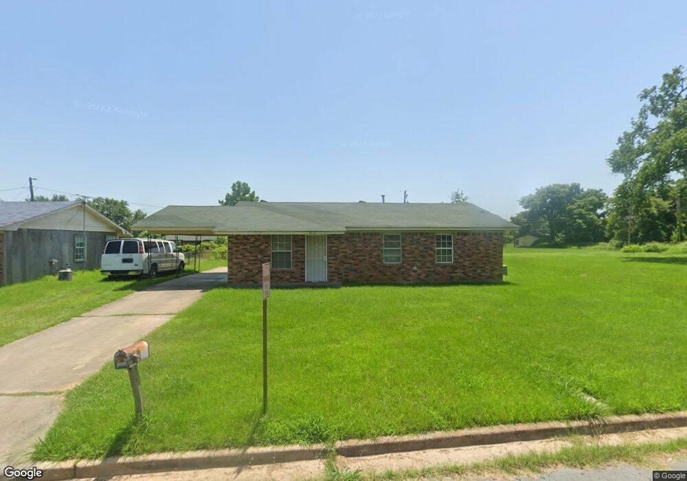
2606 Auburn Dr Pine Bluff, AR 71601
Estimated Value: $77,035 - $95,000
Studio
2
Baths
1,080
Sq Ft
$81/Sq Ft
Est. Value
About This Home
This home is located at 2606 Auburn Dr, Pine Bluff, AR 71601 and is currently estimated at $87,009, approximately $80 per square foot. 2606 Auburn Dr is a home located in Jefferson County with nearby schools including Matthews Elementary School, Dollarway High School, and Hope Academy.
Ownership History
Date
Name
Owned For
Owner Type
Purchase Details
Closed on
Nov 9, 2020
Bought by
Rinker Properties Llc
Current Estimated Value
Purchase Details
Closed on
Sep 30, 2005
Sold by
Smithwick West Roberts Limited Partnersh
Bought by
Pad Properties Llc
Purchase Details
Closed on
Sep 28, 1998
Bought by
Smithwick-West-Roberts Ltd Ptnr and 1720 Doctors Dr
Purchase Details
Closed on
Apr 10, 1998
Bought by
Roberts William A Trustee and 16 Elm Woods Cir
Purchase Details
Closed on
Jan 19, 1996
Bought by
Roberts Clarence Tr
Purchase Details
Closed on
Dec 20, 1985
Bought by
Larson Melford A Dr and Larson Wf
Create a Home Valuation Report for This Property
The Home Valuation Report is an in-depth analysis detailing your home's value as well as a comparison with similar homes in the area
Purchase History
| Date | Buyer | Sale Price | Title Company |
|---|---|---|---|
| Rinker Properties Llc | $289,000 | -- | |
| Pad Properties Llc | -- | -- | |
| Smithwick-West-Roberts Ltd Ptnr | -- | -- | |
| Roberts William A Trustee | -- | -- | |
| Roberts Clarence Tr | -- | -- | |
| Larson Melford A Dr | -- | -- |
Source: Public Records
Tax History
| Year | Tax Paid | Tax Assessment Tax Assessment Total Assessment is a certain percentage of the fair market value that is determined by local assessors to be the total taxable value of land and additions on the property. | Land | Improvement |
|---|---|---|---|---|
| 2025 | $687 | $11,060 | $700 | $10,360 |
| 2024 | $634 | $11,060 | $700 | $10,360 |
| 2023 | $582 | $11,060 | $700 | $10,360 |
| 2022 | $482 | $7,850 | $400 | $7,450 |
| 2021 | $482 | $7,850 | $400 | $7,450 |
| 2020 | $482 | $7,850 | $400 | $7,450 |
| 2019 | $482 | $7,850 | $400 | $7,450 |
| 2018 | $443 | $7,850 | $400 | $7,450 |
| 2017 | $403 | $6,570 | $400 | $6,170 |
| 2016 | $403 | $6,570 | $400 | $6,170 |
| 2015 | $383 | $6,570 | $400 | $6,170 |
| 2014 | -- | $6,570 | $400 | $6,170 |
Source: Public Records
Map
Nearby Homes
- 2608 Belair Dr S
- 1503 Collins Dr
- 2713 Claremont Ave
- 2810 Claremont Ave
- 0 NE Corner Hwy 65 425-81
- 000 S 65 Hwy
- 00
- 1302 Boston Dr
- 1309 Bailey Dr
- 1603 Belmoor Dr
- 1401 Ashley Dr
- 1307 S Dakota St
- 1909 Lucia Ln
- 820 S Ohio St
- 919 S Nebraska St
- 2221 E 6th Ave
- 812 S Nebraska St
- 00 E 24th Ave
- 1120 E 8th Ave
- 600 E 17th Ave
- 2700 Auburn Dr
- 2600 Auburn Dr
- 2606 Belair Dr S
- 2604 Belair Dr S
- 2608 Belair Dr N
- 2706 Belair Dr N
- 2601 Auburn Dr
- 2604 Belair Dr N
- 2603 Belair Dr S
- 2602 Belair Dr S
- 2708 Belair Dr N
- 2710 Belair Dr N
- 2601 Belair Dr S
- 2800 Belair Dr S
- 2704 Belair Dr N
- 2511 Belair Dr S
- 2804 Belair Dr N
- 2603 Belair Dr N
- 2605 Belair Dr N
- 2601 Belair Dr N
Your Personal Tour Guide
Ask me questions while you tour the home.